 |
The very impressive Tatsunokuchi observation deck -- we walked, not cycled, from base to top.
Why is the platform on top cantilevered over outside of the base? |
Last Tuesday I joined a small cycling tour organized on behalf of a cycling promotion unit within Ibaraki Prefecture’s government. Inbound tourism is booming in Japan these days. The prefecture wants to attract more foreign visitors and cyclists, and is looking for promotion and ideas.
Ibaraki has already made significant efforts to become a cycling-friendly destination -– most notably with a collection of cycling-related support services in the south and central parts of the prefecture that constitute the “Tsukuba-Kasumigaura ring ring road” -- centered at Tsuchiura Station on the west side of Lake Kasumigaura, and branching out from there around Lake Kasumigaura, as well as along a dedicated cycle path that extends well over 50kms to the NW along the western side of Mt. Tsukuba as far as Sakuragawa City. This entire area is one of six “national cycling roads” supported by the central government (e.g. shimanami kaido).
The support infrastructure include various “cycle support stations” and hotels such as BEB5 Tsuchiura, a hip reasonably priced cycling-themed hotel run by Hoshino Resorts, and around 50 other “cyclist-friendly” hotels that, at a minimum, offer safe bicycle storage, will receive small packages in advance of arrival, have some tools they will lend for basic repairs, etc.
Until this trip, I did not realize that Ibaraki’s efforts also extend to 2 other regions. There also are cycling-specific route designated along the coast from Oarai north to the Fukushima border, and in the interior north of Mito up to Mt. Yamizo where Ibaraki juts into a small area between Tochigi and Fukushima prefectures. (These areas of Fukushima are quite far from the Fukushima Dai-ichi nuclear reactor, by the way – far south of the routes I have cycled in southeastern Fukushima in recent years).
 |
| Ibaraki's cycle routes. We would be in the northern, inland area, the darker shade of magenta. |
Our trip would focus on the last of these 3 regions, the Kuji River valley between Mito and Daigomachi (which is on the way to Mt. Yamizo). The prefecture refers to this as the “Okukuji-Satoyama Hillclimb Route” (Japanese website only -- try automatic translation in your browser). “Okukuji” refers to the upriver, further inland areas of the Kuji river valley, and “satoyama” is a Japanese term full of secondary meaning that suggests foothill areas near villages, generally not-entirely-wild woodlands that are too hilly for rice field cultivation.
Ibaraki Prefecture has designated at least 4 “hill climb” routes at the northern end of the Okukuji area, the most challenging of which goes up Mt Yamizo to around 1000 meters elevation, with plenty of 10-12% stretches. The others are more like 5% or 7% climbs, and go only half as high in elevation. That northern area is wilder, much of it not really what I would call “satoyama” and not where we would go on our short tour. Instead, we would focus on the Kujigawa river valley.
I’ve ridden through northern Ibaraki on a number of longer events over the past decade or so. I can think of at least 3 Audax brevets that took the “Beef Line”, a “wide area agricultural road” that goes through the hills from Kasama at the southern end and NNE to Hitachi Omiya. One brevet continued onward via the “Green Furusato Line” that goes further East and North almost to the Fukushima Prefecture border near the beautiful sunny Kita Ibaraki coastline. Other trips took the road to (or from) Daigo. Last year I did a brevet that came through Daigo and down the Kuji River to Mito, hit the coastline at Oarai, then went south to Kashima Jingu shrine before heading west and returning to a starting point across the Tonegawa in Chiba Prefecture.
Other than cold temperatures in the inland mountains at night in March, my memories of Ibaraki cycling are of nice roads, attractive countryside, and relatively light traffic, except on the sometimes congested roads between southern Ibaraki (e.g. Tsuchiura, Inashiki) and Tokyo.
When the organizers of our tour sent me information, I realized we would be riding in the area between Mito and Daigomachi, a town in the far NW of the Prefecture, wedged between Tochigi to the west and Fukushima to the Northeast. This included some of National Route 118 that I rode last year at night on that brevet.
A Dutch friend of mine has a long-term lease of a cabin in the woods near Daigomachi. I visited it once (by bicycle), and he told me that the previous long-term tenant was Karel von Wolferen, a Dutch student of Japan known for his pathbreaking book “The Enigma of Japanese Power.” The book describes power as being held by a loose group of unaccountable elites who operate behind the scenes. In von Wolferen’s view, because this power is loosely held, those who wield it escape responsibility for the consequences when things go wrong. The book is essential reading for any foreigner who marvels at why Japan does not really seem to change even when a prime minister is replaced or an election lost.
When it was published in 1990 the book was harshly criticized in Japan. Von Wolferen apparently could not read Japanese well enough to use Japanese language sources, and many Japanese thought the book got some details wrong and that its criticism of the elites was unfair. Of course, soon after Japan entered 3 “lost decades” of relative economic stagnation. In hindsight, the book’s criticisms of Japan’s elite during the high-growth and bubble eras look a bit more supportable, though Japan and its politics have evolved and matured a lot since that time.
I mentioned to my hosts that this book had been written in the woods outside of Daigo. It was news to them. I guess that is part of the enigma?
Our ride started at Yamagatahara Station. The JR Suigun (水郡線) Line goes through this area, between Mito (水戸) and Koriyama (郡山), and the station house looked quite impressive for a small country train stop. It reminded me of a church.
 |
| We start our tour. |

From here we rode just a few kms up the valley then up a steep little pitch, almost a footpath, to a viewpoint built on the site of the ruins of the Yamagata Castle.
The building was impressive and provided a nice view. In February the plum (ume) blossoms on the trees adjacent would have been spectacular, and in a few weeks the cherry (sakura) lining the slope in front also would be beautiful. But not today. The shutters on the main view tower were closed due to Monday’s high winds, and the clouds had not yet lifted. March Kanto weather can be cold or warm, dark/grey or blue sky and lovely. Tuesday offered both types, transitioning over a few hours.
 |
| Viewpoint ... with shutters down. |
 |
| One of numerous treasures housed within - samurai armor |
 |
| Buddhist sculpture |
 |
| Shutters down ... |
 |
| The valley below and Kuji river. |
From here we rode a bit further to a Japanese paper (washi or 和紙) craft house. This region is home to the “nishi no uchi” (西の内) style of washi. The paper has been made since the Muromachi period (1333-1573), but saw its peak in the Edo Period (1603-1868) after the second Tokugawa shogun (who was also known as the “Mito Komon”), had the paper exported to supply merchants in the capital. The paper is incredibly durable. You can soak it in water without it losing its form or the ink running. Merchants kept records of payments and debts in books of this paper. Whenever a fire raced through their wooden neighborhoods, they could just drop the ledgers into water and preserve their records of who owed whom how much – the source of their wealth.
 |
| Even after soaking in water, the ink and paper hold fast. The ledger remains. |
 |
| Nishi-no-uchi |
We had the opportunity to make our own washi, which was fun.
 |
| Fellow cycle tourist Oxana's gift to her cat Vivian. |

I bought 4 or 5 large sheets of a heavier gauge of paper with patterns I liked – I hope I can use them as wall hangings eventually. All of the prints in the shop display beautiful Japanese design.
I think there is a place in Tokyo that offers a washi-making experience for students and tourists, … but for a cycle tourist I would definitely try it here in Yamagatajuku.
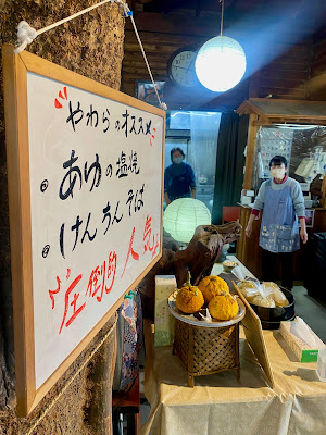
After the hard work (well, not very hard) of our washi-making experience, we headed toward an early lunch at a country-style restaurant serving salt-grilled ayu (usually translated as “sweetfish” -- a delicious trout-sized river fish for which the Kujigawa is known) and kenchin soba (Japanese buckwheat soba in a pork/miso broth).
 |
| Lunch stop - Mayako's bike, my Ramax, and Oxana's rental |
 |
| "tengu" over the restaurant entrance |
 |
| Trees for columns! |
 |
| Lunch tables -- carved from more tree trunks. |
 |
| With the two young Ibaraki Prefecture staffers |
 |
| With the ayu grilling master |
The dishes were delicious, the prices reasonable, and the view nice (it would be very nice, except for some ongoing work this year on a levy to prevent the river from flooding into the field in front of the restaurant). The Japanese countryside is full of places like this to get lunch. If you travel by bike in Japan, and are not racing against the clock, this kind of lunch stop can offer your best chance to chat a bit with locals and get great value for a sit-down meal of traditional food. Highly recommended.
 |
| Konnyaku sashimi with a miso sauce -- a favorite of mine |
 |
| Salt-grilled ayu |
 |
Kenchin soba
|
 |
| At the restaurant. |
After lunch, we headed downriver on a forest road along the east bank. These forest roads, if you can find them, are always better for cycling than the main highways, as long as you are not looking for some kind of support service. I can remember once riding a highway for 20kms or more along a reservoir in Shizuoka Prefecture at the end of a long day – what a boring road and long slog, I thought. The next time I went through, I took a forest road on the opposite bank of the reservoir, and it was a delight – almost no traffic, and a road that had plenty of shade and just the right mix of dips, turns, and straightaways.
 |
| The (forest) road less traveled |
 |
| Yamagatajuku -- home of the ayu |
Our forest road was lovely and fast, and quickly brought us back near where we had started the tour. We crossed the river and continued south for awhile until we got to the Hitachi Omiya city michi-no-eki (road station). Here on google maps. The Japanese michi-no-eki is kind of like a “rest area” on a highway in other countries, but more, often a lot more. Michi-no-eki often have local foods for sale, a cafeteria, and other minor attractions, as well as clean restrooms. Some even are connected to a higaeri-onsen (day spa.) The weather had warmed by now, so we had some gelato.
 |
Bicycle racks at the michi-no-eki -- a "cyclists welcome" equivalent signal
|
 |
| Large plaza in front of the micho-no-eki, for events |
 |
| "ayu served here" ... also, I guess soft ice cream |
 |
| Inside the main building |
This michi-no-eki had a huge store, selling a wide variety of local products.
 |
| Noodles |
 |
| Mochi (rice cakes) |
 |
| Pickled vegetables |
 |
| Local craft beers |
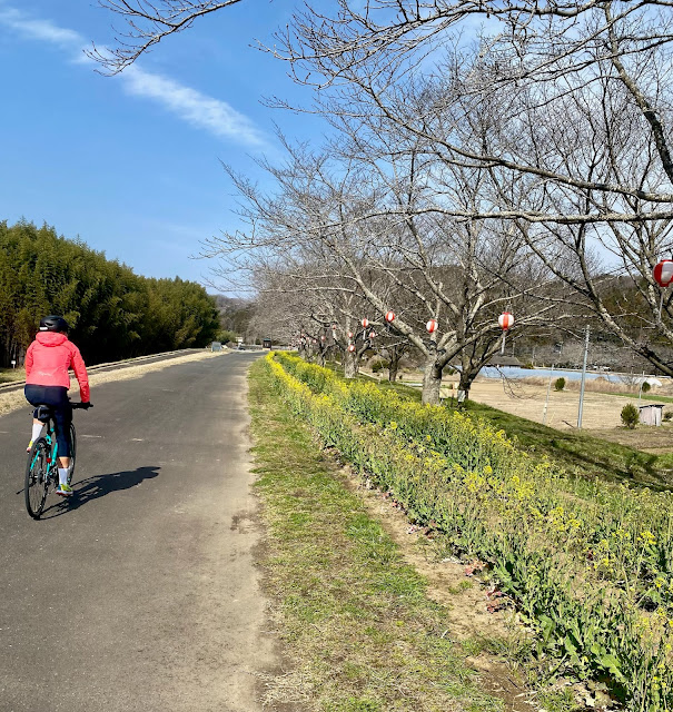
After going further downriver, we cross the Tatsunokuchi Bridge to the east bank and headed north again, riding along a wide path on top of a levy that was lined with cherry (Sakura) trees for several kilometers, it seemed. The trees already had lanterns hanging from them, ready for hanami (cherry blossom viewing) in about two weeks. On our left side as we rode along the levy, toward the river, was an incredible bamboo thicket.
As we started our climb to the final observation deck of the day, we passed an ajisai (hydrangea) park. Ajisai are my favorite flower in Japan, as they offer explosions of color throughout the countryside in June, just before, during, and after the “rainy season”. In March, the bushes were still barren and brown, but this park would be worth a side trip when the flowers are out.
 |
| The ajisai (hydrangea) park |
The climb from here was steep (in excess of 15% at points) and longer than our morning hill, but still mercifully short. The young Ibaraki Prefecture staffer was on an e-bike, and motored up ahead. Oxana, a mountain goat of a cyclist, was up the hill ahead of me even riding her mis-sized, lower-end rental bike. I hope her knees survived the experience. Mayako and I took it at a more deliberate pace.
The view was far better than in the morning, and the tower itself quite a piece of infrastructure, soaring modern steel in contrast to the morning’s traditional wood structure on a stone base.
 |
| Looking downriver |
 |
| Clear view of the sakura, levy, and bamboo thicket |
 |
| Oxana snaps a phot |
 |
| I hold on to the railing ... somehow feel more secure that way. |
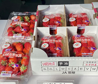
After taking in the view, we descended safely and stopped at a strawberry farm near the base. These berries were so sweet that I almost wondered if there was someone sitting in the back room injecting them with syrup? Apparently not, but still incredible. The brand/type of strawberry read “Ibarakiss”. Indeed!
 |
| Japanese style intensive farming |
 |
| Strawberries for sale! |
 |
| Strawberry guard dog? |
Having spent most of the day eating and, it seemed, much less cycling, we stretched our legs a bit by taking the Beef Line over a few hills and around 10-15 kms to the SW before returning to Mito and hopping a train home.
 |
| One last chance for direct farm-to-table vegatables at a JA store on the Beef Line |
The Tokiwa or Hitachi express trains to Mito from Shinagawa/Tokyo/Ueno stations are under 90 minutes and cost under 4000 yen (around $25) each way. The area we rode through is around 35 kms NW from Mito (or another short ride on the Suigun Line). So if you "rinko" your bicycle, you can do this as a day trip or a short overnight. Of course, you also could include this area as part of a longer tour.
I can imagine a route that would start/end at Narita Airport and take in Kasumigaura and the “ring ring road”, before moving on the Okukuji, then heading either for Kita Ibaraki and Iwaki on the coast and NW toward Koriyama/Fukushima (as I did on the last part of my Fukushima SR600), or go inland via Daigo and Tochigi then further north into Tohoku. Basically, you cannot go wrong if you avoid the major cities and do a bit of advance planning!
The cycling infrastructure around Tsuchigaura, less than 50kms from Narita Airport, actually would make that a great place to start or finish a bicycle tour around Japan. I urged the Prefecture staff to consider making sure that some of the "cycling friendly" hotels in Tsuchiura would store a bike box, also to make sure that there is bike transportation to/from Narita, and that the details are available in English, on the Internet. It was pretty clear that they are already thinking about this. There is already a regular "limousine bus" service between Tsuchigaura and Narita Airport, but I don't know if that bus would take a bike box or not. If they would, then this would be a no-brainer way to enter and leave Japan for a cycle tourist!
This gives a further idea of where we rode, if the Google Maps links are not enough:


1 comment:
As an example of how popular National Route 118 up/down the Kujigawa is with Japan’s cycling route planners … this was on the course of this year’s 1900km ride across japan event organized over Golden Week by Randonneurs Tokyo. Here I think you can see it on the Strava track of former European pro and current ultra long distance champ Mifune-san. https://strava.app.link/knK3BWiNpJb
Post a Comment