Showing posts with label Chichibu. Show all posts

13 June 2025

First Half of VCR Aoba 600km -- Am I Still a Randonneur?

On the climb to Torii Toge ... after the rain stopped.

Having cleared Audax rides of 200, 200, 300, and 400kms this year -- the last on a second try -- I had only a 600km ride left to complete the basic "super randonneur" series for 2025. I have done the series most years since 2010, absent injury or pandemic, and it is often an official pre-requisite for joining 1000km, 1200km or longer events. Even if it is not a pre-requisite, it makes no sense for me to try such a longer event unless I can clear the series first.

I signed up for two 600km rides, not knowing whether I would be able to join or complete either. 

The first was a May 17-18 VCR (Velo Club Randonneurs) Aoba event, out from Inagi-shi through NW Tokyo and Saitama, then via Yamabushi Pass and Chichibu into Gunma, eventually over Torii Pass into Nagano, and more hills in Nagano, Yamanashi, Shizuoka, and back to the start. The profile was daunting. I figured it would be a very difficult challenge, probably more than I could manage within the time limit in my current condition, but I would try it anyway as I liked the course, especially the opportunity to ride through Naganohara, Tsumagoi, and over Torii Pass, plus the next climbs between Ueda and Matsumoto over the broad, high shoulder of the mountains that stretch south into Yatsugatake.

The course looked very difficult -- not any one part, but the sum of the parts. The 600km showed 8800 meters of elevation gain on RidewithGPS. And unlike some courses, from what I could see the major passes did not have tunnels at the top that cut the actual elevation gain to less than what was showing on RidewithGPS. Any 600km event with over 10,000 meters elevation is in a special category of "SR600" and given a 60 hour instead of a 40 hour time limit.  A typical 600km in Japan might have 6000 meters of climbing.  This was was in between, but shading toward an SR600, without any extra time allowed. I remembered doing a similarly tough course more than a decade ago, but this one looked even tougher, and I have not gotten faster in the past 10 years -- the opposite.

Anyway, the course looked very nice to ride, so I figured I would at least try to do the first half, and see if I could somehow manage. I would ride my new "Mugikusa Pass" lightweight climbing bike, and use a battery light instead of a dynamo -- everything to shave off a few grams of weight and save a few watts of power.  I knew that once I got to Fujimi, close to the Nagano/Yamanashi border ... I would have 100km of downhill/flat riding to Kofu then along the Fujikawa to the coast, then after a few bumps,  a second long flat stretch, then after an 850m climb to Hakone Pass, downhill and then relatively flat to the finish.  So I figured, if I could just get to Fujimi in decent shape, I could press onward. I booked a business hotel in Shiojiri, leaving the climb up Shiojiri Toge, between Shiojiri and Okaya, and the very gradual climb up to Fujimi Toge, for after some sleep, however short it would prove. I have done these climbs when exhausted and lacking sleep, and it just is not very efficient and takes forever!

Staff (left/rear), riders (right)

The start was at 6AM at Inagi, around 27km from my house. There were no good options.  I could go out the night before and stay in a business hotel, losing any chance of early sleep.  Or I could get to Shinagawa Station extremely early, rinko my bike, take the first train to Kawasaki (I think), then transfer to the Nanbu Line to Minami Tama, reassemble the bike, and ride a few minutes to the start. Or I could just ride from home and get in 27kms before the actual 600kms. I chose the last option.

As the ride approached, the weather forecast looked difficult, as if there would be rain the first day.  And the forecast did not improve.  When I woke up the rain had already started, so I rode in rain more than an hour to the start. At least the rain was not cold, nor hot. The temperature, around 16-17 celsius, was good for riding.

When I got to the start at Omaru Park ... there were 4 staff, including Minoda-san who I've ridden with, or more accurately behind, on many events, and only 5 riders. The sign-in sheet was full of "DNS" markings. More than 2/3 of riders who had been foolish enough to try this one had opted out. No women joined.

Five riders and one pre-ride by a staff member. 14 DNS/no shows.

They let us go a few minutes early, and I was second to depart, behind a faster rider. Despite him being faster, I kept catching him a traffic lights over the initial 15-20kms.  Finally, I got stuck waiting at a gated train crossing for what seemed like 5 minutes, and he was gone ahead for good.  

At the holy shrine water stop.
Yamabushi Pass

Leaving Chichibu City

Another rider soon passed me, and the other two did also as I rested at the "holy shrine" water stop just before ascending Yamabushi Pass. I played "leap frog" with all but the first rider through Chichibu and even onto the climb out of Takasaki around the west side of Mt. Haruna, passing them when they took a rest stop and vice versa.

Michi no eki on the Haruna climb to Osawa Toge

There were two climbs around Mt. Haruna. The first was long and grinding, and still wet, always wet, peaking at Osawa Toge. Then there was a downhill, and a second climb that ended at the mouth of a tunnel. We descended through the tunnel and popped out the bottom along the Agatsuma River, just above the Yamba Dam and near our checkpoint, Kawarayu Onsen station.

Big station, no customers

The Yamba Dam is one of Japan's most controversial infrastructure projects. Its reservoir fills the valley and destroyed a great deal of natural environment. Local opposition slowed the project for many decades, even as preparatory work went forward. After the DPJ took control of the government in 2009, the project was stopped mid-way. When the LDP regained power in late 2012, it restarted. Now it is done. 


The reservoir west of Yamba Dam

I must say that this entire area looks far nicer now that the dam is done. They have ploughed in infrastructure and money to make it a success.  A few minutes after the PC, I saw a bus ... drive straight into the reservoir, making a big splash but floating.  I laughed -- this was a classic tourist "hippo" (kaba) bus, the kind of gimmick a bureaucrat might come up with to attract visitors. It was too far away to know for sure, but I did not see any passengers. Likewise, Kawarayu Onsen's main facility looked pretty deserted. Perhaps not surprising, given the earlier rain.

Anyway, as I emerged from the tunnel and headed for the control point, another rider was just heading out of the control. I was at least close to 2 of the 4 other riders, I was sure. And somewhere while passing the tunnel, the rain had stopped, completely. The road was already dry along the Agatsuma River. Only 10 and a half hours from home, and 185kms of cycling in the rain, and it had finally stopped.  Within 30 minutes, I even saw some blue sky. 


Climbing gradually to Tsumagoi, with a few bumps

The ride through Naganohara then climbing up through Tsumagoi and all the way to Torii Toge (elev. 1400m) was the literal and figurative high point of this ride. It was the longest climb, and Tsumagoi looked lovely, less beaten down than when I was here in 2020. Again, lots of road construction then underway is now complete. And I guess there has been some spillover investment as Karuizawa has boomed. Still, the climb is not easy, and there are some steep parts that were difficult with over 200kms and 3000m elevation gain into my legs. The sun had set by the time I got to the top and crossed the Gunma/Nagano border.  
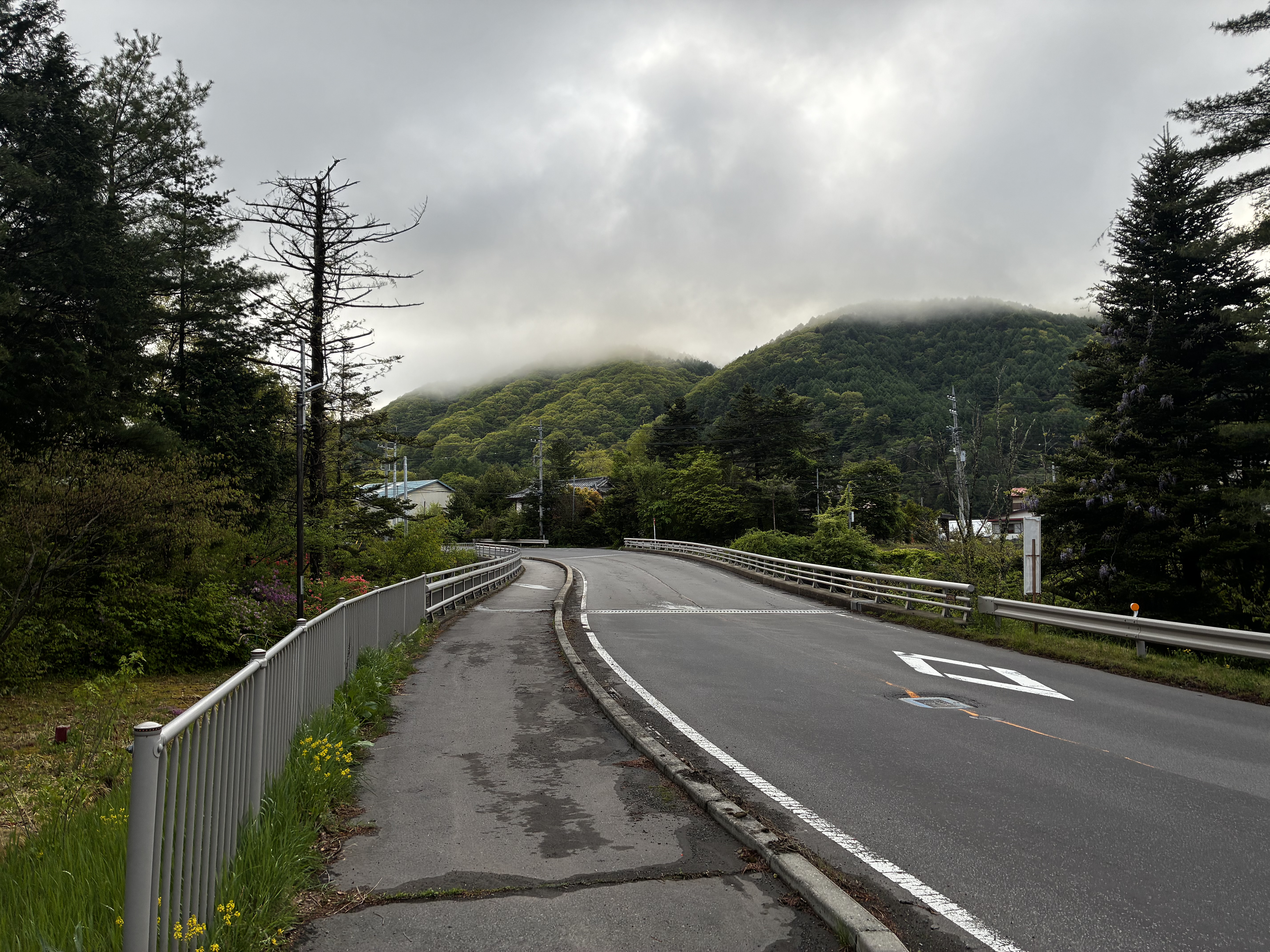


Sunset at Torii Pass - Gunma/Nagano Border

The descent into Sanadamachi and then Ueda was very familiar from when I stayed in that area for a month in 2020, an escape from the city and the summer heat when everything was shut down. I had done the Torii Pass climb/descent probably 10 times back then. But it had been almost five years since, and it was dark now, and I was now quite tired. Also, I had an unfamiliar front light.  I wanted to keep the light on a low/intermediate setting, so it would last through as much of the night as I needed.

If that climb through Tsumagoi had been the highlight of the ride, then riding Route 18 west of Ueda was the opposite. It was a slog. I stopped for some ramen at "Ramen Daigaku" along route 18 near Sakaki. I apologized that I could only eat half of the serving, telling them it was not the taste but rather my stomach and the fact that I was in the middle of a long ride. 

We had dropped from 1400 to 400 m elevation by now.  I crossed the Chikumagawa and continued to the next climb ... a relatively steep one from 400 to 800 m. I needed two short rests to make it to the top. It was getting late, 10PM by the time I started the descent. Very dark and quiet, except the lights in a tunnel along the top. The next stretch, through hilly Nagano countryside over to Akashina, looked very familiar. I am pretty sure I did this stretch on my very first 600k ride, in 2010, but I did not save that on  Strava or RidewithGPS.

Anyway, by the time I got to Akashina and turned left heading south up the valley toward Matsumoto and Shiojiri, it was well after 11PM, and there was a brisk headwind. 


It was warm, almost hot. I finally got to the hotel at Shiojiri, after 1AM, checked in, took a bath, and ... set my alarm so I could sleep for 4 hours and then get breakfast before leaving, far behind the schedule I would need to stay on track. I needed the sleep. The front desk clerk warned me that visiting school kids would fill the breakfast room early ... so I ended up sleeping later and just grabbing breakfast before it shut at 9AM.

At Shiojiri Pass crossing into Okaya

I rode over Shiojiri Pass ... It was hot and there was plenty of direct sunlight. Somehow I felt no faster than if I had continued the night before. I stopped for some soba in Chino.  ... and went to the train. 
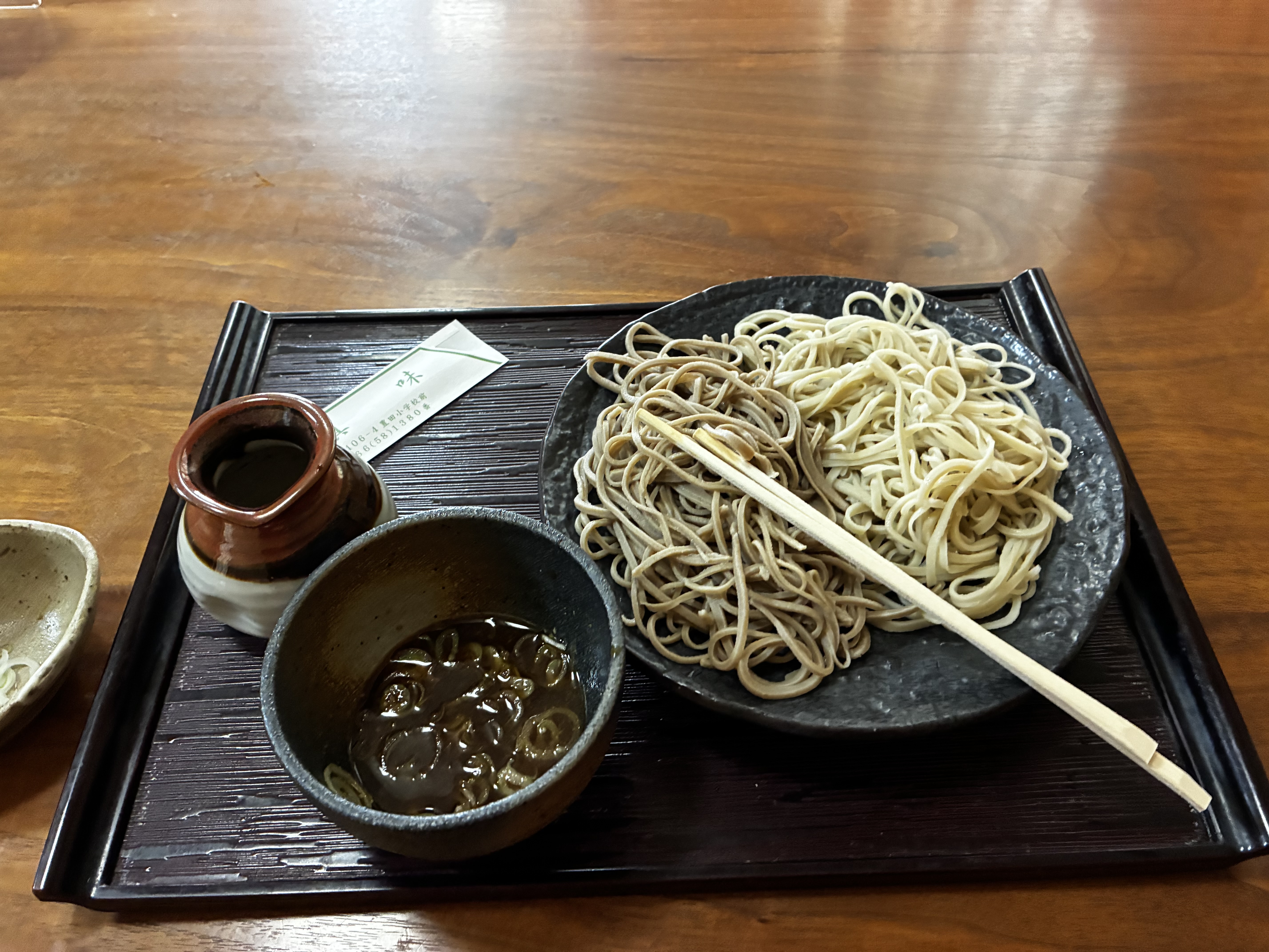


It was hot, I was cooked, I did not feel like riding more, even up the gradual hill to Kobuchisawa. I needed to get back to Tokyo and did so, via train. The Chino train station was not convenient ... I ended up climbing a short nasty slope, then racing to try to catch, but just missing an express. Not recommended.

I had abandoned rather than riding on. Surely a real randonneur would have kept going ... at least over Fujimi Toge and downhill to Kofu, or to the Shizuoka Coast. And with this, I had DNF'ed a second brevet in 2025. 

But in truth I was fine with my ride. I had ridden 316km before checking in at my lodging, with 4200m of elevation gain, in just over 20 hours, half of that in the rain. My hands and thighs were chafed from the rain, but I had done much better in the warm rain this time than in the cold rain on February 1. I had seen a bit of new territory and plenty that I had not visited recently. And I had gotten over the climbs, even if somewhat slowly. So I look at the ride as great training rather than as a failure.

10 May 2022

Golden Week Takenoko Ride to Akiyama via Wada, Suzugane, and Hinazuru Passes

Extra large takenoko -- MacGyver'ed to the seat tube.

I did not ride that much over Golden Week, using the time to recuperate a bit from doing the full 200, 300, 400, 600 km series of brevets over the preceding month, and with other commitments on top of a normal class schedule at my university.

On Saturday, April 30, I rode the rebuilt Voyage Voyage to Chichibu with Jerome, Peter J, and Peter's friend Daniel. After a 90+ minute soba lunch stop, the three of them headed for Shigasaka Pass and a long loop and evening return. I went a bit further, but then turned around and headed for Honjo Waseda and the shinkansen back to Tokyo. 

It was a very nice day all around, including the solo ride. You can see the photos and ride route on Strava. 167kms in all. I left home 25 minutes late after some last minute bicycle tweaks, and pushed hard to catch the others (including a Strava "PR" and 60/2200 all-time on the oft-traveled 5km stretch of Setagaya Dori west of Sangenjaya), met Jerome first at the end of the Tamagawa path in Fuchu, and Peter and Daniel at Oume. 

As I neared the end of the ride, I even got to race a steam locomotive full of tourists at Nagatoro.

It was easy to keep up with the train on Voyage Voyage along a flat roadway. Eventually, after taking this video, I raced ahead. But of course, I knew that eventually the train would win the race. I thought of the ballad of John Henry, who competed with a steam drill at pounding railroad ties to lay new track, and died with his hammer in his hand. But which version of the song? Johnny Cash? Paul Robeson? Bruce Springsteen? BB King, narrated by Denzel? Harry Belafonte? Mississippi John Hurt? Pete Seeger (folk / labor activist)? Leadbelly (blues)? Billy Strings (bluegrass)? It is an American classic.

-------------------------------

The other 100km+ ride was on Friday, May 6, on the RAMAX. This was a Golden Week ride, but a few minutes after leaving home, I realized that it was no longer Golden Week! Friday was a workday and everyone was back at it. The early roads were full of trucks in town hauling massive pieces of buildings to construction sites ... but empty of vacationers in the countryside! Of course, Monday also had been a workday ... but had been nothing like this. Apparently many companies had taken Monday off, but all were back at work on Friday. Schools also seemed back in session -- not just my university but elementary school students heading on their commutes before 7AM.

A headwind slowed me, and was a few minutes late to meet Peter J at our regular starting point along the Tamagawa just northwest of Komae. We called Jerome. He was still in bed, having ridden several days mid-week, and was not coming along. Peter J said he would head out with me and then, as planned turn around so as not to push an iffy knee too much. We decided to head for Wada Pass via Daigo Rindo.

The last time I went up here, the road was partially washed away in places. Now it has all been restored with nice new asphalt. It is still a rindo, however, with moss, plenty of leaves and some rocks. I like to go up Wada this way (no traffic at all), but prefer other routes down. Peter J climbed with me to 500m elevation, then turned back for the trip home. I pressed on to the top (~740m elevation) and then down to the pass (~700m elevation). I did not climb quickly, but at least I did the entire climb without a foot down. The descent down the west side (Ura Wada) was exhilarating, as usual.  The RAMAX was "fun to ride" going both up and down.

No GW traffic on the rindo climb to Wada!

RAMAX at Wada Pass -- the classic photo spot

Koi Nobori on Ura Wada

I then faced a difficult issue. Where to go next? Kobu Tunnel? Or Tsuru Pass? Or Bijotani? Or head south to Route 76 and Doshi? In the end, I decided to head toward Uenohara and further west from there. Maybe I would go over Sasago Pass? Or I could try one of the climbs south of Sarubashi area that I had never done. Now that I was alone, I was aiming for a most-of-day ride, home before dinner. 

I decided to try Suzugane Pass, a route I had somehow never taken in all these years! I could see on my smartphone that after cresting the pass and descending to the south, I would need to then do the shorter climb to the tunnel at Hinazuru Pass and down through Akiyama in order to return toward Tokyo. This was a lovely route. The only real traffic after leaving Tokyo was on Route 20 between Uenohara and Sarubashi, and that was far lighter than normal. The weather was perfect. 

Looking back at Uenohara from Route 20

At Suzugane Pass

Maglev track descends valley, Hazy Fuji in the background

Looking back downhill and downstream, toward Tsuru

Once in Akiyama, I stopped at Tsuruya, better known to expat cyclists as "the manju place in Akiyama."  I ordered a Miso Manju. 150 yen ($1.15). It was , served with vegetables and green tea. I could digest fully while riding as the descent continued for at least the next 8-10kms.  There were flatter sections and -10% ramps--reminding me how hard this little valley is to climb up in the other direction especially on a hot day. I passed one tunnel entrance on my left that led back to Uenohara. ... I don't remember ever having taken that either. But I kept going down the valley. At the bottom, instead of climbing up the South rim of the valley to meet Route 76, as I have always done in the past, I continued on a road that would loop around to the North, eventually meeting the route I would have taken if I had gone through the tunnel ... in time to go through another tunnel and onto a descent to Uenohara. 

Tsuruya, The Manju Shop

Always lovely flowers here, and little/no traffic.

Vegetable and tea make the manju go down, make the manju go down

GW traffic on Route 35 in Akiyama

We used to call this spot "The Vending Machines" in Akiyama.
Now it is just another "Happy Drink Shop".
 
Beautiful Akiyama

Along the way, I came across an unmanned roadside vegetable stand. The only offering was takenoko -- bamboo shoots. 3 huge shoots, priced at 300 or 400 yen. Takenoko is my wife's favorite Spring delicacy ... so I wanted to take one home and see if I could learn to cook it. But I had not brought a rucksack, and the huge shoots were too big for my jersey pockets or my underseat bag.

One of the shoots, the thinnest of the three, looked as if it might fit inverted into my bottle cage. I deposited 300 yen in the coin box, and put the takenoko in the bottle cage, moving the empty water bottle to my rear jersey pocket. The inverted takenoko fit the bottle cage, but I realized it was so top heavy and large that it would flop around and fall out. But wait, I had some zip ties, for exactly this purpose -- to secure items to the bicycle! Two daisy-chained zip ties worked to secure the stalk, and I could ride, with only a modest rub of the takenoko against the inside of each leg.

By the time I approached Uenohara, I realized that I would seriously chafe my legs if I went too much further, ... so I decided to get a snack and hop the train. My timing was not great ... after I rinkoed the RAMAX and got to the ticket gate, I could see the next train was not for 35 minutes. I bought and drank a cold beer. Only 125 kms for the day, but real climbing up Wada (with its long 13-15% grades), Suzugane, and a shorter climb to Hinazuru Tunnel meant that I did get a decent workout. You can see the statistics and route here on Strava.

I bought the middle one.

d
Bike and Takenoko, leaning.


Thank you!

The lower 2/3 of the takenoko was wrapped in plastic, but it was quite a sight for the other passengers at the back of the local Chuo Line train. The first few minutes of the journey, it kept falling over on the floor of the train. Eventually, one man who had boarded with me at Uenohara reached in his briefcase and handed me a large paper shopping bag. I could fit almost the entire stalk into the bag, and thanked him. One of the hikers across the aisle handed me a smaller plastic bag that I could use to cover the top of the stalk that still protruded from the bag. I thanked her also. Everyone in the back of the last train car felt better about me and my takenoko. The "wa" had been restored.

The next day, I got some "nuka" (ground up rice bran) at our local supermarket, and boiled the takenoko with nuka in a pressure cooker for 20 minutes to remove the "aku" bitterness. I could then slice the edible parts of the plant into pieces for grilling in a skillet. Grilling was the easy part, with some olive oil. They were served with salt to taste. The slices tasted pretty good, and my wife seemed happy with the saga.

Boiled and ready to grill

Grilled with olive oil and salted


22 March 2022

Attack Mitsumine Shrine -- RAMAX Maximum Adventure Ride (and Hike); Served by a Robot

Bike & Hike

Jerome (in road shoes w/ cleat covers)

Nice view ... from 1200 meters elevation.

Saitama Audax brevets are usually named "Attack [place name]". Jerome's first 600km ride was, I believe, the 2011 version of "Attack Nihonkai" -- we rode from Iruma-shi (Saitama) to the southern outskirts of Niigata-shi on the Sea of Japan, and back. Yesterday, we were scheduled to ride the Saitama "Attack Ashitaka" (アタック愛鷹) 300km brevet. Mt. Ashitaka is on the southern shoulder of Mt. Fuji. The route for this event heads SW from Iruma through Oume, Takao, and Sagamihara cities, then climbs up to Yamanakako via Doshimichi, over Yamabushi and then Kagozaka Passes, descends to Gotemba, then goes around the large volcanic cone-shaped Mt. Ashitaka by climbing up to Fuji Safari Park and then descending the far side down to the Sagami Bay ... before returning all the way to the start in Iruma. Indeed, this was the same course that Jerome and I rode last October.  I was definitely out of shape then, and there was a lot of climbing (and a couple hours of cold hard rain). It took me 19 hours out of the 20 hr time limit to finish. I was hoping we could shave an hour or more off that time.  

This weekend, Jerome had done another long ride on Saturday (200km plus more to/from the start/goal), so he was hoping to string two one-day rides together as preparation for a multi-day event like Cascade 1400.

We got to the start under Toyomizubashi in Iruma around 630AM via Jerome's car ... and no one was there. Checking the organizers' website, we saw a notice from nearly two weeks ago that the event had been postponed ... just like last weekend's 200km brevet by a different organizer, and Jerome's 400km Chiba ride last month. Other audax events have gone ahead without postponement ... indeed, I had checked the event's webpage, even downloaded the most recent cue sheet, just the day before, but I had not checked the general Saitama Audax "news and events" page where I would have found the notice. After apologizing to Jerome, we discussed what we would do. There we were in Iruma, 50km NW of our typical starting point, before 7AM on a Sunday of a 3-day holiday weekend. We quickly dismissed the idea of riding the 300km Mt. Ashitaka course. It passed many areas that are within riding distance of our homes. If instead we headed further west or northwest, we could ride territory that is out of reach for a typical day ride from west central Tokyo.

I suggested we head west toward Chichibu, go over one of the passes that avoids the tunnel on Route 299 (Shomaru Pass or Karibazaka Pass), then try Mitsumine Shrine to the far WSW of Chichibu City. If we got through with that string of climbs quickly (midday) and the weather held ... we might even try Saitama Route 210 through the wilds of deep western Saitama to Shigasaka Pass, and return back. We had never done Mitsumine, nor Route 210, by bicycle. (I had been to the shrine once by motor vehicle, as 99% of the arrivals travel).

Leaving Rte 299 for the climb to Shomaru Pass

RAMAX leaning

Jerome arrives at Shomaru Pass

Jerome was slow starting out, no doubt due to his long ride on Saturday. I had the rare experience of easily leading him up the Shomaru climb and waiting at the top. We quickly descended into Chichibu City and found a Gusto family restaurant for breakfast along our route. We ordered a "volume" breakfast set from a touchpad at the table. A robot brought our food. It thanked us after we took our trays from its shelves, then happily returned toward the kitchen area.  This was a new experience for both of us. Wow, I thought, I had no idea Gusto was using robot servers. I felt out of date, behind the times. The only human interactions were when we entered the restaurant (someone told us to sit anywhere we liked), and when I paid.  I asked the employee how long they had been using the robot. She hesitated and seemed to be considering carefully the right response. "Nine days", she finally said.  Okay, at least I did not feel so behind the times anymore.

Serving robot leaves after thanking us.

We headed WSW taking a parallel road to Route 140 through much of SW Chichibu City. It had almost no traffic. Eventually the road ended and we rejoined Rte 140. A bit further on we pulled into the Arakawa michi-no-eki for a restroom break. As I returned to the bicycles, Jerome was talking with a woman cyclist. she had an Audax reflective vest, and a reflective triangle "slow vehicle" symbol as well. She told Jerome she had just come from Mitsumine Shrine. She was doing a Nihombashi Audax 300km ride that had NOT been cancelled. (Instead, they stretched out the start times to avoid any crowd or gathering at the start/goal.) She had started alone or nearly so in the middle of the night, ridden from central Tokyo, climbed Mitsumine Shrine (elev ~1000m) in what must have been quite cold temperatures and was on her way back. Respect. 

We saw a few other Nihombashi audax riders headed back as we continued toward Mitsumine. But we had a different plan. Mitsumine can have heavy traffic on a narrow road. So some riders take a different route on the other (NE) side of the mountain all the way up to around 1220m elevation, through a short tunnel, and descend to the shrine at just over 1000m.  Indeed, this route has even been used for a hill climb race at times in the past. Our plan was to take this rindo, then after a quick lunch at the shrine, to descend the main road.

Onto the climb - beautiful and empty road.

We found the turnoff and started the climb. Jerome lagged -- unusually -- his fatigue from the day before still showing. It was a lovely road -- wide, empty, and not TOO steep -- all the way up a valley to a "fishing spot" (釣り場) that had a parking lot full of cars. From there, the road turned up steeply and was blocked by some "no way through" signs and pylons. On the left side, however, there was a note that visitors to Taiyou-ji temple should move the barriers and proceed. 

Lots of these signs up here.

On the left side is the note that visitors to Taiyou-ji may proceed.

A nice spot to rest and wait a bit for a tired Jerome

I rode to the next switchback, where there was a babbling brook and I could wait for Jerome in the sunlight. The next segment was to the turn off for Taiyou-ji. Here was another gate across the road we would take. There was a helpful sign that the road led to a trailhead for the climb up Mt. Kirimogamine. 


We continued, but soon found sections where the road was covered with snow, only tire tracks exposed. We could ride in the tracks, but needed to be careful and watch for icy patches. In some places, the snow was a bit deeper and crustier, and so riding into the edge of the track would be dangerous. We proceeded slowly, walking at times.


No more tire tracks ... only an animal.

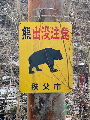
Finally we passed the Kiromogamine trailhead, marked by a small gazebo/picnic table. The tire tracks ended here and the road headed around a bend so it was on a north facing slope that did not get sunlight. On the next snowy section there were only ... animal tracks. Deer? I saw three further up the hill. Bear? We saw MANY bear warning signs but no bears... perhaps the local bears were still hibernating. Or else they had awoken and were very hungry?

From here, the last 2+ kms to the tunnel through the mountain, we would walk the entire way, sometimes pushing and sometimes carrying our bikes where the snow got deeper.  


More animal tracks

I was glad to have MTB shoes. Jerome, meanwhile, had road shoes with rubber covers on his Look Keo cleats. Not ideal for this long a walk! But we made it. It was a long traverse, it was cold at 1200m elevation in the snow, it was not so easy to walk carrying a bike. But it was never so far, nor so cold, nor so hard that we considered turning back. The vista was spectacular, its own reward. I am afraid that the average speed for our ride ... dropped pretty precipitiously on this climb. On Strava I could see that I was the third fastest to do the climb this year ... out of three. The other two were recorded in early January, before the snowfall, and must have just ridden up at a good pace.

Once through the short tunnel, we could quickly descend the rindo to Mitsumine. There were plenty of snowy stretches still, but on this side the snow on the road was wet and at most a few centimeters deep. We could ride through it downhill being careful not to go too fast, nor to brake or turn suddenly. We knew we were approaching the shrine when we came to another closed gate ... and a huge parking lot full of cars. 

Outer gate to the Mitsumine Shrine complex

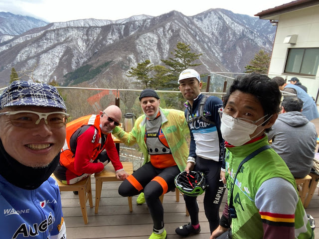
We went up the path toward the shrine entrance and found a cafeteria full of visitors. There were three bicycles together out front. No audax rear-triangles, but they looked as if they might be part of our extended Audax family.  Sure enough, we entered to find Messrs. Minoda (Aoba organizer), Tachibana (Gunma organizer) and Shimura. Shimura-san's bike was a beautiful titanium SEVEN, with his name painted on the top tube. Minoda-san we have known a long time from Aoba rides and as a local -- I would come across him on his daily commute down (then up) the Tamagawa Kawasaki occasionally when I lived near Futako Tamagawa. Tachibana-san I've also met before on rides. I follow him on Strava and am always amazed to see him racking up 200km+ rides on a typical weekend. He has already gone over 9,000 kms this year ... a significant share of that on Zwift.

Messrs Shimura, Minoda, and Tachibana

On the veranda

I think Jerome and I burned a few more calories than they did on the climb!

Jerome and I could only get a seat quickly on the veranda outside ... but we could warm ourselves by the wood stove inside then sip hot tea as we waited for our food, and were relieved that the glass wind barrier kept it quite warm even on the veranda outside of the restaurant. The other three audax riders said farewell and headed down the hill and we relaxed and finished our meal. 

We got on our bikes and started down the hill ... first passing what seemed like at least a kilometer long line of cars waiting patiently to enter the parking lot. I was glad we had come up the rindo, and very glad not to be arriving there by motor vehicle. Most of the descent was fast ... switchbacks that were long enough to gather up good speed yet still brake in plenty of time for the curve.  On the RAMAX, I could descent with confidence, the disk brakes working like a charm. After we were more than halfway down, the road narrowed. At points we waited behind a car that had stopped to let opposing traffic pass. Jerome said "they need a more powerful politician." Indeed, this route gets enough traffic so it would seem to merit some sky bridges like Yanagisawa Pass on Route 411! 

I'm thankful I did not drive here.

In any event, at the bottom of the hill, there was a red light and a line of cars, just before the road narrows to a single lane to cross over the spillway of a dam. Jerome went ahead and I followed. We were almost across when the line of opposing traffic came at us ... but there was plenty of room for two bicycles to slide by without inconveniencing them. We saved at least 5 minutes right there. Further down the hill we can to another long 3-way traffic signal ... and were able to move by the cars, to the front of the line ... and there we met the three riders who had left at least ten minutes ahead of us. 

I'm on the drops in front.

The five of us rode together to Chichibu. Jerome and I could hang with them well on the gradual downhill ... but we lost contact on the flat stretch going into town, riding along a line of cars. Those guys are all very strong riders! We caught them again ... as they waited at a light, and said our farewells. They were heading back to town via 299 and Yamabushi Pass. We were heading in a large arch to Yorii and then down along the east side of the mountains back to Hanno/Iruma.

The rest of the ride was ... around 25 kms arching to the north/east, parallel to the Arakawa as it flows from Chichibu City through Nagatoro and to Yorii, then another 40+kms to the southeast via Ogawamachi, Ogose, Moroyama, Hidaka, Hanno, and finally to Iruma. By far the longest stretch was heading southeast on Saitama Route 30, a very familiar road. Finally, we turned off onto Saitama Route 262 for the last stretch into Iruma ... the short ups and downs on this stretch reminded me of past Saitama brevets starting at Toyomizubashi, even that 2011 "Attack Nihonkai".  

Across the road from our convenience store food stop in Chichibu City

Near dusk, passing Yorii

We made excellent time on the last 65kms ... with Jerome pulling or at least leading much of the last 40 from Yorii back to Iruma, because he had his iphone attached to his handlebars and had the route visible, whereas I did not have it in my Wahoo. But other than a brief stretch where I felt as if I were "riding-while-digesting" after food stops in Chichibu City in both directions, I felt pretty strong the entire day. The RAMAX is now officially dialed-in and is very comfortable. With the Panaracer Gravel King 700x28 tires, it both climbed and descended very nicely. With a 120mm stem, my body position is just right. Nothing ached after 185kms and 2300m of climbing. The bike continued to feel comfortable for the long cruising stretch back to Iruma.  The only pain I suffered alld ay was some "hot foot" later in the ride, but a minor tweak to the location of the right shoe's cleat seemed to resolve that entirely.

The RAMAX model name means "Randonneuring Adventure MAXimum" ... and today we did our best to live up to that.