|
| Somewhere in Saitama, or Ibaraki in the wee hours of Sunday. I am thankful as always for my dynamo lighting -- SP Dynamo SD-8 hub and Supernove E3 Pro 2 light. |
 |
| Sunday Sunrise over Lake Kasumigaura |
 |
| Sunday Sunset, over Tokyo Bay from the promenade near Makuhari |
The Route
I signed up for the event despite a relatively familiar, relatively flat, less interesting, and heavier traffic course all within or on the edges of the Kanto plain.
 |
| The route -- 400 kms around the Kanto Plain. |
That said, the course was not without its highlights.
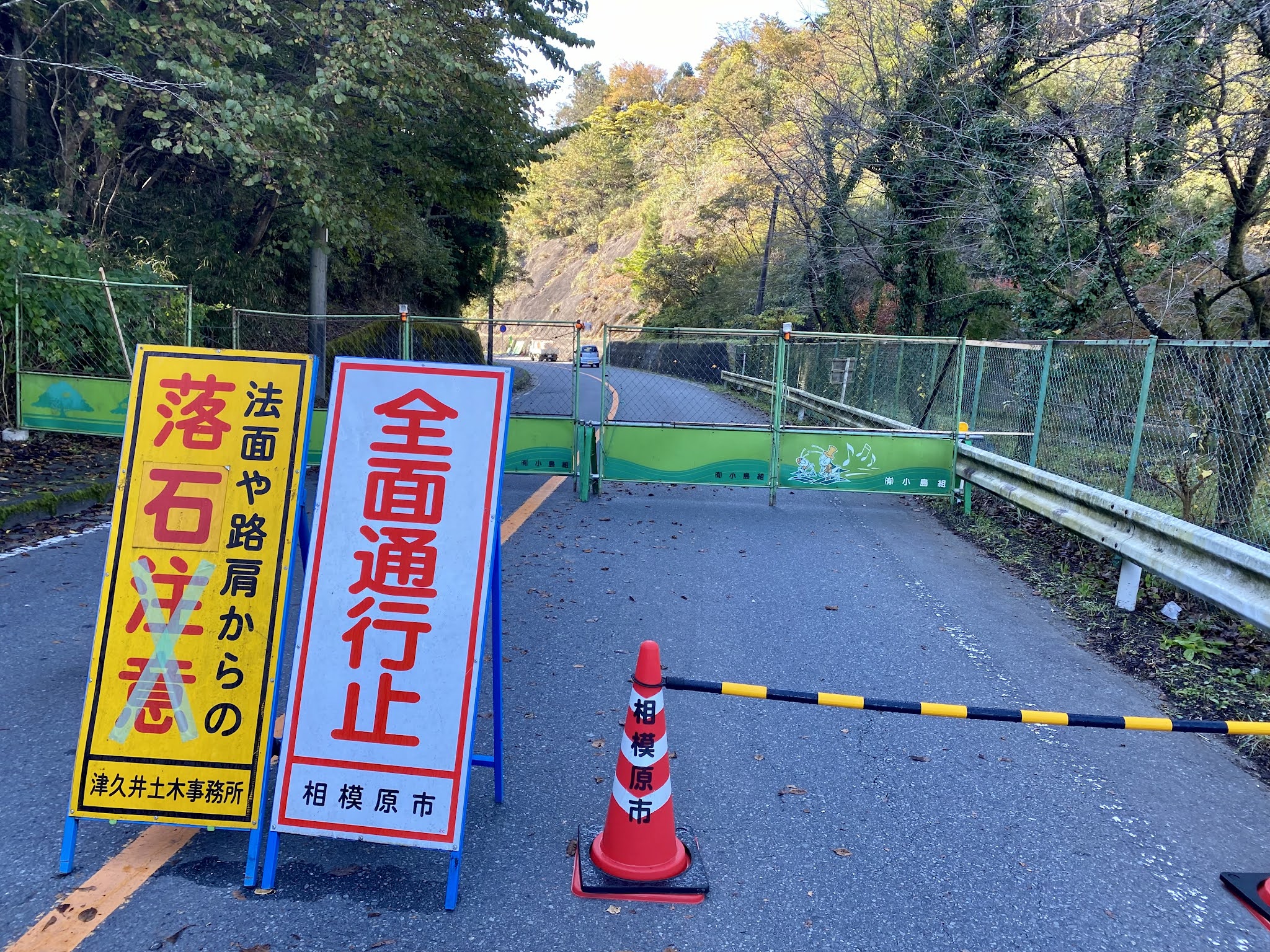
- The route it takes north of Oume to at least Moroyama reminds me that this is the "best" way S-N (or N-S) along the eastern edge of the mountains, with some nice minor twists such as getting away from Route 299 at kms 63-64, and the nice side road at kms 65-67 -- classic Audax hacks to enjoy a bit nicer ride than along the main highway -- as well as one of the best ways through Hanno. And there is that long downhill from Oume to Hanno after the short climb that follows Oume Station (when going S-N direction). My GPS was off for part of that section, but you can see it on the ride's route map, kms 50-72 or so.
- The route takes advantage of new cycling infrastructure, along bike paths in several places.
- The first was a 10 km stretch between Tsukuba and Tsuchiura (kms 179-190), where there is a new, nicely paved, dedicated bike path through the fields. The path goes much further to the NW, then N, and apparently includes an "optional" loop up onto Mt. Tsukuba.
- Next, we joined the Lake Kasumigaura "ring road" for much of our route to the SE alongside Lake Kasumigaura. This was delightful in the morning, warmed by the sun with a nice view across the Lake and plenty of waterfowl. Indeed, if I could make an easy change to the course for this brevet, I would have had us join the lakeside path earlier (as looks possible from around km 204 instead of km 220), and staying along the lake from kms 232-239 instead of rejoining the road, to save over 20 kms of short rolling hills and Ibaraki traffic (still relatively light for me at 630-830AM Sunday morning).
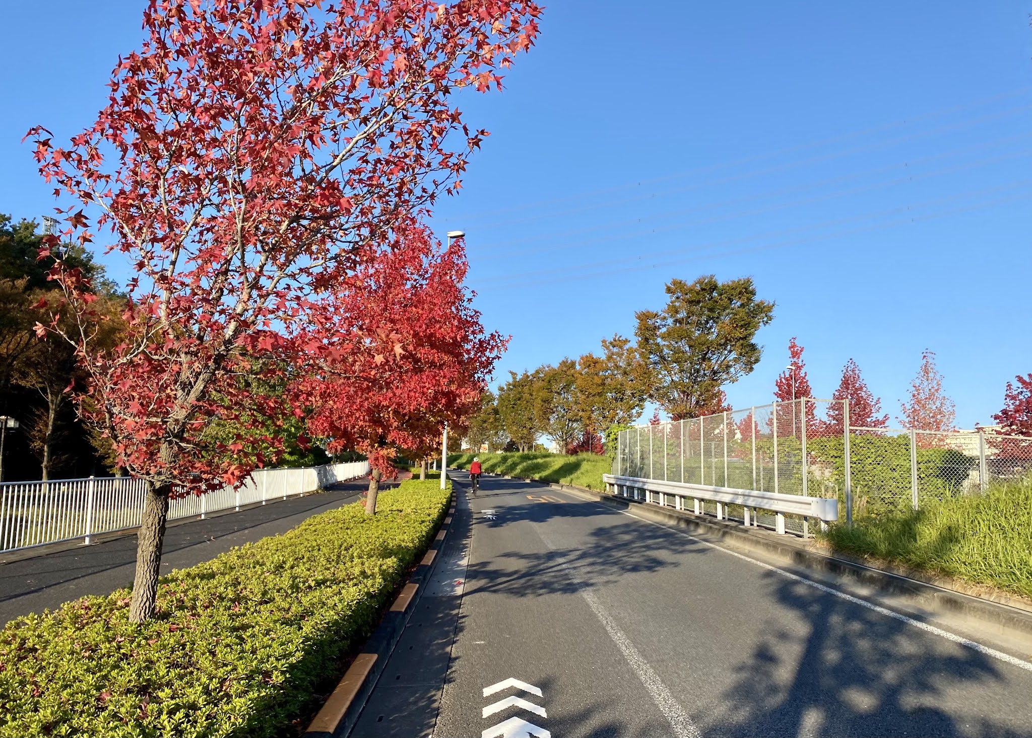
- Finally, there is now a decent bike (and running) path alongside Tokyo Bay in between Chiba City's harbor and the area west of Makuhari (approx kms 352-360). In a few stretches, it is a proper bayside promenade even. Now, if only Chiba and Tokyo Prefectures, together with Funabashi-shi, Ichikawa-shi, Edogawa-ku, and Koto-ku, could extend this type of infrastructure to create a link all the way between Tokyo and Chiba ... but I am not holding my breath. So Ibaraki competes with Izu, and the Shimanami Kaido, with new cycling infrastructure or support.
- The road along the coast on the northern portion of kujukuri-hama is narrow and has plenty of traffic on a Sunday afternoon. I wanted to try the bike path along the ocean whose signage I saw ... except that I did not want to delay, nor to ride into a headwind with full exposure, as opposed to a street lined by structures and trees. Then again, I was very happy with the route taken from Togane toward Chiba City, at least the first 15kms or so (kms 320-330). I usually have taken a route west from Togane on Chiba Route 301, that takes in Lakeside Hill/Hiyoshidai where I once developed a solar farm. The brevet took a route one valley toward the North -- pleasantly undeveloped with forests and fields after the first bit.
 |
| Up the valley west of Togane |
 |
| More internal Chiba just west of Togane |
Besides, this course includes some heavy traffic roads that are not a lot of fun, and some relatively monotonous scenery -- urban sprawl and flat farming areas of endless northern Kanto territory. I figured that as long as I was well-rested at the start, I could make good time and, if i could get through the first 250kms largely in the dark and before the arrival of peak Sunday mid-day and afternoon traffic, I would enjoy it more. In the end, I did the entire ride without seeing any other brevet riders. There were plenty of other cyclists during the day hours. There was even a brevet-like cyclist I was trading places with in the first 10kms, .but no rider had the distinctive reflective vest and required lighting that signals "Japan Audax".
The Randonneurs Tokyo N2 brevets use a "remote brevet card" to record progress. This involves uploading photos of convenience store receipts with a "frame badge" that shows one's registration number. The system works very well, once I decipher the Japanese instructions. I did a 200km version back in January, so this time only a short refresher is required and I do not need to worry too much about getting something wrong.
 |
| My "remote brevet card". |
 |
| Report of my Start |
This is a brevet format in line with the times -- no unnecessary human contact. I can do the entire event by just filling in forms, uploading photos, sending a bank transfer (of the $20 equivalent entry fee). Indeed, the closest thing to a human touch was a reminder email from the organizer that I had not paid my fee on time, and my application would be cancelled if I did not do so within 24 hours of notice. This is a far cry from 7 years ago, when I did the Randonneurs Tokyo Ise Itte Koi 1000km ride, got to know many of them and joined many familiar riders, ended up building and giving Tsumura-san a handmade (home made?) front wheel with SP Dynamo hub for testing by their core members, and got a bottle of Okinawa sake in thanks. The elimination of unnecessary paperwork is to be applauded -- and should be emulated by the government -- and probably removes much of the drudgery for the sponsors, but I hope that eventually they return to a "regular" format where we ride together, and the organizers appear at the start and finish.
Riding The Pelso [Brevet]
The other unique feature of this brevet is that I decided to ride the recumbent Pelso Brevet. A brevet on the Brevet. This was to be my first ride longer than 200km on the Pelso, and I was a bit worried (actually quite worried) whether I could do it. This is the main reason that I chose an event with a relatively flat course. I am slow climbing on the Pelso, and a long climb of steeper than 5-6%, especially when tired out from several hundred kms of a brevet, is out of the question. I can power up a short steep grade, or a longer gradual one, but trying to do a longer climb after many, many hours of riding ... is beyond my current capabilities. Hence, I chose an event with a course that stays out of the mountains, even if it does go through hills over the first 100kms (when I would be "fresh"), and has short up/down sections later on. I hoped to compensate by the Pelso's somewhat faster "cruising speed" on the long flat sections.
 |
| The Pelso, as I stopped for a fruit/nut bar somewhere NE of Moroyama on Saturday evening The Radical Designs rear bag fit everything I needed and more. |
How did it work out? Well, I made it, so that says something. And the flat run from west to east across Saitama and Ibaraki, after the last hills around Higashi Matsuyama until the Tsuchiura checkpoint, was definitely easier than it would have been on an upright bike. Likewise for the stretch into the wind along Kujukurihama. My overall time was probably about the same on the Pelso as it would have been on a road bike.
But I will need to change something if I am to use this bike much on climbs or in heavy traffic areas with lots of stops and starts.
Just after leaving the Oume checkpoint, the route hits a short steep climb over the ride to the north, or at least up to a tunnel through the ridge to the north. There is a short steep section (10-11% grade) that was too much for the Pelso and me. I could feel my heart racing and lactic acid in my legs burning ... so got off and walked a minute or three, up nearer the tunnel mouth. I was reassured that it took only a little while, saved my legs for later, and that this was the highest hill on the entire ride if the route map was to be trusted. An hour or two later I walked up one short hill in Saitama, as a way to catch some rest, and again the next day some nasty very short climbs in Chiba where the back roads dip through some hollows with +/- 10-15% grades, as well as part of the not-so-steep climb after crossing the Tonegawa. Otherwise, I stayed on the bicycle.
Thanks to the night start time and a nice wide shoulder on the busy highway while passing through Kamisu (kms 250-270), I did not hit nasty traffic until the approach to Chiba City (kms 330-345). At times there were cars streaming by me. At times there were LONG lines of cars sitting, waiting for a bottleneck intersection, with only a narrow area next to the gutter in which to slide by on the left. It was heavy traffic most of the way to the border with Tokyo, though I could avoid about half of it by utilizing the bike path / promenade in places. Getting by the lines of traffic in a narrow space is not so easy on a road bike, but it was definitely more difficult on the Pelso. The Pelso is longer and a bit less maneuverable than a road bike and my current handlebar setup is at least 6~8 cms wider. And it is less stable at low speed, and sometimes requires adjustments to keep it from going off its "line". In the absence of an adjustment, I must put a food down to stop from falling over if not careful, especially when starting uphill. In the last 100kms of the brevet, I needed to put a foot down several times. And I worried that I would strike a side view mirror or scratch a car when passing at close quarters. I did not do so, but I needed to focus on it in circumstances when I would have been watching the road ahead or the scenery had I been on a road bike.
 |
| I was expecting some kind of prominent signage, maybe an intersection with traffic light, and was getting a bit tired, so completely missed the entrance road to tiny Shingo Station. |
I have learned that the way to avoid the risk of going off balance on the Pelso at slow speed is to sit up straight, holding the bars tightly, and only recline onto the seat once I am gathering speed. That technique makes the bike very stable, and with it starting and stopping is no more risky than on a road bike. But it is not a position that I want to use for many kilometers when already quite tired, nor do I want to sit up and pull the bars 50-100 times over an hour. Indeed, the wonderful Ventisit seat pad is just coarse enough so that it grips and rubs against one's shorts and jersey. I wore out one pair of shorts already in recent months on the Pelso. Going through Chiba, I could feel the seat grabbing the shorts a bit as I "slid" up or down, over and over, on Sunday afternoon.
Of course, I took only 3 rides, none longer than 70km, on the Pelso the past two months, since my September U.S. trip and October quarantine. So the shortcomings that I mention can probably be overcome with a bit more recent training and preparation. And climbing would be far better if I lost 10-15 kgs. On the other hand, if I lost 10-15 kgs, I would be that much better climbing on an upright bike as well.
How did and do I feel?
Well, I have done plenty of 300/400km or longer brevets before where I felt great during and after the ride, and also my share of events where I had pain somewhere -- a stiff back, stiff neck, chaffing or saddle sores in the groin, searing pain of "hot feet", pain in the hands and even temporary numbness in the little fingers of one or both hands. I can remember a few earlier efforts (Rocky Mountain 1200) where I had trouble with my ankle (achilles tendon?) developing some pain and even a slight "click", and needed to take some ibuprofen. My first PBP I was a wreck. On the other hand, I gradually have developed muscles and adopted gear that get me through most events without any such difficulties. The right saddle, good insoles and more comfy/roomy shoes with thicker wool socks, the right bike "fit" for handlebar position, seat posts with a bit of flex, slightly wider tires with lower air pressure, frames that are not overly stiff -- all add up to the possibility of much longer rides in comfort.
The recumbent takes away all the stress on back, hands, and groin. With the recumbent, there is no getting off the bike and feeling like an "old man" as you try to straighten your back after hours in an aerodynamic position. The neck can suffer as much, or more, stress than on an upright bike, though on the Pelso you are trying to hold the head forward/upright, rather than backward/upright, to see ahead. The solution -- a neckrest at the top of the seat -- is easy for the recumbent. I used mine to rest my neck every so often, and could use it pretty much non-stop on long traffic-free sections in the wee hours of Sunday morning.
The recumbent does, however, put stress on the legs. A lot. And the pressure on my knees and ankles as I push in the pedals, pressing into a fixed carbon shell seat with my back, is far greater than even when I stomp on the pedals applying my body weight on an upright. So I need to be careful not to push too hard or ride in too heavy a gear. And to lighten the pressure, I ride the Pelso with flat pedals and regular athletic (running) shoes that have a sole designed to absorb impact.
I felt some mild pain in both knees and ankles during parts of the ride, not to mention the intense burn of lactic acid in my legs as I pushed hard on short climbs. I needed to remind myself to ride a somewhat lighter gear. At 275-300km, I was a bit worried that if my leg pain increased, my knees might start to swell, or my ankle suffer an obvious problem, and so I might not make it. Instead, though, I stretched my legs a bit then took my only real "nap" of the ride -- 15 minutes -- at a gazebo along a river by the sea just north of the jujukuri hama checkpoint. That seemed to do the trick. I could make it through without the symptoms worsening, and indeed improving. The day after the ride, my legs feel very heavy, my knees and ankles somewhat sore, but, as they say, "none the worse for wear"?
Despite the different style of bicycle, I still find that an intense, 24-hour effort such as this ... is rewarded with a beautiful, deep, 10 hours of sleep, and that the next day my body feels completely stress free and "detoxified".
Could I use the Pelso for PBP in 2023? I think the jury is still out. I would not rule it out, but to do so I would definitely need to be better at climbing. PBP does not have any mountains, and the longest climb, coming back out of Brest, is not steep. But there is a lot of up and down over 1200kms.
---------------------
Anyway, after an early dinner I left home at 7PM, arriving at the start (Musashi Nakahara Station in Kawasaki) 10 minutes ahead of my start time. My convenience store receipt shows 19:45 exactly, and after a few minutes taking my photo and uploading to the "remote brevet card", I was off!
The first 50km segment to Oume was uneventful, still some evening traffic, especially through Kawasaki's wards adjacent to the Tamagawa. I was at Oume just before 10PM. So far so good. It was cool but I did not feel a need to change to my warmer gloves or cap, yet. After a bit of invigorating chill on the descent to Hanno (and the minor panic of going a few kms off course and needing to backtrack), I made good time through the rest of the northern leg.
But I was tiring as I neared Shingo Station near Hanyu, the second checkpoint. My kilometer count was thrown off by the "off course" episode, and I was over 3kms beyond the checkpoint before I thought to pull out the map and cuesheet and look for it. So I circled back and did not arrive until 1:30AM, 3 1/2 hours after leaving Oume for what should have been a 74km stretch, in fact around 85kms for me.
At Shingo I put on my warm Q36.5 Anfibio "winter rain gloves" and a felt lined helmet liner. I passed one signboard that showed 2 degrees Celsius (37 fahreinheit) just before Shingo, but in fact it cannot have been colder than 5-6 degrees. I never needed a jacket over my long-sleeved winter jersey/leg warmers setup, nor did I use any of the "kairo" (chemical warmers) I had brought along.
I continued to make decent time to Tsuchiura in the wee hours. By 530AM (9hrs and 45 minus after start), I was at 190kms, actually closer to 200kms including my detours. That is faster than my recent 200km brevet times, definitely.
 |
| Mimura, in Ishioka-Shi, Ibaraki right here |
The trip to the north from Tsuchiura included some lovely farm houses, especially a collection of them that streched on for quite awhile, well-maintained, with beautiful plantings - flower or Japanese gardens. And the ride down the eastern edge of Lake Kasumigaura was also lovely.
 |
| Wetlands along Lake Kasumigaura |
I generally have a bad impression of cycling near Kashima and Kamisu, SE of Lake Kasumigaura.-- heavy traffic on limited roads. But traffic was not bad on Sunday morning, and the main route (124) we took had a wide shoulder.
 |
| In the 20 yen lane (sidewalk) on the Tone Kamome Bridge |
The bridge we took over the Tonegawa and into Chiba had a 20 yen toll for walkers and cyclists. There was a toll box ... but I had brought no change with me. No electric money. and no one there to make change. I was struggling with whether to insert a 1000 yen note, or maybe walk across several lanes of traffic to the office on the far side and try to find someone to make change, when an older man passed. I mentioned my dilemma and he said "that's okay, just go ahead, even many Japanese do not pay here". So I went. I told him "next time I come here, I will bring 40 yen"..
 |
| Along the Chiba coastline |
 |
| My view as I took a short nap Sunday afternoon |
The headwind had kicked in on the southern part of the ride down Lake Kasumigaura, and then were gale force on the bridge over the Tonegawa. The winds continued from SW until evening, slowing my progress some ... but not as much on the Pelso as would have been the case on an upright.
 |
| The Epic Ride Weather app does a good job at matching wind, precipitation, and temperature forecasts along a ride route ... just give it a start time, average speed, and link to a route that has been entered into any of the common GPS services. |
 |
| Central Chiba city. |
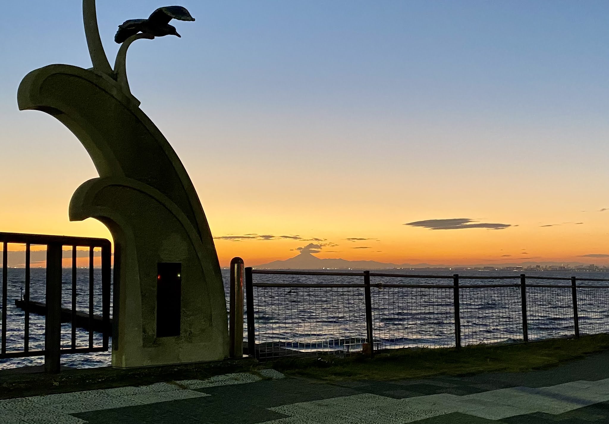
I survived the traffic on the eastern approach to Chiba City, got rewarded with a lovely view of Mt Fuji at dusk across the waters, enjoyed a trip through Ginza, and then was at the finish, a 7-11 on Nakahara Kaido just before Kanpachi.
 |
| Along the promenade approaching Makuhari |
 |
| Bright lights, big city (Tokyo), from Eitaidori bashi |
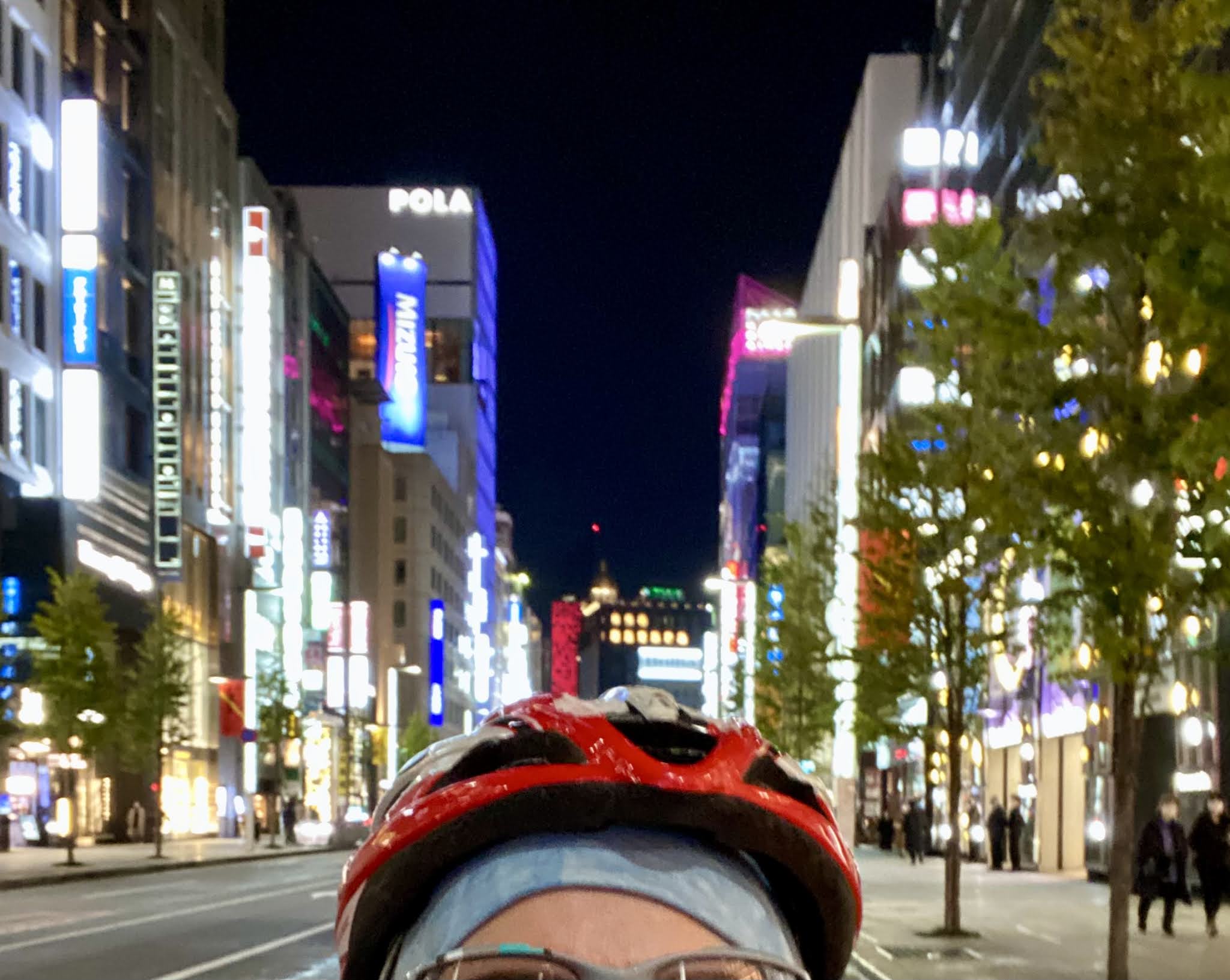 |
| I cruise through the Ginza. At this point my clothes are ... a wee bit smelly, so I don't stop for any shopping. |
In the end, I did not get to the goal before 8PM, over 24 hours after the start. I need to get faster again if I am going to enjoy - and get enough sleep - on the multi-day rides such as PBP.
As I rode the Pelso back into town from the goal, along Nakahara Kaido toward home, somehow the uphill sections did not seem so tough anymore.