Showing posts with label Hakone. Show all posts

27 July 2022

Riding the Rindos of Odawara from Cycling Gypsy Cafe

A closed rindo above Odawara!
RAMAX was a joy to ride on mountain/forest.gravel roads.

Last Saturday morning, I was in the Odawara vicinity and had my RAMAX adventure/gravel bike with me. Finally, a chance to try the RAMAX on some mountain/forest roads!

Looking down to the NE from the agriculture/forest border region above Odawara

Looking down to the South toward Sagami Bay

Since moving to a neighborhood not far from Shinagawa Station five years ago, the fastest way to get quickly to some lovely rides is to hop the shinkansen from Shinagawa to Odawara (26 minutes, ~3100 yen) or Mishima (35-40 minutes, ~4500 yen).  Going to Odawara, I am in the countryside and on a climb within 15 minutes of leaving Odawara Station, instead of the 2 hours it takes from my home to, say, Takao. So far, trips to Odawara have involved climbing west up the old road (kyu-do) through Hakone to Lake Ashinoko, and on from there, or perhaps starting by going northwest around the hills and then climbing up toward Ashigara Pass from the east.  

But in recent years I have noticed lots of cyclists posting Strava rides on the network of forest roads between Odawara and Ashigara. And I knew that Michael Rice, who I’ve ridden with long ago on Tokyo-Itoigawa, among other events back in the glory days of TCC, had opened the Cycling Gypsy Café in Odawara some years back, though I had never made it there. You can see details here in an article from one of the Japanese cycling magazines about the café and Chapter 2 Bikes, which they are selling. Or you can see another article here, or a blog post here or here, and info about rental bikes here, or Gypsy’s Instagram feed here. (Mike is one of the hosts of NHK World’s “Bike Around Japan” show … from which some readers may know him.)  He has been posting some of his rides in the hills nearby on Strava, including a regular “grand fondo” he hosts for other riders, as well as shorter “test rides” he takes with potential Chapter 2 bike customers.

Anyway, I decided to stop by the Cycling Gypsy Café to say hello, before doing a ride based loosely on one of Mike’s Strava tracks. I met Mike and Glen (“Gypsy”), chatted a bit, then headed out. There were people waiting to test ride one of the Chapter 2 bikes.  The café is located within walking distance of the shinkansen station, and at a jumping off point for rides in the hills, and had a nice breeze on a hot morning. I could understand why he picked this place.

Mikey Rice -- Fully recovered from Gravel Unbound 2022

Glen "Gypsy" showing her strength ... and the bike's lightness .. at the same time.

The roads above Odawara were lovely. After climbing 15 minutes or so, mostly on quiet back roads, I got to the long “virtually no traffic” section of the ride. I continued and eventually hit the network of forest roads (“rindo”). I kept coming to large signs by the road that warned against “unauthorized” vehicles. They had a long list of exceptions, including 地元関係医者—someone local or connected with someone local. I did ride one rindo that actually had closed gates at each end and, according to the signage, was 8.9km long. But the rest were open with only the signs to protect them. I guess the idea is that people not use these roads as a short cut to avoid traffic jams on the main road from Hakone Yumoto up to Gora.

Closed road ... unless you fit in one of the many exceptions. These signs were all over!

There was even a Salvador Dali "melting" version of the closed road sign.

It was nice in the forest riding in dappled sunlight at around 500m elevation … but it was beastly hot on any climbs where there was exposure to the sun. I had taken 1.7 liters of water, topped off at Gypsy Café, and was running low already when I could not have been more than 40% of the distance I wanted to travel up to Ashinoko via upper Ashigara. At one point I missed a left turn (Mike had said the route generally “keeps left” to continue climbing the top of the ridge).  For some time I continued on the level. Then, as my bicycle started to point down, I got off and checked location. It looked as if I could continue along the side of the hill, gradually descending, then eventually I would point straight down toward the flat lands. 

I did so, got to the bottom of the hill, turned right to head back toward central Odawara, … made a couple short detours that involved really nasty little hills, and was back at the Gypsy Café in time for a nice vegan curry (*with cheese) lunch.  By now it was the hottest part of midday, but the veranda at the café was still cool enough to relax and enjoy lunch outside. 

Spectacular paint job on this Chapter 2 bike

Chapter 2's gravel bike. No, it's not made of wood, just brown paint.

Cycling Cafe Gypsy is a great place to hang out, even on a hot day!

Delicious vegan curry.

My GPS somehow cut off mid-ride, but I could not have gone more than 40-45kms. It was a hot day and a very hilly course, so that was enough. I look forward to more, longer, cooler rides out of Odawara soon, once the peak summer heat has passed.


06 May 2019

Hike (and Bike) in Hakone to one of the best 100 bridges in Kanagawa!

A lower shoulder of Fuji barely visible over Ashinoko if you look closely, after the rain.

This Golden Week has been without any major bike rides.

I have somehow managed to maintain my sanity with shorter rides and trips near Tokyo, a few swimming workouts, and a mix of events in town, all undertaken without too much rain. (While still sane, I am now "chomping at the bit" for the 600km Okitsu classic, coming up May 18-19).

One of the events this week was a hike planned for students from the Keio LL.M. program. I suggested the "old road" at Hakone -- since I have done the climb from Odawara to Ashinoko/Moto Hakone by bicycle several times in recent weeks, and also that is where my teachers took me on a hike when I was at the Inter-University Center for Japanese Language Studies more than 30 years ago.
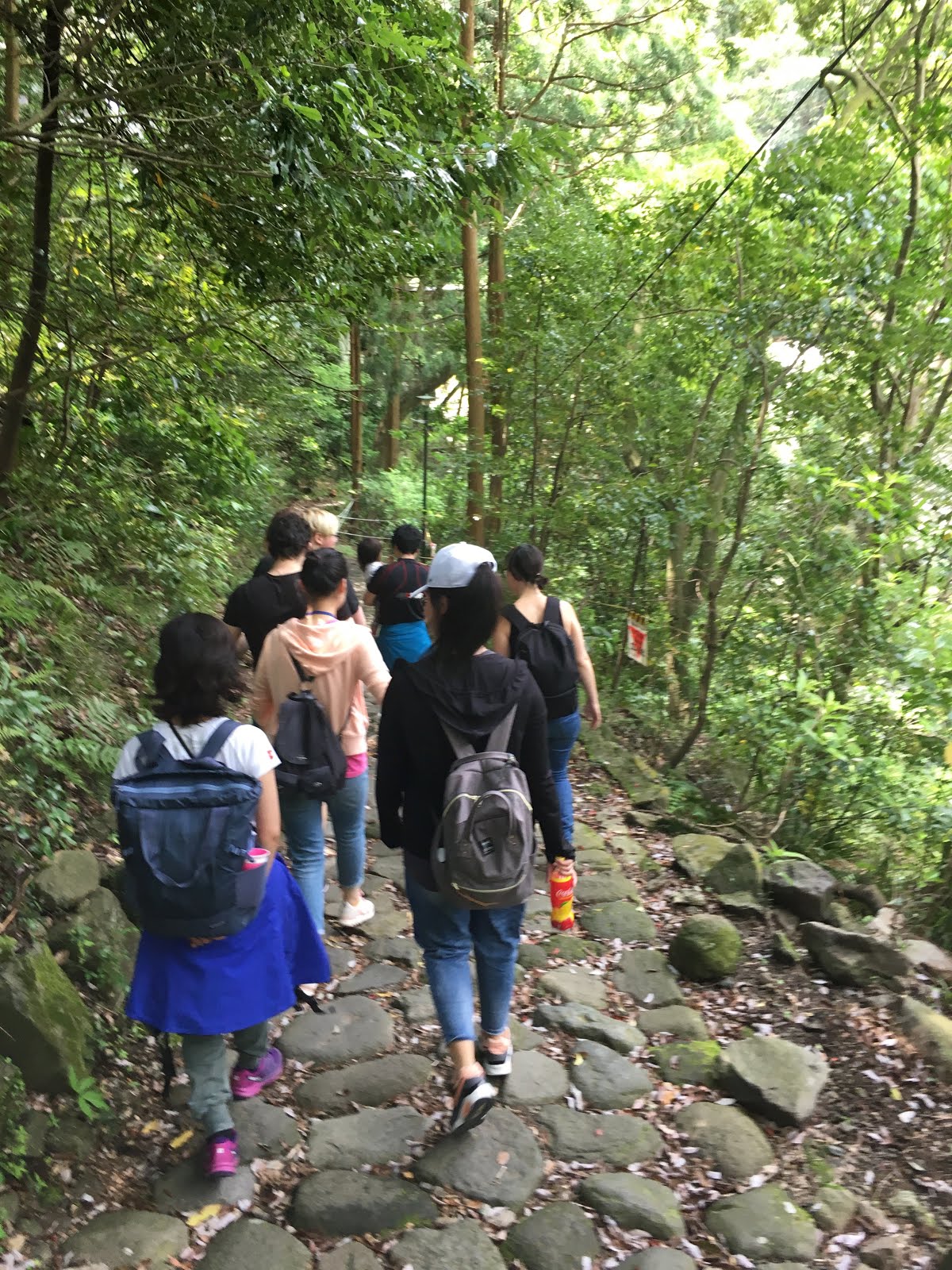
An orderly procession
We planned to meet at Hakone Yumoto at 930AM. That would have given me time to ride out, if I had left home shortly after 6AM. I left home well after 7AM, so rinko'ed my bike and hopped the Tokaido Line from Shinagawa. I was late enough so that I took the train all the way to Oiso and only rode the last 21km to Yumoto. At least I was confident that bicycle would be the fastest way to get between Odawara and Yumoto -- I rode by a standing line of cars and buses, as usual. Yumoto is a major bottleneck from all directions, and requires a train transfer if you take JR to Odawara.
Ai the trailrunner leads the group across water.
Valerie next.
Then Kohei, Ai's husband, carries their daughter Nozomi.

Delicious green shade and dappled sunlight aside a stream.
The hike up the hill is mostly along on road the first half, and mostly on trails -- including the rough stone "paved" old Tokaido path -- the second half. It is nearly 13km from Yumoto to Ashinoko, and parts of it are steep. We rested briefly several times, including at Hatajuku, where there were woodcraft exhibits just off of the road.
Looking back toward Yumoto and Odawara
Everyone made it up the steepest part of the trail, the "nanamagari saka" or "seven hairpin curves slope". Actually, there are 12 hairpin curves on the current road, though the trail skips some curves and just goes straight up stairs or a very steep path at some points. This must have been quite steep back in the Edo Period, with only 7 switchbacks!
Our smallest hiker
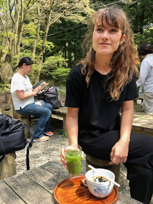
Our first major stop was at the Amazake Chaya rest house -- Amazake being "sweet sake". I was curious to stop in, having passed it several times on my bicycle. The rest house serves a variety of traditional Japanese snacks, including ice cold Tokoroden, oden with miso, iced matcha green tea and, of course, amazake. I think all agreed that it was a really nice place to stop for a rest.  From there, it was only a short climb over the last ridge and then down to Ashinoko.
Well deserved rest at Amazake-Chaya.
Janina samples the delicious green tea and tokoroden
Close up of the snack
As we leave the Amazake Chaya
We could hear the thunder claps in the distance as we started this last stretch, and it started to rain ... though not the torrential downpour I associate with "thunder shower" ... on the last stretch downhill to Moto Hakone. Ai, wife of Kohei, one of the Japanese lawyers in our LLM Program, jumped from rock to rock on the descending trail as if she were an elf. I asked if she is a trail runner. Yes, she replied. Very impressive, though actually everyone was impressive, and made it to the finish without complaint.
We just hiked up that.
A better view of the old stone paved path
We could enjoy a filling lunch including "wakasagi" fish from the lake as the rain fell, and then headed across the road to the Moto Hakone bus station.
Kohei, Ai and Nozomi waiting for the bus in the cold rain.

More than half the group decided to head back by bus -- the prudent choice, especially for Kohei, Ai and their two-year old daughter Nozomi (who Kohei had carried up the mountain). With a small child, always quit while you are ahead). But also Wenyi and her friend Chao-san, as well as Janina. Three diehards remained, undeterred by the rain, and I continued with them in the rain down the cedar-lined path toward the Hakone Sekisho (checkpoint), restored to its Edo Period glory.
On the cedar-lined route to the Hakone Sekisho


The restored sekisho -- show your passports, please!

Hakone could be a cold, wet posting for a bureaucrat.
(Apparently some people would skip the checkpoint and pass around the back of the mountain. This was a serious offense, but was typically explained away and excused with "I got lost", part of the Japanese tradition of hon-ne and tatamae,
if I read the explanatory material correctly.)
By the time we left the sekisho, the rain had stopped, so we strolled on a detour through Onshi Hakone Park, climbed up and down lots of stairs (down the walkway of 200 stairs), and stopped at a view point. The views were well worth the effort.
Helpful sign to show where Mt Fuji would be, if it were sunny today.
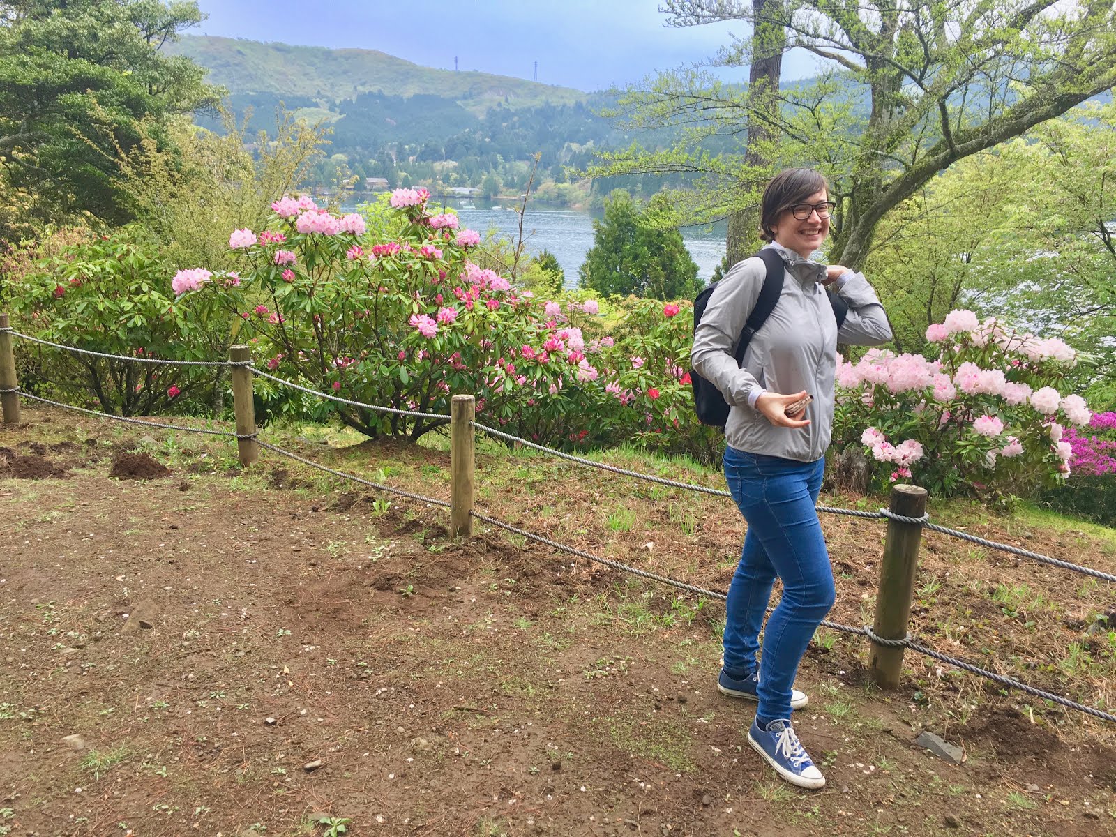
Valerie, still smiling.
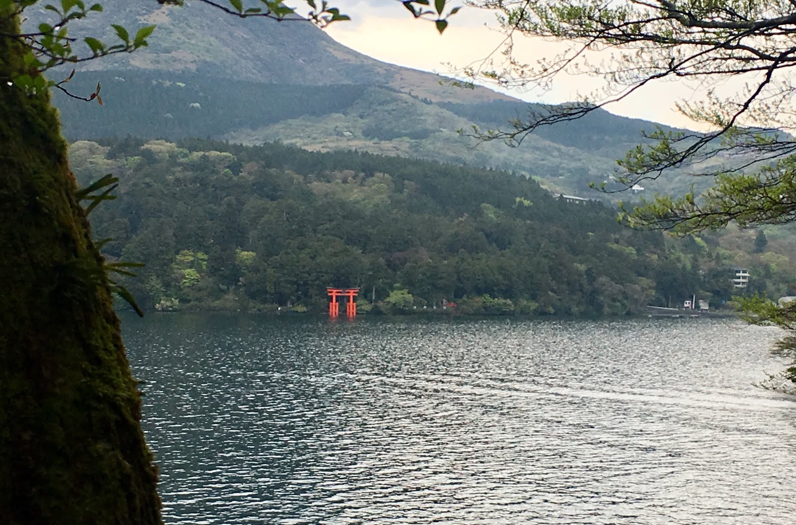
Hakone Shrine and its Torii across the bay
The diehards- one crazy professor, one LLM student and two Canadian (BC) youth.
Lower portion of the walkway of two hundred stairs. I only counted 197.
We did get to see, and cross, the famous Ashigawa-bashi or Ashigawa Bridge. I know it is famous because the mapboards inside the park told us it is one of the hundred best bridges in all of Kanagawa Prefecture.
One of the best 100 bridges in the entire prefecture!
This tells us a lot. For example, we know it is likely not in the top fifty, nor the top ten. And we can be pretty sure that it is not in the top 1000 bridges in the country. But it was even less impressive than we had anticipated. My first thought upon seeing it was "where is the bridge"? But sure enough, a granite post told us this was it, and there was some water, or at least a muddy area, underneath the pathway at some point.  Hidden in the brush on the opposite side of the mighty 2-meter (or 2.5-meter?) span was a plaque acknowledging its "best 100 bridge" status.
Ashigawa-bashi!
Best 100 bridges of Kanagawa!
Across the bay again.
We took the bus down the hill. I thought the bus would take us on the limited access "shindo" or "new road" back to Yumoto, but the driver announced as we started up that, due to traffic jams, we would take the same route we had come up, and we only switched to the limited access "shindo" for the last few km.
Silouhette of Canyon at Odawara Castle -- classic pose.
After standing on the crowded bus through the 12 hairpins of the 7 hairpin slope, I was glad to hop on the bicycle again and ride 30km to Hiratsuka before hopping the Tokaido Line home again.  So, counting the short trips to / from Shinagawa and the walk after lunch at Ashinoko, 53-55kms on the bicycle and at least 15-16km hiking. I slept soundly.
The main hike.

17 April 2019

A Cyclist's Late Afternoon Delight - Hakone/Tsubaki Line Loop

Today I wanted to swim in the morning, then get in a decent bike ride.

But I got out of bed a bit too late for Wednesday morning Masters' swimming. And I needed to post some materials for students and send a couple work emails ..,  The work took much of the morning. Then I called to wish my father a happy 86th birthday, and started various other tasks that kept me sitting at my desk until mid-afternoon.

So it was after 345PM when I got to Shinagawa Station, way too late to actually ride out to nice territory before dark. I was on the 4:04PM Kodama shinkansen to Odawara, and on my bicycle by 4:45PM, heading up Route 1 to Hakone Yumoto.

As with last week, I took the old road, Route 732, from Yumoto up the hill toward Moto Hakone. Again the road was nearly deserted. I cannot imagine why I did not take this route regularly years ago, instead sticking to heavily travelled Route 1 -- the ekiden route, not to be confused with the Bypass version of Route 1 that does not allow bicycles. Route 1 traffic is so awful that I generally avoided Hakone.  But Route 732 is really nice, based on two different rides up, different days of the week and times of day.

The upper slopes of the hills were full of flowering sakura, even if the lower elevations are now "done" for this year.

By the time I got to Moto Hakone, it was near dark, and the temperature had fallen from 18 degrees C at the bottom of the hill to around 10 degrees C at the top. I could see Mt Fuji peaking through the clouds just over the trees of Hakone Jinja.
Mt Fuji peaking out from behind the Torii of Hakone Jinja

There was cloud cover and the forecast did not suggest it would get much colder at night, so I decided I could climb a bit higher. I rode to the southern end of Lake Ashinoko, then climbed a road up toward the Kanzansan Observatory, I think Route 75.
Another view of Fuji from early on the climb above Ashinoko
The "observatory" looks like a sightseeing location, and no doubt has a spectacular view in the daytime, something like this:
Someone else's photo from Kanzansan observatory
But at night in the clouds, there was no one in sight. There was a sign that said the temperature was now 5 degrees, and I put on my jacket and arm warmers for the descent. I probably could have made it past a sleeping toll booth operator and ridden down the toll road turnpike straight back to Odawara, but I did not want to push my luck. Instead I headed down the Tsubaki Line, a soaring 16 km descent to and then around the edge of Yugawara.
What Kanzansan Observatory looked like to me
I thought about hopping a train from Yugawara -- the station looked bright and cheerful after the dark, solitary descent. But the next local train to Odawara was not for 19 minutes -- and Odawara was less than 20 km away. So I rode my bike. I took Route 740, the "high road" from Manazuru to Nebukawa, passing and being passed by only a few cars over this 9km stretch. Even the last few km in to Odawara were nice.

The ride was only 60km, but it included over 1200m of climbing, and took me up over 1000m elevation. This ride should be great in Fall and Spring, a nice option for someone who lives near Shinagawa Station.


Strava info is here.

07 April 2019

Return to Hakone and Ashigara

Along the Sakagawa
I woke up on Friday determined to get in a morning ride, before some mid/late-afternoon meetings. I need to teach on Saturday late mornings this month, so if I do not get out some Fridays, I will lose all the fitness I got in Tasmania.
Hakone the old road
No cars?!


I was out of my house at 624AM, good enough to be on the 640AM Kodama shinkansen to Odawara, arriving at 707AM. I was on the bike quickly and headed for Hakone.
Along the old road
This time I finally tried the "old road", the alternative route up to Moto Hakone and Ashinoko that goes up the same hillside as the Route 1 Bypass ... but had blessedly little traffic. I can see that this road would probably "bottleneck" where it joined Route 1 at Yumoto, and so may not be an automobile option, but for a bicycle it was far better than Route 1, or the Route 138 option to Sengokuhara. It was a lovely climb, from just above sea level to over 800m. I rode along Lake Ashinoko, past Hakone Shrine, along a familiar route through Sengokuhara and the T intersection to Route 138.
I passed two cyclists ... and none passed me!?!

Steep bend


Ashinoko - a cold stiff breeze
After a convenience store stop, I took Route 138 to the turn off for the road over Mt. Kintoku and down to Ashigara. The road is gated, and the only time I have ever taken it before was with Jerome once at year end. We went around the gate. This time, the gate was open, but it was guarded by an old man in a blue parka with an orange traffic-directing wand. "The road is closed!" "You cannot go through". I protested.  "Surely a bicycle can pass. I will get off and walk around the construction."  He would not budge.  "But, but, I need to get to Minami Ashigara. Is there any other way?" He tried to tell me I could stay on 138 then take Route 246 down the hill.  "Route 246, are you crazy! That is way too dangerous! I'll get hit by a truck, surely there must be another way?"  "Well, there is another "michi" over the mountain -- the entrance is down there past the shrine ... but a "chari" (bicycle) .. can you make it? With that chari?"  Anyway, I went to look at the alternate route. It was a steep paved road ... that turned into a rock strewn trail. A hiker was coming down. He said it would take me about an hour up walking. I pushed and carried my bike, then carried it over my shoulder.
Road construction ... easily passed by a bicycle
Anyway, after some tough climbing over rocks and walking with the bike, in less than a kilometer, I came to a place where the trail crossed the road that I had wanted to taken in the first place! I switched to the road. There was one crane I needed to pass on the way up, some more machinery inside the tunnel, and there was a LOT of work on the retaining walls along the road during the descent on the other side. All the construction folks were polite, even friendly. At one point, the road really WAS closed off, but there was a side route up over a mountain shoulder on a rindo (forest road) around the blockage. It was a very nice side trip.
Just came up that detour

Looking down at Minami Ashigara
Then it was down the other side, through the sakura along the Sakagawa again, opposite direction from last Sunday, and along the coast to Chigasaki before hopping the train home.

Kintaro Land

Rest house

Site of Kintaro's birth?

Add caption

Add caption

Almost back to the main road

On the descent
Strava data is here.

Hatena ride?