02 November 2024

A Ride in The Dark -- and a WUCA Record Established?!?!

After my ride across Honshu last year, I have wanted to try a few other WUCA (World Ultracycling Association) unsupported record attempts, to try and get this concept established in Japan. 

Since I did my unsupported Honshu WUCA record ride, supported/crewed WUCA records have been set in Japan by 32 yr old Yaofeng Cheng, a Japan resident woman rider going North-to-South and 35 yr old Australian Jack Thompson going South-to-North, in each case including Kyushu and Hokkaido as well as Honshu. But no one has duplicated the unsupported Honshu-only ride. Of course, Thompson, who did Japan South to North in just a smidgeon over 5 days, has a number of other records around the globe, and rides complete with sponsors and a full crew. No desk job. It looks as if Yaofeng Cheng had a full crew of Japan Audax riders and other cyclists with her.

Anyway, this year I am not in as good cycling condition as previous years. I never got in my SR series this Spring, having missed several due to schedule issues, and DNFed (recurring stupid mechanical issues) my 300km ride, and then DNF'ing a Golden Week 1000km ride (lack of preparation mostly). 

So I have had limited ambitions for the Fall. I have tried to build up some more base since August, at least, in order to try a shorter record attempt.

WUCA also registers records for major city-to-city pairs, and for going across a region, or state/prefecture. I thought -- why not go across Tokyo Prefecture. Set forth below is an extended version of my "narrative" ride report to the WUCA.

-----------------

Start.  I started at 10:50PM on October 26, on National Route 411 at the Yamanashi border near the far western end of Lake Okutama.  There is a small bridge over a gulley with a stream into the river. The Eastern side of the bridge has Tokyo border signs, while the western end has Yamanashi Prefecture and Tabayama Town border signs. I started just off the western end of the bridge inside Yamanashi.

Conditions

The conditions were near perfect for this ride.

I wanted to do this ride late at night to avoid traffic. The main challenge of riding across Tokyo Prefecture – population 14.1 million – is congestion.  Many of the most direct routes are no fun to ride during the day, fighting with trucks and cars. The first third of the route to Oume is mostly rural and so congestion is not an issue, absent roadwork, but once you get into the city, congestion would add time to this ride and make it unpleasant. Late at night, with very low traffic volumes, it could be much faster, safer, and a lot more fun.

I spent an inordinate amount of time trying to figure out the best route.  Should I go the straighest line 98.13kms?  
( https://www.strava.com/routes/3273251512526534248 ) 


Or perhaps make a minor alteration and take Inokashira Dori into town - a fast, flat, straight, and low traffic alternative that I know well 101.67km? ( 
https://www.strava.com/routes/3283272140791505062 )


Or swing north and avoid central Tokyo to instead go down the Arakawa 102.98kms
https://www.strava.com/routes/3273258823699968166 )


Or even go through Saitama (Tokorozawa ... Wako) and a longer stretch of the Arakawa to avoid traffic lights and take a very fast, dark Arakawa path 105.81kms?
( https://www.strava.com/routes/3283278143772050928 )


Or down the Tamagawa and in Meguro Dori ... to maximize the no-light stretch along the Tamagawa and then be on familiar roads through town 110.99kms?
( https://www.strava.com/routes/3283461428696622960 ) 


In the end, I opted for a compromise -- familiar roads, and a route with a slight dip to the South, around 103kms.  Rte 411, then Yoshino Kaido, then Ome Kaido, then Shin Ome Kaido, then Rte 20 (Koshu Kaido) through Fuchu/Chofu and all the way to Shinjuku, Yasukuni Dori east to the Sumidagawa and R 14 beyond to the Edogawa.)  

Strava Link

https://www.strava.com/activities/12751175085

I think that route worked out well. In town on Rte 20 and Yasukuni Dori then Rte 14, I could see the traffic lights far ahead, see the walk signal change to flashing green then red, accelerate or relax depending on whether I was going to make it. And when I missed a light, I decided to enjoy the brief respite. The only section where I got really frustrated by the lights and constant stop/start was on the stretch between the Imperial Palace and the Sumidagawa (Sumida River) – the old central Tokyo downtown.

I think a faster rider could do better with the route through Saitama then down the Arakawa. That is only a few kilometers longer and offers 25kms of nonstop time trial down the Arakawa.  But I did not have time to vet it carefully for the stretches between Oume and Wako, and also, is it really a ride "across Tokyo Prefecture" if you take large stretches through Saitama. Somehow that does not seem in the spirit of the challenge, even if it would not violate the rules (I was told I could take any route, as long as the end points are clear). 

The weather was fine -- warm for late October. It was 14 Celsius (57 fahrenheit) and cloudy at the start and this remained nearly constant (12~16 Celsius) even as I rode from the mountainous interior to the plain adjacent to Tokyo Bay.  As I planned the ride, I was concerned that it might be quite cold at the start deep in the interior mountains, even this time of year. So I did not want to ride too late in Fall. On the other hand, the Tokyo weather can remain hot and humid into October and I did not want to ride it too early.  I ended up with Goldilocks weather – just right! 

There was a breeze from the NE at times – it felt a bit as if I was riding into a headwind on Route 20 around Chofu as the road turned from ESE to ENE direction -- but the breeze was not strong and never directly in front.

Why This Record

I wanted to do this to “lay down a marker” so that someone else will beat it. There are plenty of Japanese cyclists who could do it faster than I can, some much faster, some in my age group, some who ride recumbents, and many younger road cyclists. I hope this will encourage them to try.

Equipment Used

I rode my Pelso Brevet “carbon high racer” recumbent. I am slow climbing on the Pelso, but this was a largely flat and downhill course with very little climbing. I now have a 48-tooth oval single front chainring and an 11-50 rear cassette, with a 12 speed SRAM mountain bike derailleur, but it is otherwise set up the same as for last year’s long ride across Honshu.

Since the ride would be entirely at night I used my SP Dynamo hub front wheel, as well as a Busch Mueller Icon IQ/XS front light and several battery-powered rear lights. I experimented some with LED powered front lights, but could not get any to work as well as the dynamo-powered Icon IQ/XS. So it is a no brainer choice – set and forget – even with some very modest drag from the dynamo.

I rode in relatively leg-hugging running shorts, cycling jersey, wool short-sleeved inner layer, reflective vest and ankle bands, and running shoes with wool socks, with rain/warm gear stowed in my Radical Designs rear seat bag just in case.

Eat and Drink

I left home around 1PM and rode the 89.4kms (and 640m elevation gain) to the start.


A quick stop at Y's to replace a bell that broke a few kilometers beforehand.

A cloudy, hazy, and warm (for late October) afternoon climbing from Oume.

The start of Yoshino Kaido, at Kori. I will head down there tonight.

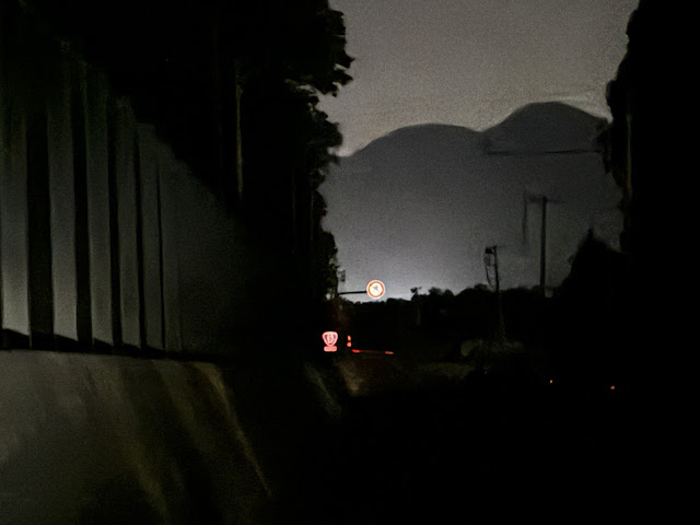
It was after 6PM and pitch dark by the time I approached the west end of Okutama.

I was feeling pretty drained even before leaving home from lack of adequate rest over the past week, and I could feel some burning in the legs at times as I climbed toward the start at Lake Okutama. My Garmin smart watch told me that my "body battery" was empty already that morning ... as it had been the day before. So doing such a long ride to the start was not ideal, not at all ideal … but I had planned to do this effort entirely alone, the Pelso is not easily carried on Japanese public transit, and the logistics of leaving a car at the start and returning to pick it up later were not great, so I just rode to the start and then home from the finish.

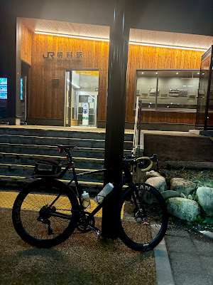
The minshuku where I rested, as it looked at 10:45PM.

I booked a room for JPY3000 ($20) at a very basic inn very near the start. I arrived at 630PM and planned to leave around 1030-11PM. The inn seems mostly to host groups of hikers, who do their own cooking. They do not serve food, and most of the nearby restaurants  (including Yagyu-tei where we often stop when we ride the west end of Okutamako) serve only lunch to passersby. So I knew I could not get dinner anywhere near the start. Instead, I ate (carbonara pasta, a rice doria, etc., etc.) on the way out, one stop in Oume and again at the 7-11 at Kori, and took some sandwiches and Japanese convenience store basics with me to eat after arriving at the inn. 

The innkeeper and his wife were both in their 90s, and I was their only guest Saturday evening. I was quite impressed with the 93 year-old innkeeper who spryly walked up several flights of steps on the outside of the building to show me my room. I ate my sandwiches, rested and even got an hour of sleep. In this perfect weather I could have rested without an inn, but in any other conditions the inn would have been a lifesaver. And given my exhaustion I really needed some rest.

During the ride, I ate maybe 4 half-sized “Kind” nut/energy bars, some bite-sized 7-11 apple danishes, and a Snickers bar, with more similar food in reserve.  I carried a 950mm water bottle with a mix of water and sports drink, and another 500mm water bottle in my bag. I felt somewhat de-hydrated from the climb up to Lake Okutama, so I drank a lot of water at the inn to try and re/pre-hydrate in the 4+ hours before the ride. Of course, I wanted to do this sub-4 hour ride without any convenience store or other stop to take on food or drink, and was able to make it. Ideally, I would have had a bit more sports drink with me, but the cool weather and nice downhill section early in the route meant I could manage without. My only stops were traffic signals, plus 2 quick bathroom breaks at roadside (a side effect of having drunk so much liquid before the ride).

Best Part

The best part of this ride was that probably 75% was on familiar roads, ridden in ideal weather and low traffic. I love riding in Japan at night when traffic is low. It helps to have relatively smooth and unobstructed roads and good lighting.

Hardest Part

At the start ... very quiet, but there were actually some people around,
and some cars driving along Lake Okutama late on a Saturday night.

The start was really difficult.  Lacking adequate rest, I felt drained, even after a couple hours of rest. The first stretch along Lake Okutama had me wondering if I should not just give up, relax, ride home, and try again another time. Every time I pushed it a bit, I needed to back off the throttle. But I recovered on the long downhill and so, by the time I needed to really start to work harder again on the remaining two-thirds of the ride, I felt okay.

Entering Chiba, at the sluice on Kyu Edo Gawa

Finish.  I finished at 2:37AM on October 27, for 3 hours and 47 minutes.  I finished just on the eastern side of the Kyu Edo River at the Edogawa Sluice.  Tokyo Prefecture follows the Edo River and, after they divide, the Kyu Edo River, and this is the furthest east crossing into Chiba that I could locate. There is a wide cycle/walking path over the river here (on top of the sluice) that is closed to cars but regularly used by cyclists and pedestrians. Even at the end of my ride at 2:37AM on Saturday night, there were 3 younger men fishing off of the sluice and talking.

I chatted with them a bit, explained that I had just come from the Yamanashi border and was happy to get to the Chiba border.  One of them said that there is actually a dispute between Tokyo and Chiba as to which of them controls the bit of land on the island at the east end of the sluice. ... but Google Maps, Yahoo Maps and others all show the border where I was standing as Chiba.

After the finish, I stopped at a nearby convenience store for some food and a cup of coffee, then rode back to and across the sluice, and home slowly. On the ride home, I went right down the middle of the Ginza -- Chuo Avenue -- the bright lights of the stores on even at after 3AM. The blocks are short and each one has a traffic signal, and they all turn red and green together. It makes for a nice effect ... but that is one street where it is impossible to time the traffic lights!

Approaching Ginza, at 3:30AM.

This felt a bit odd to report this ride to WUCA. It was not my toughest ride this year, not my longest, and I am not in my best shape. But at least I've put down a marker and now someone else can beat it!


22 September 2024

165mm cranks

I've never had a professional bike fit. 

I started cycling in the late 1990s, got my first road bike (an "Airborne" -- mail order titanium frame with Ultegra components) in 2000 or so, and gradually boosted my mileage over the following decade until I was a committed Audax rider. 

I experimented with saddles and position until I could do long rides without pain or numbness. David Marx, the Assos then Q36.5 importer into Japan, whom I met relatively soon after arriving in Japan in 2004, persuaded me that high end bib shorts where well worth the investment for someone who is riding as much as I do.

I have gradually adjusted my bikes to increase comfort and avoid pain when it shows up. 

The first time I rode PBP, in 2011, I used 700x23 tires and stiff wheels. The vibrations on a descent of a chip-sealed road sent sharp pain up both arms, and my little fingers were both numb after the event for several weeks. The next time I did a 1200km ride, in 2012, I had 700x25 tires with a better setup and gel pads under my bar tape. I soon felt I had hit an equilibrium where my body could take even the longest multi-day rides without feeling too much punishment. By 2019 I was on 700x28 tires with lower pressure, and these days I mostly ride a 700x30 or 700x32 rear tire.

My main complaint has been foot pain. I have gotten "hot foot" at various times. I have tried roomier shoes, better/different insoles, cushier socks, different cleat positions, etc., gel pads under the metatarsals, and various other attempts at mitigation, but it still comes and goes. I have concluded that some shoes just don't work -- one Shimano shoe does fine, then next one does not. They are not consistent.  One is narrow through the arch, the other wide (even though neither is a "Wide" as opposed to "Medium" type, or maybe both are one or the other. One allows me to slam cleats back quite far, the other does not. Anyway, a proper fitting shoe goes a long way toward mitigating hot foot. 

A few years ago I started to occasionally get pain in my right knee when riding. And I could tell that my feet were not "stable" in position as my legs went through a full peddling rotation. Something was wrong.

I really SHOULD get a professional bike fit, but in watching various bike fitters online, they seem to have a variety of approaches and different degrees of success. And I feel as if I should be able to work through issues on my own over time with plenty of experimentation, rather than in one session. 

Anyway, on the Tohoku 1000km ride that Jerome and I started (but only got halfway through) during Golden Week, I had both my share of right knee pain and hot foot. I started to feel that I could solve one by moving my seat up/down, while making the other worse. 

So what am I going to do about it? 

For the "hot foot", first, I got some cleat adjustment adapters. These allow you to really push cleat back toward mid-foot. After they arrived, I realized that I only need them on some shoes, while others already offer a very long adjustment area for a slammed back cleat. I tried the adjusters on my newest Shimano shoes for SPD. The shoes are still uncomfortable.  Why?  I think they are just too narrow through the arch and heel -- even when I swap in a different insole. And they are narrower than other Shimano SPD shoes in the same size from a decade ago. They don't feel uncomfortable when I first put them on ... but they just don't work after 75+kms, and even the cleat adapter does not solve it.

Meanwhile, what about the knee pain?  Well, having a more "stable" leg position should help -- maybe a shim inside the right shoe to bring up the outside of my foot, which seemed to be lower than the inside? But that did not help. I decided instead to try 165mm cranks.

Why?  Well, mostly because of my youtube bike fitter, Neill Stanbury of Australia.  He appears in various Road Cycling Academy and other videos, and explains it better than I could hope to: here: https://www.youtube.com/watch?v=5fCTCyZqFGE

People go to him from all over the world and, I have got to say, if I DID get a professional bike fit then I might try to squeeze it in on a trip to Australia ... except I have not been to Australia in five years, and I might make a mistake and drive 600km north from Brisbane to see him in Kawana, when he seems located at the OTHER Kawana just north of Brisbane.  He has a great set of youtube videos on bike fit issues on the Road Cycling Academy channel.
https://www.youtube.com/playlist?list=PLCyklBca6SZF1tRwSYsek-ZnsNBI-GPuY

Or, since he comes from the Steve Hogg bike-fitting school, maybe I could use one of the others who has the same training and is located elsewhere ... none within a 3 hour flight of Japan, regrettably.
https://www.stevehoggbikefitting.com/


One of Stanbury's clients, Cam Nicholls, took the advice and is on 165mm cranks. His explanation here: https://youtu.be/svlDq-NStcc?si=wjbsBSzwbX13sFsi

I have been using a 165mm crankset (single chainring) on the Pelso brevet recumbent since shortly after I got that bike. The original 172.5mm cranks were just too big for a comfortable pedaling rotation with my legs jutting up in the air in front of me. Indeed, many recumbent riders recommend smaller cranks than on road bikes. 

But when I suggested switching to 165mm for my road bike(s) to a bike industry veteran here, he told me it would mess up my bio-mechanics, after more than 20 years riding 172.5, and in his experience it does not solve problems. So I put it off.

But then a few weeks back, Lifetime Grand Prix gravel/mtb racer Dylan Johnson (aka "my youtube cycling coach"), in the end of a discussion of his bike setup for Gravel Unbound and/or Leadville 100 this year, let slip that he had gone to shorter, 165mm, cranks, in part as a way to eliminate knee pain that had shown up in some of his most intense, lengthy training "blocks".  (He has videos on "block periodization" as well, if you aren't familiar with the idea of a training block). He said it has worked and the pain is gone.

Also, did I mention that Tadej Pogacar, the best cyclist in the world, is riding 165mm cranks this year as he achieves the best results of his career? If it works for Dylan Johnson and Tadej Pogacar, maybe it is worth a try.

Anyway, after the massive problem with Shimano cranks that failed (it happened to Jerome back in 2020) and that ultimately led to a recall after more than a decade of complaints and denail ... I did not really feel as if I needed to pay for a new set of Shimano 105 or Ultegra cranks in order to try 165mm.  Instead, I went on Aliexpress and found a basic crankset for 8600 yen (around US$60). It arrived in a few days and was simple to swap in for my 172.5mm Ultegra. It also had 50/34 chainrings so no need to adjust the chain or anything else. Nothing fancy, not the lightest, nor the stiffest (6061 aluminum) ... but they seem fine!


I rode the new cranks on the Ramax for the first time today and ... I think I am going to really like this change. The bottom of the stroke is 7.5mm higher, and top is 7.5mm lower, so in total the leg rotation diameter is 15mm (1.5cm) less from top to bottom. I moved the seat up about 7.5mm, not precisely measured but it felt right. 

This is not a big change in the scheme of things, but very noticeable. I did not ride faster today over the full route -- I was riding with a friend -- but I did not ride slow. I found that when I wanted to push ahead a bit, I felt I could do so and hold the speed with less stress on the legs. Of course, it is just a wee bit easier to get in the drops or get down low with my arms on the hoods with my legs coming up just slightly less into my chest. And getting out the saddle and pedaling while standing -- dancing on the pedals -- was noticeably easier with the slightly smaller rotation. Maybe I just had fresh legs after a couple nights of decent sleep? Or maybe I was noticing a difference?! And I really did feel that perhaps these cranks will mean less stress on my joints, especially my knees.


I'll try this set of 165mm cranks for some time and on a series of rides ... then figure out if I want to change out other bikes as well. ... I may be having a sale on 172.5mm cranks in coming months?!

22 June 2024

Sun Trip 2024

Congratulations to Jack Butler on winning the 2024 Sun Trip -- a 7000km race for solar-powered (recumbent) bicycles in France and Morocco.

A brief event summary video with theme song:  https://youtu.be/bz4ipea3kfs?si=EfoinnXswxV4ZNQe

I must admit ... as I watched some of Jack's videos, I was thinking, what a great challenge! Was there ever a more perfect event for me? 
First I will need to electrify my recumbent, then add the solar panel.
Then perhaps we can organize a similar event in Japan someday?

2024 champion Jack Butler

Butler's videos documenting the journey can be found here: 
https://www.youtube.com/@JackButlerVideos

2023 Champion Jean-Marc Dubouloz

Theme song (full lyrics in video description) but the chorus goes:

The Sun Trip
It's calling me
I'm gonna ride
Gonna set myself free
No limits
No boundaries
I'll rise above
On the Sun Trip
I'll find my love

21 June 2024

Bike computer gps comparison — Wahoo Roam, Hammerhead, Garmin 840

 Over a decade ago, I got very frustrated with Garmin 605 era buggy software and firmware, lost ride data, frozen screens, and happily switched to Wahoo. I have used both generations of Wahoo Element Bolt gps units since with very few issues. 

Meanwhile, there are now many more choices for a dedicated cycling gps computer. And all reports are that Garmin fixed their products and improved their offerings.  I don’t know when I will get my next gps unit, but based upon this review comparison it may well be a Garmin 840 or 840 solar. Two features I like … first, the ability to set up different profiles for different bikes. This is really good if you have different power or cadence or other sensors on different bikes.  Second, 2x or 3x (with solar) the battery life … very helpful for randonneuring if you don’t need to worry about recharging during any event shorter than 1000kms. 

DC Rainmaker is very thorough:

https://youtu.be/9awgCtgmaus?si=bztgImrpqSWTNJKY

25 March 2024

The Enigma of Ibaraki Power

The very impressive Tatsunokuchi observation deck -- we walked, not cycled, from base to top.
Why is the platform on top cantilevered over outside of the base?

Last Tuesday I joined a small cycling tour organized on behalf of a cycling promotion unit within Ibaraki Prefecture’s government. Inbound tourism is booming in Japan these days. The prefecture wants to attract more foreign visitors and cyclists, and is looking for promotion and ideas. 

Ibaraki has already made significant efforts to become a cycling-friendly destination -– most notably with a collection of cycling-related support services in the south and central parts of the prefecture that constitute the “Tsukuba-Kasumigaura ring ring road” -- centered at Tsuchiura Station on the west side of Lake Kasumigaura, and branching out from there around Lake Kasumigaura, as well as along a dedicated cycle path that extends well over 50kms to the NW along the western side of Mt. Tsukuba as far as Sakuragawa City. This entire area is one of six “national cycling roads” supported by the central government (e.g. shimanami kaido).

The support infrastructure include various “cycle support stations” and hotels such as BEB5 Tsuchiura, a hip reasonably priced cycling-themed hotel run by Hoshino Resorts, and around 50 other “cyclist-friendly” hotels that, at a minimum, offer safe bicycle storage, will receive small packages in advance of arrival, have some tools they will lend for basic repairs, etc. 

Until this trip, I did not realize that Ibaraki’s efforts also extend to 2 other regions. There also are cycling-specific route designated along the coast from Oarai north to the Fukushima border, and in the interior north of Mito up to Mt. Yamizo where Ibaraki juts into a small area between Tochigi and Fukushima prefectures. (These areas of Fukushima are quite far from the Fukushima Dai-ichi nuclear reactor, by the way – far south of the routes I have cycled in southeastern Fukushima in recent years).

Ibaraki's cycle routes. We would be in the northern, inland area, the darker shade of magenta.

Our trip would focus on the last of these 3 regions, the Kuji River valley between Mito and Daigomachi (which is on the way to Mt. Yamizo). The prefecture refers to this as the “Okukuji-Satoyama Hillclimb Route” (Japanese website only -- try automatic translation in your browser). “Okukuji” refers to the upriver, further inland areas of the Kuji river valley, and “satoyama” is a Japanese term full of secondary meaning that suggests foothill areas near villages, generally not-entirely-wild woodlands that are too hilly for rice field cultivation. 

Ibaraki Prefecture has designated at least 4 “hill climb” routes at the northern end of the Okukuji area, the most challenging of which goes up Mt Yamizo to around 1000 meters elevation, with plenty of 10-12% stretches. The others are more like 5% or 7% climbs, and go only half as high in elevation. That northern area is wilder, much of it not really what I would call “satoyama” and not where we would go on our short tour. Instead, we would focus on the Kujigawa river valley. 

I’ve ridden through northern Ibaraki on a number of longer events over the past decade or so. I can think of at least 3 Audax brevets that took the “Beef Line”, a “wide area agricultural road” that goes through the hills from Kasama at the southern end and NNE to Hitachi Omiya. One brevet continued onward via the “Green Furusato Line” that goes further East and North almost to the Fukushima Prefecture border near the beautiful sunny Kita Ibaraki coastline. Other trips took the road to (or from) Daigo. Last year I did a brevet that came through Daigo and down the Kuji River to Mito, hit the coastline at Oarai, then went south to Kashima Jingu shrine before heading west and returning to a starting point across the Tonegawa in Chiba Prefecture. 

Other than cold temperatures in the inland mountains at night in March, my memories of Ibaraki cycling are of nice roads, attractive countryside, and relatively light traffic, except on the sometimes congested roads between southern Ibaraki (e.g. Tsuchiura, Inashiki) and Tokyo. 

When the organizers of our tour sent me information, I realized we would be riding in the area between Mito and Daigomachi, a town in the far NW of the Prefecture, wedged between Tochigi to the west and Fukushima to the Northeast. This included some of National Route 118 that I rode last year at night on that brevet. A Dutch friend of mine has a long-term lease of a cabin in the woods near Daigomachi. I visited it once (by bicycle), and he told me that the previous long-term tenant was Karel von Wolferen, a Dutch student of Japan known for his pathbreaking book “The Enigma of Japanese Power.” The book describes power as being held by a loose group of unaccountable elites who operate behind the scenes. In von Wolferen’s view, because this power is loosely held, those who wield it escape responsibility for the consequences when things go wrong. The book is essential reading for any foreigner who marvels at why Japan does not really seem to change even when a prime minister is replaced or an election lost. When it was published in 1990 the book was harshly criticized in Japan. Von Wolferen apparently could not read Japanese well enough to use Japanese language sources, and many Japanese thought the book got some details wrong and that its criticism of the elites was unfair. Of course, soon after Japan entered 3 “lost decades” of relative economic stagnation. In hindsight, the book’s criticisms of Japan’s elite during the high-growth and bubble eras look a bit more supportable, though Japan and its politics have evolved and matured a lot since that time. 

I mentioned to my hosts that this book had been written in the woods outside of Daigo. It was news to them. I guess that is part of the enigma?

Our ride started at Yamagatahara Station. The JR Suigun (水郡線) Line goes through this area, between Mito (水戸) and Koriyama (郡山), and the station house looked quite impressive for a small country train stop. It reminded me of a church. 


We start our tour.

From here we rode just a few kms up the valley then up a steep little pitch, almost a footpath, to a viewpoint built on the site of the ruins of the Yamagata Castle. The building was impressive and provided a nice view. In February the plum (ume) blossoms on the trees adjacent would have been spectacular, and in a few weeks the cherry (sakura) lining the slope in front also would be beautiful. But not today. The shutters on the main view tower were closed due to Monday’s high winds, and the clouds had not yet lifted. March Kanto weather can be cold or warm, dark/grey or blue sky and lovely. Tuesday offered both types, transitioning over a few hours. 


Viewpoint ... with shutters down.

One of numerous treasures housed within - samurai armor

Buddhist sculpture

Shutters down ... 

The valley below and Kuji river.

From here we rode a bit further to a Japanese paper (washi or 和紙) craft house. This region is home to the “nishi no uchi” (西の内) style of washi. The paper has been made since the Muromachi period (1333-1573), but saw its peak in the Edo Period (1603-1868) after the second Tokugawa shogun (who was also known as the “Mito Komon”), had the paper exported to supply merchants in the capital. The paper is incredibly durable. You can soak it in water without it losing its form or the ink running. Merchants kept records of payments and debts in books of this paper. Whenever a fire raced through their wooden neighborhoods, they could just drop the ledgers into water and preserve their records of who owed whom how much – the source of their wealth. 


Even after soaking in water, the ink and paper hold fast. The ledger remains.

Nishi-no-uchi

We had the opportunity to make our own washi, which was fun. 

Fellow cycle tourist Oxana's gift to her cat Vivian.


I bought 4 or 5 large sheets of a heavier gauge of paper with patterns I liked – I hope I can use them as wall hangings eventually. All of the prints in the shop display beautiful Japanese design.


I think there is a place in Tokyo that offers a washi-making experience for students and tourists, … but for a cycle tourist I would definitely try it here in Yamagatajuku.

After the hard work (well, not very hard) of our washi-making experience, we headed toward an early lunch at a country-style restaurant serving salt-grilled ayu (usually translated as “sweetfish” -- a delicious trout-sized river fish for which the Kujigawa is known) and kenchin soba (Japanese buckwheat soba in a pork/miso broth). 

Lunch stop - Mayako's bike, my Ramax, and Oxana's rental

"tengu" over the restaurant entrance

Trees for columns!

Lunch tables -- carved from more tree trunks.
With the two young Ibaraki Prefecture staffers

With the ayu grilling master

The dishes were delicious, the prices reasonable, and the view nice (it would be very nice, except for some ongoing work this year on a levy to prevent the river from flooding into the field in front of the restaurant). The Japanese countryside is full of places like this to get lunch. If you travel by bike in Japan, and are not racing against the clock, this kind of lunch stop can offer your best chance to chat a bit with locals and get great value for a sit-down meal of traditional food. Highly recommended. 

Konnyaku sashimi with a miso sauce -- a favorite of mine

Salt-grilled ayu

Kenchin soba


At the restaurant.

After lunch, we headed downriver on a forest road along the east bank. These forest roads, if you can find them, are always better for cycling than the main highways, as long as you are not looking for some kind of support service. I can remember once riding a highway for 20kms or more along a reservoir in Shizuoka Prefecture at the end of a long day – what a boring road and long slog, I thought. The next time I went through, I took a forest road on the opposite bank of the reservoir, and it was a delight – almost no traffic, and a road that had plenty of shade and just the right mix of dips, turns, and straightaways. 

The (forest) road less traveled


Yamagatajuku -- home of the ayu

Our forest road was lovely and fast, and quickly brought us back near where we had started the tour. We crossed the river and continued south for awhile until we got to the Hitachi Omiya city michi-no-eki (road station).  Here on google maps. The Japanese michi-no-eki is kind of like a “rest area” on a highway in other countries, but more, often a lot more. Michi-no-eki often have local foods for sale, a cafeteria, and other minor attractions, as well as clean restrooms. Some even are connected to a higaeri-onsen (day spa.) The weather had warmed by now, so we had some gelato. 

Bicycle racks at the michi-no-eki -- a "cyclists welcome" equivalent signal

Large plaza in front of the micho-no-eki, for events

"ayu served here" ... also, I guess soft ice cream

Inside the main building

This michi-no-eki had a huge store, selling a wide variety of local products.

Noodles

Mochi (rice cakes)

Pickled vegetables

Local craft beers

After going further downriver, we cross the Tatsunokuchi Bridge to the east bank and headed north again, riding along a wide path on top of a levy that was lined with cherry (Sakura) trees for several kilometers, it seemed. The trees already had lanterns hanging from them, ready for hanami (cherry blossom viewing) in about two weeks. On our left side as we rode along the levy, toward the river, was an incredible bamboo thicket. 


As we started our climb to the final observation deck of the day, we passed an ajisai (hydrangea) park. Ajisai are my favorite flower in Japan, as they offer explosions of color throughout the countryside in June, just before, during, and after the “rainy season”. In March, the bushes were still barren and brown, but this park would be worth a side trip when the flowers are out. 

The ajisai (hydrangea) park

The climb from here was steep (in excess of 15% at points) and longer than our morning hill, but still mercifully short. The young Ibaraki Prefecture staffer was on an e-bike, and motored up ahead. Oxana, a mountain goat of a cyclist, was up the hill ahead of me even riding her mis-sized, lower-end rental bike. I hope her knees survived the experience. Mayako and I took it at a more deliberate pace.  

The view was far better than in the morning, and the tower itself quite a piece of infrastructure, soaring modern steel in contrast to the morning’s traditional wood structure on a stone base. 

Looking downriver

Clear view of the sakura, levy, and bamboo thicket

Oxana snaps a phot

I hold on to the railing ... somehow feel more secure that way.
After taking in the view, we descended safely and stopped at a strawberry farm near the base. These berries were so sweet that I almost wondered if there was someone sitting in the back room injecting them with syrup? Apparently not, but still incredible. The brand/type of strawberry read “Ibarakiss”. Indeed!


Japanese style intensive farming

Strawberries for sale!


Strawberry guard dog?

Having spent most of the day eating and, it seemed, much less cycling, we stretched our legs a bit by taking the Beef Line over a few hills and around 10-15 kms to the SW before returning to Mito and hopping a train home. 

One last chance for direct farm-to-table vegatables at a JA store on the Beef Line

The Tokiwa or Hitachi express trains to Mito from Shinagawa/Tokyo/Ueno stations are under 90 minutes and cost under 4000 yen (around $25) each way. The area we rode through is around 35 kms NW from Mito (or another short ride on the Suigun Line). So if you "rinko" your bicycle, you can do this as a day trip or a short overnight. Of course, you also could include this area as part of a longer tour.

I can imagine a route that would start/end at Narita Airport and take in Kasumigaura and the “ring ring road”, before moving on the Okukuji, then heading either for Kita Ibaraki and Iwaki on the coast and NW toward Koriyama/Fukushima (as I did on the last part of my Fukushima SR600), or go inland via Daigo and Tochigi then further north into Tohoku. Basically, you cannot go wrong if you avoid the major cities and do a bit of advance planning!  

The cycling infrastructure around Tsuchigaura, less than 50kms from Narita Airport, actually would make that a great place to start or finish a bicycle tour around Japan. I urged the Prefecture staff to consider making sure that some of the "cycling friendly" hotels in Tsuchiura would store a bike box, also to make sure that there is bike transportation to/from Narita, and that the details are available in English, on the Internet. It was pretty clear that they are already thinking about this. There is already a regular "limousine bus" service between Tsuchigaura and Narita Airport, but I don't know if that bus would take a bike box or not.  If they would, then this would be a no-brainer way to enter and leave Japan for a cycle tourist!

This gives a further idea of where we rode, if the Google Maps links are not enough: