Showing posts with label Yamabushi Pass. Show all posts

13 June 2025

First Half of VCR Aoba 600km -- Am I Still a Randonneur?

On the climb to Torii Toge ... after the rain stopped.

Having cleared Audax rides of 200, 200, 300, and 400kms this year -- the last on a second try -- I had only a 600km ride left to complete the basic "super randonneur" series for 2025. I have done the series most years since 2010, absent injury or pandemic, and it is often an official pre-requisite for joining 1000km, 1200km or longer events. Even if it is not a pre-requisite, it makes no sense for me to try such a longer event unless I can clear the series first.

I signed up for two 600km rides, not knowing whether I would be able to join or complete either. 

The first was a May 17-18 VCR (Velo Club Randonneurs) Aoba event, out from Inagi-shi through NW Tokyo and Saitama, then via Yamabushi Pass and Chichibu into Gunma, eventually over Torii Pass into Nagano, and more hills in Nagano, Yamanashi, Shizuoka, and back to the start. The profile was daunting. I figured it would be a very difficult challenge, probably more than I could manage within the time limit in my current condition, but I would try it anyway as I liked the course, especially the opportunity to ride through Naganohara, Tsumagoi, and over Torii Pass, plus the next climbs between Ueda and Matsumoto over the broad, high shoulder of the mountains that stretch south into Yatsugatake.

The course looked very difficult -- not any one part, but the sum of the parts. The 600km showed 8800 meters of elevation gain on RidewithGPS. And unlike some courses, from what I could see the major passes did not have tunnels at the top that cut the actual elevation gain to less than what was showing on RidewithGPS. Any 600km event with over 10,000 meters elevation is in a special category of "SR600" and given a 60 hour instead of a 40 hour time limit.  A typical 600km in Japan might have 6000 meters of climbing.  This was was in between, but shading toward an SR600, without any extra time allowed. I remembered doing a similarly tough course more than a decade ago, but this one looked even tougher, and I have not gotten faster in the past 10 years -- the opposite.

Anyway, the course looked very nice to ride, so I figured I would at least try to do the first half, and see if I could somehow manage. I would ride my new "Mugikusa Pass" lightweight climbing bike, and use a battery light instead of a dynamo -- everything to shave off a few grams of weight and save a few watts of power.  I knew that once I got to Fujimi, close to the Nagano/Yamanashi border ... I would have 100km of downhill/flat riding to Kofu then along the Fujikawa to the coast, then after a few bumps,  a second long flat stretch, then after an 850m climb to Hakone Pass, downhill and then relatively flat to the finish.  So I figured, if I could just get to Fujimi in decent shape, I could press onward. I booked a business hotel in Shiojiri, leaving the climb up Shiojiri Toge, between Shiojiri and Okaya, and the very gradual climb up to Fujimi Toge, for after some sleep, however short it would prove. I have done these climbs when exhausted and lacking sleep, and it just is not very efficient and takes forever!

Staff (left/rear), riders (right)

The start was at 6AM at Inagi, around 27km from my house. There were no good options.  I could go out the night before and stay in a business hotel, losing any chance of early sleep.  Or I could get to Shinagawa Station extremely early, rinko my bike, take the first train to Kawasaki (I think), then transfer to the Nanbu Line to Minami Tama, reassemble the bike, and ride a few minutes to the start. Or I could just ride from home and get in 27kms before the actual 600kms. I chose the last option.

As the ride approached, the weather forecast looked difficult, as if there would be rain the first day.  And the forecast did not improve.  When I woke up the rain had already started, so I rode in rain more than an hour to the start. At least the rain was not cold, nor hot. The temperature, around 16-17 celsius, was good for riding.

When I got to the start at Omaru Park ... there were 4 staff, including Minoda-san who I've ridden with, or more accurately behind, on many events, and only 5 riders. The sign-in sheet was full of "DNS" markings. More than 2/3 of riders who had been foolish enough to try this one had opted out. No women joined.

Five riders and one pre-ride by a staff member. 14 DNS/no shows.

They let us go a few minutes early, and I was second to depart, behind a faster rider. Despite him being faster, I kept catching him a traffic lights over the initial 15-20kms.  Finally, I got stuck waiting at a gated train crossing for what seemed like 5 minutes, and he was gone ahead for good.  

At the holy shrine water stop.
Yamabushi Pass

Leaving Chichibu City

Another rider soon passed me, and the other two did also as I rested at the "holy shrine" water stop just before ascending Yamabushi Pass. I played "leap frog" with all but the first rider through Chichibu and even onto the climb out of Takasaki around the west side of Mt. Haruna, passing them when they took a rest stop and vice versa.

Michi no eki on the Haruna climb to Osawa Toge

There were two climbs around Mt. Haruna. The first was long and grinding, and still wet, always wet, peaking at Osawa Toge. Then there was a downhill, and a second climb that ended at the mouth of a tunnel. We descended through the tunnel and popped out the bottom along the Agatsuma River, just above the Yamba Dam and near our checkpoint, Kawarayu Onsen station.

Big station, no customers

The Yamba Dam is one of Japan's most controversial infrastructure projects. Its reservoir fills the valley and destroyed a great deal of natural environment. Local opposition slowed the project for many decades, even as preparatory work went forward. After the DPJ took control of the government in 2009, the project was stopped mid-way. When the LDP regained power in late 2012, it restarted. Now it is done. 


The reservoir west of Yamba Dam

I must say that this entire area looks far nicer now that the dam is done. They have ploughed in infrastructure and money to make it a success.  A few minutes after the PC, I saw a bus ... drive straight into the reservoir, making a big splash but floating.  I laughed -- this was a classic tourist "hippo" (kaba) bus, the kind of gimmick a bureaucrat might come up with to attract visitors. It was too far away to know for sure, but I did not see any passengers. Likewise, Kawarayu Onsen's main facility looked pretty deserted. Perhaps not surprising, given the earlier rain.

Anyway, as I emerged from the tunnel and headed for the control point, another rider was just heading out of the control. I was at least close to 2 of the 4 other riders, I was sure. And somewhere while passing the tunnel, the rain had stopped, completely. The road was already dry along the Agatsuma River. Only 10 and a half hours from home, and 185kms of cycling in the rain, and it had finally stopped.  Within 30 minutes, I even saw some blue sky. 


Climbing gradually to Tsumagoi, with a few bumps

The ride through Naganohara then climbing up through Tsumagoi and all the way to Torii Toge (elev. 1400m) was the literal and figurative high point of this ride. It was the longest climb, and Tsumagoi looked lovely, less beaten down than when I was here in 2020. Again, lots of road construction then underway is now complete. And I guess there has been some spillover investment as Karuizawa has boomed. Still, the climb is not easy, and there are some steep parts that were difficult with over 200kms and 3000m elevation gain into my legs. The sun had set by the time I got to the top and crossed the Gunma/Nagano border.  
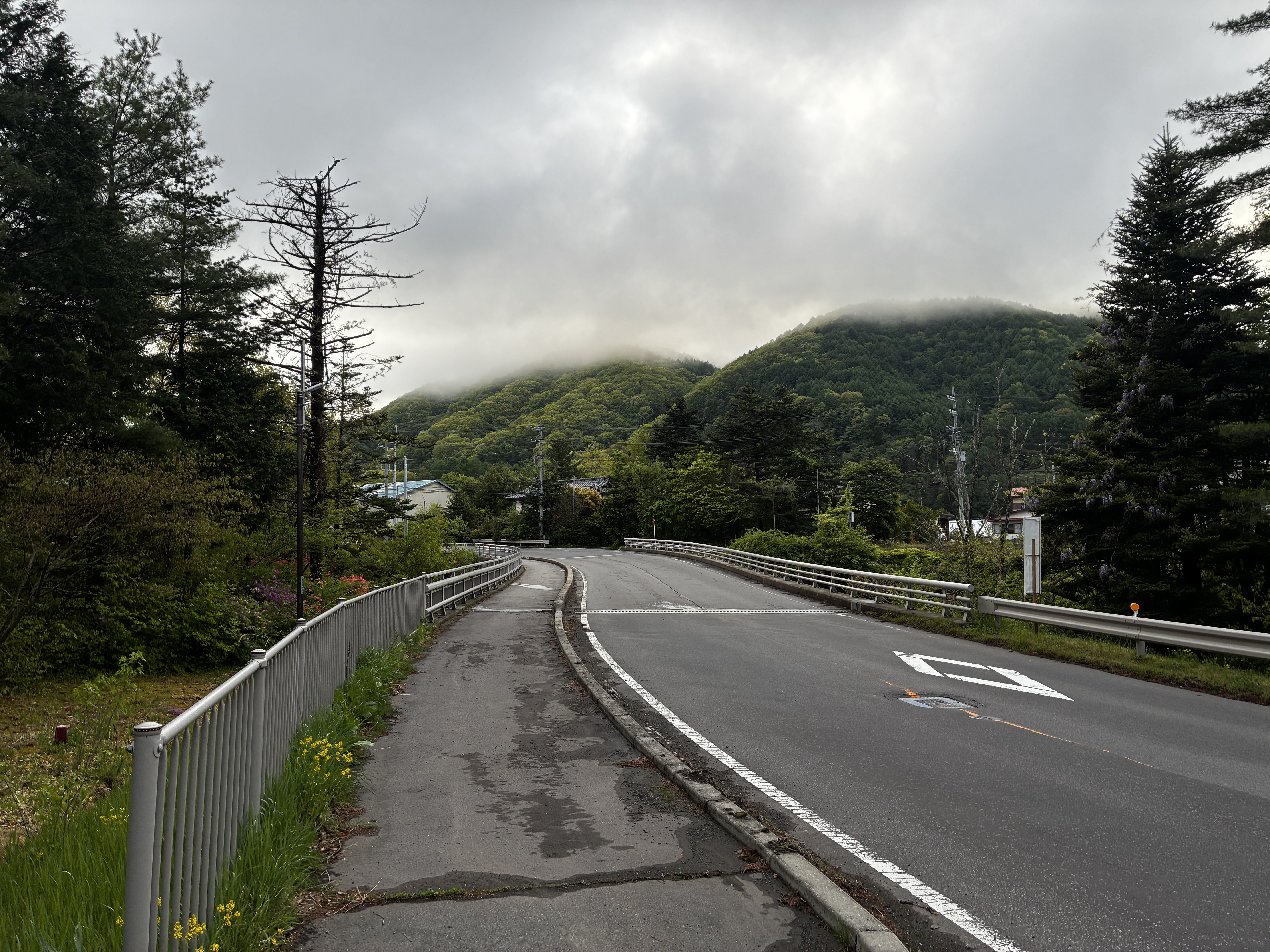


Sunset at Torii Pass - Gunma/Nagano Border

The descent into Sanadamachi and then Ueda was very familiar from when I stayed in that area for a month in 2020, an escape from the city and the summer heat when everything was shut down. I had done the Torii Pass climb/descent probably 10 times back then. But it had been almost five years since, and it was dark now, and I was now quite tired. Also, I had an unfamiliar front light.  I wanted to keep the light on a low/intermediate setting, so it would last through as much of the night as I needed.

If that climb through Tsumagoi had been the highlight of the ride, then riding Route 18 west of Ueda was the opposite. It was a slog. I stopped for some ramen at "Ramen Daigaku" along route 18 near Sakaki. I apologized that I could only eat half of the serving, telling them it was not the taste but rather my stomach and the fact that I was in the middle of a long ride. 

We had dropped from 1400 to 400 m elevation by now.  I crossed the Chikumagawa and continued to the next climb ... a relatively steep one from 400 to 800 m. I needed two short rests to make it to the top. It was getting late, 10PM by the time I started the descent. Very dark and quiet, except the lights in a tunnel along the top. The next stretch, through hilly Nagano countryside over to Akashina, looked very familiar. I am pretty sure I did this stretch on my very first 600k ride, in 2010, but I did not save that on  Strava or RidewithGPS.

Anyway, by the time I got to Akashina and turned left heading south up the valley toward Matsumoto and Shiojiri, it was well after 11PM, and there was a brisk headwind. 


It was warm, almost hot. I finally got to the hotel at Shiojiri, after 1AM, checked in, took a bath, and ... set my alarm so I could sleep for 4 hours and then get breakfast before leaving, far behind the schedule I would need to stay on track. I needed the sleep. The front desk clerk warned me that visiting school kids would fill the breakfast room early ... so I ended up sleeping later and just grabbing breakfast before it shut at 9AM.

At Shiojiri Pass crossing into Okaya

I rode over Shiojiri Pass ... It was hot and there was plenty of direct sunlight. Somehow I felt no faster than if I had continued the night before. I stopped for some soba in Chino.  ... and went to the train. 
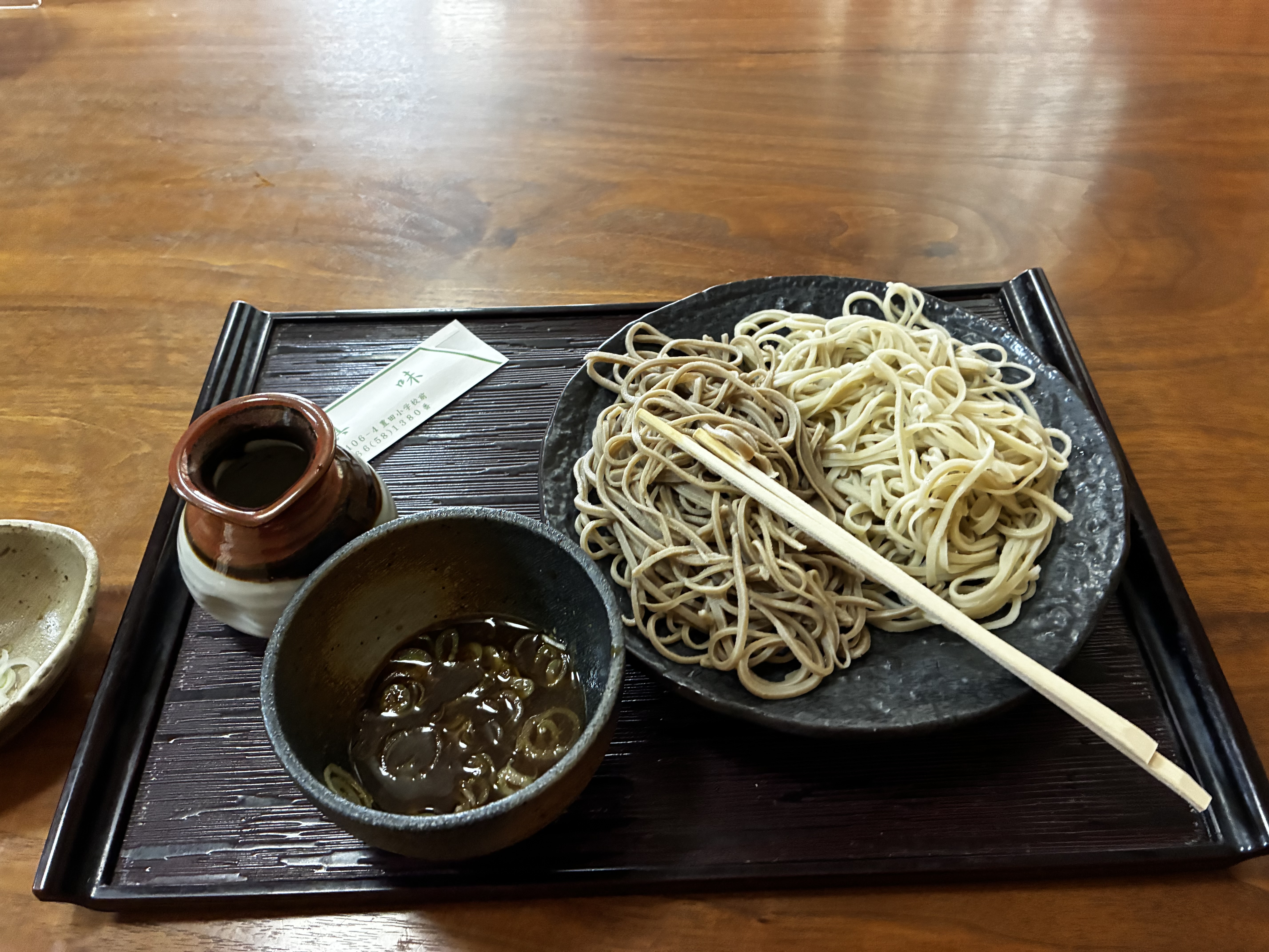


It was hot, I was cooked, I did not feel like riding more, even up the gradual hill to Kobuchisawa. I needed to get back to Tokyo and did so, via train. The Chino train station was not convenient ... I ended up climbing a short nasty slope, then racing to try to catch, but just missing an express. Not recommended.

I had abandoned rather than riding on. Surely a real randonneur would have kept going ... at least over Fujimi Toge and downhill to Kofu, or to the Shizuoka Coast. And with this, I had DNF'ed a second brevet in 2025. 

But in truth I was fine with my ride. I had ridden 316km before checking in at my lodging, with 4200m of elevation gain, in just over 20 hours, half of that in the rain. My hands and thighs were chafed from the rain, but I had done much better in the warm rain this time than in the cold rain on February 1. I had seen a bit of new territory and plenty that I had not visited recently. And I had gotten over the climbs, even if somewhat slowly. So I look at the ride as great training rather than as a failure.

11 July 2019

Swim and Bike day - to Chichibu and Takasaki with Peter - SRAM Etap Fail

Hydrangeas still blooming in July along the slopes of Nariki-Kaido
Deep green with running water -- beautiful in every season.

Last weekend I could not get out on the bike. Rain, work on Saturday, and a barbecue for my students on Sunday (not work, but workplace-related), all prevented it.

So I looked forward to trying a mid-week ride. 

I had been talking about trying to ride with Peter W. I met Peter when he gave me a lift to and from the Fuji Hill Climb.  (I offered to drive or be driven ... just to cut down the number of cars going with the Tokyo Cranks and avoid sitting alone in traffic. Peter loves to drive, ... but he is the first to admit he would not make a good passenger, so the bikes went on top of his sportscar. I am more flexible in these things.) Peter has a flexible schedule mid-week.

Anyway, we settled on yesterday, Wednesday, to try to ride, and the weather forecast was for cool, cloudy, but dry -- as good as it gets near Tokyo in July, I think, though a bit of blue sky might have been nice also. 

I suggested 3 possible routes, all starting from Oume and ending in Karuizawa or Sakudaira. And I had told Onikata-san, the cyclocross racer I met on the way back from Karuizawa a few weeks ago, that if I got back to Gunma I would let her know and see if we could ride with her when in her home territory (she and her husband are in Annaka). She reported that she should be able to ride some in the afternoon.

After morning swim practice, I headed to Tokyo Station where I met Peter, and we boarded an 8:30 Chuo Line rapid train that would continue to Oume. The train starts at Tokyo Station and ends at Oume, so this assured we could fit our bikes even during rush hour, and get a seat the entire trip. Peter would rather have driven (did I mention he likes to drive?).  But we needed to go by train to Oume so we could come back a different route. Frankly, in Japan train offers much more "optionality" than car even if it can sometimes be slower. 
South entrance to Chuo Line platform, Tokyo Station 830AM weekday -- not so bad, though
now that I think about it, the sign does say "don't put luggage in front of here".
My first choice is to ride the entire trip, but if distance and time do not permit that,  I prefer train to car. My fast, minimal "rinko" preparation makes train easier, also -- 5 minutes and my bike is in or out of the rinko bag and ready to go. Again, Peter is more deliberate, and more careful, but it takes him much longer to pack or unpack his bike, even though it is a "rear wheel on" rinko bag (no grease on the hands from removing the back wheel, but takes much more space on the train).  
Takes a bit of time to get this bike ready out of the rinko.
Anyway, we were at Higashi Oume and on the road by 1015am. 
Another view -- always beautiful ... near the start of the Tokyo Hillclimb
We made decent time to the "Holy Fountain", where we had a quick water stop, then climbed Yamabushi and were at the top by Noon. 
The shrine of the holy fountain - fresh water before the climb
Arai Fudou-son shrine - the "holy fountain"
Peter is taller and thinner than me, and has a lighter carbon Specialized "S Works" Roubaix bicycle. But I am still a faster climber and waited 4-5 minutes at the top of Yamabushi. He is relatively new to road cycling, and if he rides regularly I expect he will at some point improve and get up the hills faster than I do, at least he will do so unless I lose some weight. Physics and the magic "power to weight ratio" make it highly likely. So for the time being I enjoy every hill that I summit ahead of him.
Elev 600m, or 608m, or 610m.
This sign serves as SR600 Fuji proof of passage ... only the framebadge is missing. 
Peter arrives at the top of Yamabushi ...
He grumbled about it being 30 meters lower than I had represented, as his Garmin still registered under 600m.
... Said he was "saving his energy for the last push".
I got way ahead again on the downhill, and I do not expect this will change. I drop like a rock and am descending well this year, picking my line carefully and trying to stay off the brakes--eager for Alpine descents. My knowledge of these roads, heavier weight, and Peter's upright riding position give me the advantage on the downhill.  Plus I had my mini aero bars on the bike, which pull in my shoulders and cut drag. Near the top of Yamabushi the pavement was wet and we were in mist from the clouds, but the lower part of the descent to Route 299 was dry, and once we joined 299 (this stretch aka the "ajisai kaido"), it was very fast all the way into Chichibu.

On the Fuji Hill Climb weekend Peter had brought all his own food -- a bit fanatical, I thought. Perhaps excused as a by-product of years living in China and Hong Kong, where food safety and quality can be an issue? I was glad that once we reached Chichibu he seemed eater to eat a regular meal, in fact said he preferred a sit down lunch. We went to an Italian place with good pizza and pasta, full of local ladies at Wednesday noon. The food was tasty and prices were reasonable--not a tourist stop.

From Chichibu the ride went downhill, figuratively and, mostly, literally. I was riding my SRAM Etap setup. I love this wireless electronic shifting. But last week I had a dead rear derailleur battery, way too premature. I figured the battery had a problem, or maybe I had done something to it. So I swapped out the battery for my spare. I put the same battery back in after recharging -- better check to make sure it was not my imagination. Sure enough, on Tuesday when I checked it was dead, so I used the spare battery. But that battery was ALSO dead when I left swimming to ride to Tokyo Station yesterday morning. Hmm. I almost went home ... would have missed the train, so instead decided to swap front and rear batteries and limit myself to a single chainring. Big ring, but I could temporarily change the batteries and use the small chainring on the Nariki Kaido climb and on Yamabushi.

Anyway, this worked fine until one of the sections a few km after Chichibu. The last battery died. I was stuck for the rest of the ride in a 50-23 gear. If you needed to pick one gear for the rest of this ride, it might have been 50-23 or 50-21 -- just enough to get over the last few hills until the climb to Usui Pass, and just big enough to make OK progress on the flats, even if I would "spin out" as soon as I exceeded 28-29kph.

With this gearing, Peter went ahead and soon had a few hundred meters lead on me. ... I could not tell him to turn left for one last hill that would have taken us to Oni-ishi and Fujioka. In the end, we just kept going down a valley to the Northeast and emerged to the flats of the north Kanto plain.

We contacted Onikata-san, whom we had planned to meet at Tomioka and ride with as far as Karuizawa. Instead we headed for Takasaki, a major station. She came by and we could at least get some coffee at a Starbucks. Annaka, Tomioka, Takasaki are all close and all her riding territory. She told us about her Sunday group rides -- typically they train on Jizo Touge, or Mt. Haruna, or a few other places. She said there was lots of repetition, always the same 3-4 routes. I guess I am envious, since living in Annaka puts you close to plenty of nice riding territory, far better than Tokyo. But to get variety you need to go a bit further afield. Or rinko, as we did. Her husband apparently was a serious bike racer -- won the Japanese national championship in his university days. And a friend of theirs runs a bike shop next to her hair salon in Annaka.
Post-coffee pre-train photo.
Anyway, it was a good, active weekday. Even though we could not make our goal of Karuizawa, I still rode 87km with good company, nice roads, and did one of the classic Kanto passes (plus I got in another 10km in town, and a morning 1800m swim).

Also, importantly, my etap failed BEFORE my Europe trip, with still time to put on a mechanical groupset -- better safe than sorry for PBP. Mark Thomas and Lois Springsteen, two winners of the "American Randonneur Award", both warned me off of electronic shifting systems for long events ... and I guess, despite my happy experience in Tasmania, they were probably right. I will submit a warranty claim for the SRAM rear derailleur, but meanwhile will likely be riding good old trusty mechanical shifting in France, cable splitter, spare cables and all. 

15 April 2018

Spring is Sprung! 4/14 AJ Tamagawa 300km Brevet

In Gunma on Route 299, between Kanna Town and Ueno-mura
I was really looking forward to yesterday's April 14 brevet. This type of event, after all, was the reason I joined the AJ Tamagawa chapter of Audax Japan.
-- A start and finish about a 35-minute spin from my home.
-- That would take me on familiar, but beautiful roads I do not see often enough.
-- That gets out of Tokyo before the traffic, and returns after.
-- With a tough, rewarding first half ... and an easier, forgiving second half.
-- In a beautiful season for this part of the world (and, as it turned out, with ideal cool, cloudy but never cold cycling weather -- the kind of weather in which world records are set (by those in the shape to do so).
I was not disappointed!!!
At the start area at Futako Tamagawa ... last minute repairs to a randonneuring bike?
Or just one of many abandoned mama-chari?
Our route -- clockwise, out through the mountains, back on the plains
We started a few minutes after 6AM. (I was in the second wave of starters, officially slated for 6:10AM, in fact a bit earlier). Another group would start at 7AM. 90 people had signed up, but there were 25 DNS's, according to the staff. I guess the forecast for afternoon and evening rain scared people away?
In any event, I was the first rider to go through "bike check" for the second wave, and was off. Within 45 minutes, I passed a few of the riders who had left 10 minutes earlier. Around Tachikawa, our route left the river and switched to some major roads -- roads Jerome likes but I usually try to avoid. Fortunately, traffic was still light.
On Nariki Kaido. Flowers and flowering trees.
At Higashi Oume Station, we entered the Nariki Kaido, the cyclists' most well-known route into Chichibu. After several short climbs and 3 tunnels, I was in Naguri and slowly ascending the valley that ends at the base of Yamabushi Pass -- all very well-known, rewarding territory for a road cyclist day trip from Tokyo. Then, a quick water stop at the "holy fountain" (our name for the shrine 1-2 kms from the base of Yamabushi).
The "holy fountain" -- delicious water, and free
Looking toward Yamabushi from the holy fountain - no cars even at 830AM.
Looking back from the holy fountain ... an Audax rider in the distance - no cars
Here, a few riders passed me, ... and a couple more on the climb. I am overweight and not as strong as in some years. I really needed this event for training, and I was not surprised that I struggled a bit on the climbs. Then again, I made it, and what doesn't kill you makes you stronger. If I can get in some decent GW rides in series, keep swimming on weekdays, and then make it through the Chubu Audax 400 next month ... I just may be back in shape.
Hairpin turn - steepest section on the Yamabushi climb.
Spectacular new buds and light green leaves on the adjacent slope, even on a cloudy morning.
Anyway, from the top of Yamabushi I was down and at the river in Chichibu in no time, it seemed. From 625m elev. to 190m ... the low point between Yamabushi and 800m Elev Shigasaka Pass.
The Arakawa, early on its journey from mountains to Tokyo Bay.
I remember the first time I made it to Chichibu by bicycle, back in the Positivo Espresso heyday. It was a hot day, and the town seemed dusty and downtrodden. Not yesterday! The roads have been repaved (including a formerly nasty, bumpy, even dangerous stretch of Route 299 coming into town from the East), pedestrian areas widened, historical buildings fixed up, and even some convenience stores have bike racks (and inside seating). The town looks, well, worth stopping over sometime to spend an afternoon and night, and getting to know a bit instead of just riding through. Of course, it still has the lovely hilltop "Muse" park across the river, and it still is a gateway to many mountains and rivers.
Route 299 between Ogano and Shigasaka Pass - VERY light traffic.
An example of the typical farmer's garden on this road.
And we saw lots and lots of small solar farms, even more, and larger, later on around Tomioka and Fujioka.
After Chichibu, we stayed on Route 299. Of course, the only thing that remains the same about the road at that point is its Route number. Once past Ogano ... just a few kilometers west of Chichibu city, the traffic volume drops to near zero. The climb up Shigasaka Pass was tough, for tired legs and an overweight body, but beautiful.
From the Shigasaka Climb
From the Shigasaka top
Entering Gunma, finally
Then it was down the hill to Kanna, past the dinosaur exhibits, and onto the grinding 0, 1, 2% uphill to the west toward Uenomura. This area is known as the site (up on one of the mountains) of the crash of a JAL 747 jumbo in 1985. But I know it for its lovely, peaceful nature. My favorite stop is the "Kawa no Eki" (a play on the typical "Michi no Eki") at the west end of the town, where one can sit and watch the river from an amphi theater, bamboo on the opposite bank. I bought some "tako yaki" to refuel a bit for the climb to the entrance of Yu-no-Sawa (湯の沢) Tunnel, at 710meters elevation.
On the short (3km) climb to the entrance to the 3km+ tunnel from Uenomura to Nanmoku/Shimonita
Once in the tunnel, the grade turned into a descent, losing at least 50-75 meters elevation in the 3km tunnel. The descent continued after the north exit, and it was a quick descent to Nanmoku and the next checkpoint at a beautiful "michi no eki".
Beautiful "Michi No Eki Oasis Nanmoku "with delicious breads for sale
And lots of vegetables too ... alas no room to carry them home by bicycle
I bought some delicious dark bread, filled with nuts and other goodies, weighty. I gave away part of it, ate part of it, and took the rest with me (where a few bites at a time helped keep me fueled the remainder of the ride.

By the time I left the Nanmoku checkpoint, it was almost 3PM. I was only 1 hour ahead of the cut off for that point, shockingly slow, with half the distance left! If I was done with the climbing, the weather forecast for the rest of the ride had looked grim. We were about to head east along Route 254, with a stiff headwind predicted. Then sometime around 5 to 7 PM, the rains were supposed to it.

In fact, over the next stretch the winds were light to non-existent so I could make good time. And the rain held off to the finish. If the scenery was boring after dark, at least I was riding many roads I knew reasonably well, or at least could recall having ridden sometime in the past, if not in a few years. That really helped in the dark. By the time we headed downriver from Oume again, the winds had picked up into a swirling gust. At first, this was a crosswind. But then, it became mostly a tailwind and pushed me the last 20-25 kms home. This video from near Sekidobashi (where I stopped for the last of the bread) gives some idea, though it was actually taken during a "lull" in the gusts:
As I munched on my bread, I saw two riders zoom by. They were gone long before I mounted up, but I thought (maybe, just maybe, I can catch them). Sure enough I could finally see them and made it through the same traffic light (barely) at Tamagawaharabashi, and was only 75-100 meters back passing the Keio Oval and as the road bends left. Then there is a right turn at a traffic signal.  They were stuck behind cars waiting at the light. I crossed the road, so that when the light turned green, I could use the crosswalk and immediately turn right. I did so and was off with a zoom. I had passed them without even figuring out who it was ... immediately, I thought, perhaps I should have been more social and joined them for the ride in? But with a tailwind, and my eye on the clock, trying to get to the goal within 17 hours, I felt not a moment to lose.

AJ Tamagawa had commandeered a room in small structure in Futako for the finish. It was not easy to find ... for a newby. Only one Audax PBP reflective vest hanging outside in the dim of a streetlight, and a couple bikes inside the fence, gave it away. Precious minutes lost finding it ... so a 17hr 02min finish -- plenty of time given the 20-hour cutoff, but not fast enough to do really long events (600, 1000, 1200) and get enough sleep/recovery during the event.

The check-in building was little more than a shed, but there was space for us to check in, plenty of light and warmth, and a place to sit and discuss the ride and get some small snacks and a cup of tea. I rode this event alone pretty much the entire way -- so I was glad to chat with some people I had passed, or who had passed me. Eventually the two riders I had passed came in ... and one was the tiny woman rider from Kansai who had zipped through the Isabella Byrd series last year, riding some with Jerome and me on the 600k leg. Sure enough, she had started at 7AM, so instead of finishing 5-10 minutes behind me, was actually 45-55 faster. Many of the others at the finish are familiar faces ... but none who I know well.

Jerome missed the event, returning from a business trip Saturday evening. So as I was eating a late lunch, I got an SMS from him:  he was 100kms into the ride and on Shigasaka!  As I write this, he is well over 200 kms and heading through Saitama toward Oume, and on a pace for a 14 hr ride.

15 August 2016

Ride Back from Karuizawa

A friend recently bought a place in Karuizawa that he and his wife plan to run as a "guest house" in high season, and use for themselves and friends the rest of the year.  It is within 15 minutes' walk of the shinkansen station, so seems to have no difficulty attracting guests.  In fact, the cars were lining up nearby in Karuizawa when I arrived on Saturday afternoon.
The quiet countryside?  Lines of cars in both directions.
I rode to Tokyo Station, rinko'ed the Ti Travel bike, and was in Karuizawa before I knew it.  Then 5 minutes or less by bike from the station to the guest house.  Door-to-door just over 2 hours, despite peak summer travel.  Not bad at all.

We took a short afternoon spin through some areas on the south side of town, climbing through a quiet area of second/vacation homes to the entrance to the Myogi-Arafune forest road that I had ridden from the other end back in 2009. It was a decent climb up to the road entrance, and we were ready to loop back.

The forest road was closed in the direction we wanted to go.

 ... but we figured this would just add to our adventure.  Indeed, the road was passable 90% of the way by bike, though we needed to dismount and walk or carry our bikes a few times.


Classic Gunma mountains -- the rindo skirted the Nagano-Gunma border.
Maybe neither city or prefecture had the budget to maintain a road that included the other?

My host pointed out that we were very close to the site of the Mt. Asama corporate lodge of Kawai Musical Instruments site of a 10 day seige when Japanese Red Army members holed up with a hostage and a cache of weapons back in the early 1970s. I guess the day the police stormed the building to break the seige is a marathon live broadcast event that everyone remembers in Japan who saw it.  Anyway, the vacation home areas south of Karuizawa seem quiet.  Last time I came into town in 2009 via the forest road, they were deserted.  At least this time, the absolute peak of peak season, I could see cars in driveways and some people out gardening or strolling.
The only exposed stretch of expressway between two long tunnels, from the forest road on Saturday afternoon.
My main ride was the return trip to Tokyo on the next day, around 180 kms door-to-door.  I left at 730AM or so.  I usually go in the opposite direction -- brevets, even the SR600, leave Tokyo and pass through Karuizawa.  And there was that trip Jerome and I took in 2010 where we arrived in Karuizawa via Chichibu, Shigasaka Pass, Tano District and Shimonita.  That was 183kms and 2750 meters of elevation gain on a very hot day.
Going under the expressway Sunday morning.
I thought about doing a "reverse" of that 2010 route, since I would at least shave maybe 8-900 meters of elevation gain off by starting from the high ground.  But when I got to Shimonita and recalled that in this direction I would need to slog uphill for over 20 kms, the last 3-4k ms climbing inside a tunnel, I opted for a slightly easier route around the south side of Tomioka, with a relatively short stretch on congested Route 254.
Almost no traffic to Shimonita, after getting past the expressway entrance route ...


Central Shimonita.
Bike leaning. Close to central Shimonita.
Say "Shimonita" and most Japanese think "Konnyaku" - a kind of vegetarian gelatinous
low calorie food included in "oden" and various "nabe" dishes.
Konyaku plants without flowers -- a perennial. These fields dot the landscape around Shimonita.
180 kms and almost 1500 meters of climbing -- not bad for a "downhill" route back to Tokyo.
On Gunma Route 193 - again no vacation traffic here
My route took me through the town of Karaku.  The michi-no-eki was not yet open.
But I noted the bike racks and lots of other attractive features for a return visit.
These michi-no-eki can be very pleasant surprises.
Also in Karaku SE of Tomioka. Spacious old houses and a stream at roadside.
Jerome was planning to ride out to meet me, and he ALMOST made it to the top of Yamabushi Pass, despite a late start.  As it was, I met him on the Tokyo side of Yamabushi as he climbed through 450-475 meters elevation, and we rode the last 80 kms or so home together, arriving back on schedule a few minutes before 5PM.
Still hydrangea in bloom on the north side of Yamabushi.

Flowering trees north of chichibu.
On Sunday night, my thought was that I am not doing enough of these classic one-day 130-200km rides this year or last.  It is hard to fit them in with my current schedule AND focus on the longer 400, 600 and 1200km events that take preparation and recovery.  Maybe next year?