|
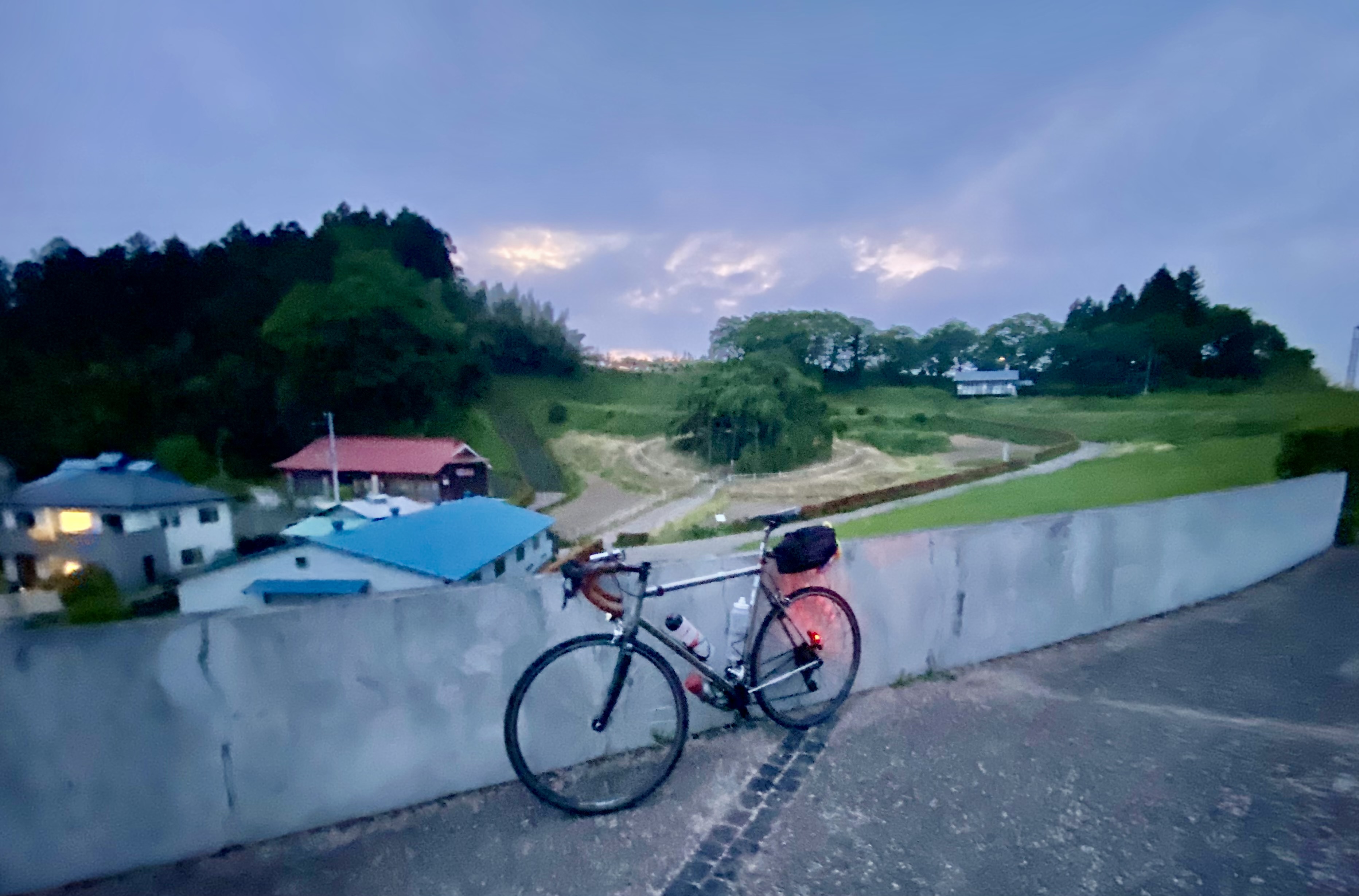
| North of Aizu Wakamatsu, mountains of Bandai Asahi National Park in the distance |
I woke up in my hotel in Aizu Wakamatsu at 830AM. I jumped in the shower, dressed, and went down to get the hotel breakfast and drop off my chaku-barai box of dirty clothes (I had sent a box of clean ones ahead so it had been waiting for me when I arrived, with some energy bars, spare tire tubes etc. in case I needed to replenish supplies, and now I sent the dirty laundry home). I was on the road by 9:15AM or so.
I had planned to sleep another hour or more, but when my eyes opened, I knew it was better to just go instead of lying in bed trying to get back to sleep. I had a long day ahead.
The first part of the ride was 20kms from Aizu up to Kitakata along a valley, almost flat and a good warm-up. I stopped at a convenience store in Kitakata to stock up for what looked like another lengthy no-convenience-store stretch to come, found the checkpoint (PC) memorial stone for a photo at a shrine, then started the long morning climbs of Day 2.
I would go through Kita Shiobara and climb up to the Ura Bandai area around Lake Hibara, only a few kilometers (as the crow flies, across the lake) from the 7-11 I had stopped at last night, then turn north along the lake for a second climb up to the top of Shirafu Pass and the border between Fukushima and Yamagata. If you counted these two climbs as one big uphill with a nice respite in between, this was the second biggest climb of the entire event, with the high point around 1400m elev.
My plan was to just push through these climbs the first half of my day, enjoy the long descent to Yonezawa, and then just tough it out for the remaining 180 kms to Iwaki. Sure, there was one more climb out of Yonezawa, but that started higher, and finished lower, than the morning climb, and after that I would enjoy 40kms of mostly downhill back to Fukushima city, then a long stretch in the lower hills without any big climbs, and another nice 40kms of mostly downhill into Iwaki. I hoped I would not arrive later than I had in Aizu ... but resolved to sleep in before doing a half-day ride to the finish on Saturday, well within the 60 hour limit.
I struggled up the first 600m elev. warm climb to the Lake Hibara area, still tired from yesterday and the short night of sleep. I could not help but think that if the first climb of the day was this tough ... it was going to be a long day. That's rando and ultra-endurance. I stopped a few times to rest and was quickly swarmed with gnats that did not seem to bite, but seemed attracted by my dripping sweat and were quite bothersome. They mostly dissipated when I remounted and got up to "speed".
 |
| View from the Michi-no-Eki |
 |
| An early lunch. |
 |
| The pun in Japanese is in "kami-sama", with "kami" meaning either paper or spirit/god depending on the character used. It does not translate. |
 |
Michi-no-eki = "stations on the road"?
Anyway, it is an annoying habit of some Japanese to refuse to use the last bit of toilet paper rolls but rather switch to a new roll. Bizarre and wasteful. Not eco-friendly. |
 |
| No other cyclists here yet. One arrived before my departure. |
Anyway, I decided to get some shio ramen at the michi no eki just over the small pass before Lake Hibara. I could sit outside in a breeze with a bit of a view of the lake. They had a bike rack, but mine was the only bike there on a Friday. Others arrived by car or motorcycle. The "michi no eki" is a Japanese institution -- a rest area that includes restaurant, sale of local produce and crafts, toilets, tourist information, sometimes even an onsen. Communities seem to take pride in these way-stations and they often include nice surprises ... such as the ability to sit outside in a breeze and look at a lake while eating. Salt (shio) is a traditional product of this area, and hence the shio ramen.
My plan had been to eat something at the other end of the lake, another 10-15kms on, just before the next climb. I rested a bit longer than the meal required, then headed on. It was easy to make progress along the lake. The road (Aizu Wakamatsu-Urabandai Line - Route 64) was mostly shaded, there were some signs of human inhabitance -- a few houses (mostly boarded up) or summer camp-type facilities. There were a couple pairs of cyclists on rental bikes (dendo?) coming the other direction and one or two roadies as well. And there were tunnels so that the road had only modest ups and downs.
 |
| A quick stop before starting the Route 2 climb to Shirafu Pass. |
That ended at a "T" intersection where I turned left/north, joined Route 2 (NishiAzuma Sky Valley) and started the next climb. The climb was hot due to lack of shade and my general overheating by this point. The gnats were back, together with a few larger insects that buzzed a lot but did not seem to bite. There was not a lot of breeze now, and that encouraged the bugs. (Note to self: get bug spray in Yonezawa! and bring some on subsequent rides in case of emergency.) Eventually I got to a section marked as a kind of "nana-magari" (七曲がり), so I knew that the switchbacks would continue as the road climbed. I discovered that at as I rounded the eastern end curves, I got some breeze, then the breeze would disappear until the next eastern end curve ... just a bit more exposed given the wind direction. The bugs would keep their distance as long as I kept moving, and scatter completely at the eastern end. But the even the breeze was not strong enough to keep them off if I stopped at the eastern curve. I don't think I would have noticed the gnats if I had been well-rested and just climbing the hill normally.
 |
| Coming out on top of the climb. No bugs here. |
 |
| Entering Yamagata and starting a long downhill |
Anyway, eventually I got to a flatter section along the top of the ridge, and crossed over at the PC photo sign welcoming me to Yamagata. From there it was a quick and relatively steep descent over 25 kms to the next PC, another stone memorial outside the Uesugi Shrine and museum in Yonezawa. The steep part of this descent was not so much fun ... nothing like the delightful one yesterday afternoon into Fukushima, nor even the one into Aizu Wakamatsu.
Where had the time gone? It was already 4PM in the afternoon. I had hoped to be here by 2-230PM! I still had 160-170kms to go to Iwaki. Another convenience store, another pasta, more coffee, a purchase of some bug spray, some brief rest, and then I headed out. The next stretch was not as long a climb as either half of the Kitakata-Shirafu Pass segment I had already done today and, once up it, I could rest on the bike while descending to Fukushima. If I could get there by early evening, I would have done over half of the day's distance and all the big climbs, plus I had that long descent into Iwaki to look forward to, so I just needed to push through!
Soon after leaving Yonezawa, I found myself on Route 232 toward the East/Southeast, a lovely road for the early part of the climb up the west side of the mountains that separate Yonezawa from Fukushima city. Within a few kilometers there was very little traffic, then there was NO traffic as the road passed through only a few dilapidated collections of houses and the forests closed in. Then the road became a real forest road. At one point I heard what must have been an animal through some dense brush on the left side of the road. I did not stop to figure out what it was. If it was a bear or inoshishi, I did not want an encounter. If deer or kamoshika, my loss.
After another 5-10 minutes, I stopped at a stream crossing, admiring the lovely surroundings.
Then the road turned up steeply. Wada Pass-like steep.
Then the surface deteriorated to a mix of potholes, gravel, and debris-covered concrete. Even though the surface was dry, and my Open Pave tires have good traction, my rear wheel slipped a few times on the debris -- I would need to stay seated and make sure not to make any sudden pushes.
I was in no condition to climb this after the last 30 hours of riding. I got off and walked long stretches, remounting when the surface was a bit better, the slope not quite as steep. I was not expecting this. What I had thought would be much easier than the day's climbs up to that point ... turned into a kind of Bataan death march. (I later went back and read some of the pre-ride reports and I did find warnings I had missed before. One rider specifically cautioned against trying this stretch at night or in the wet. Others used some pejorative descriptors about the slope).
 |
| Steep + crappy road surface |
 |
| Dense forest on these mountains - jungle! |
 |
| Finally, out on top! |
 |
| The "station in a shed" at Toge Eki |
Anyway, after what seemed like forever, I got to the top. It was 6:25PM and the sun was setting in the west. There was another wind power project (the turbines marked "Ichigo"). At least I was on top and could descend to Fukushima. Hurrah! Next I needed to find the PC, which was "off course"
at a place called Toge-Eki (the "Station at the Pass"). Okay, I was AT the pass, so the station could not be far, I thought.
I was wrong. I followed the route some way down the eastern side of the hill and found the turn off to Toge Eki. ... I then needed to climb some back up to the ridgetop and over and way back down the west side, descending around 150 meters. One car came out of the road (a good sign, at this point), and at least it was paved and relatively clear. At one point the road split and there was a sign for 4 kms to Namegawa Onsen up a side road (I cannot imagine many places are more rustic or remote). I got down the last steep stretch of road to Toge Eki, There was some kind of minshuku or inn, and another house, but I did not see any people around. The "station" itself was inside a huge shed (I guess this is all snowed in during the winter). It was deserted (it is an unmanned station, of course). It did seem to still have train tracks, but the idea of the trains stopping here ... well, who would get on or off? Only few hikers.
It was 645PM and would be dark soon, and I needed to climb back up that hill again, so I did not dawdle. At least this time I had come down the slope that I would go up, so no surprises. I slogged up the hill and then back down to the "main" road. I could see what looked like a new, modern, and fancy house across the way back in the woods. Maybe they own the wind project? I started down the eastern side. There was still a bit of light in the sky, so I could see beyond my bike's headlamp. After a few minutes I saw a large collection of closed big white buildings on the left side below me. ... They must be keeping animals inside. Chickens? Pigs? ... no, I thought as I passed below and the stench hit me -- beef! Okay, that stench could have been pigs as well, but Yonezawa is famous for its beef. It seems it must be the 村上畜産 板谷ファーム. On Google Maps I cannot see any buildings ... so they must be quite new. Hard to find a location for this kind of factory farm in Japan -- you cannot site it near anyone since the stench and waste are difficult to bear. The animals are sealed away inside so I could only imagine what it must be like.
 |
Phone booth in the middle of nowhere. Well, in the middle of Itaya.
Lots of these along this ride, and needed due to poor cell coverage? |
 |
| The long, empty tunnel on Route 13 toward Fukushima city. |
Anyway, I continued down the hill and soon passed the post office and station at Itaya, as well as what looked like a huge facility up on the hill (the
zeolite quarry and processing plant). After a short up and down stretch, I was back on National Route 13 and at the entrance to a 2.36km tunnel that would take me through the mountain and onto the real descent to Fukushima-shi. It was dark by now. The tunnel, however, was well-lit. I made it almost all the way through before a single truck passed heading the opposite direction. And then I was on the descent to Fukushima.
The descent was fast and uneventful, and unmemorable. After I turned off of Route 13, I passed Jurokunuma Park. There was a soccer facility with artificial turf and a roof ... that was full of young people, both boys and girls, passing and kicking. The energy was palpable. There were coaches and parents standing around outside, watching the action, and a full parking lot. I felt a wee bit of hope for the future of Fukushima city. The park had other facilities as well, though none had the kind of Friday night frenzy of the soccer ground.
I rolled into Fukushima city down the road that stretched from Jurokunuma Park all the way to the shinkansen track crossing at Soneda, just north of Fukushima station. I had planned for a sit-down meal here, ... but I was behind schedule. More convenience store pasta. More restock. Really, I could have called it a day and checked into a business hotel, slept 6 hours and then done the last 200km+ on Saturday. But I had a reservation in Iwaki and a box of clean clothes waiting for me. And there were no more big climbs ahead, so I pushed on.
The route would pass just south and west of the nuclear disaster "exclusion zone", through rural areas and rolling hills. It was night, but the areas near Fukushima city I sensed were prosperous farm country. Nothing like the run-down sense in some areas of rural Japan. I guess they have managed okay since the nuclear disaster, no doubt thanks in part to inflows of public money but mostly because this was a prosperous rural area to begin with. I was lucky to find the PCs (one post office, one train station) in the night and take my photos, but my pace was slow, twice I stopped for cat naps, lying near roadside, with a bit of protection from passing cars (not that there WERE passing cars). By the time I got to the second PC between Fukushima and Iwaki, at Ohno, it was getting light again. Now I was on the eagerly awaited descent to Iwaki, which followed the Natsui-gawa through a gorge. The road was wet in place from some rain during the night.
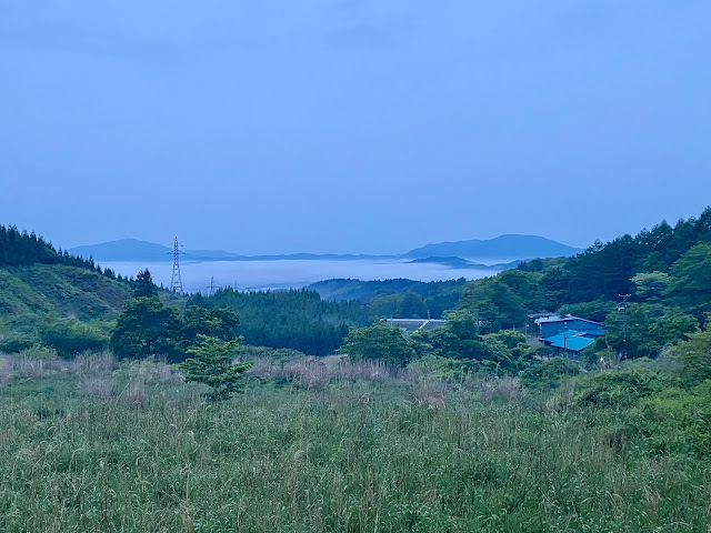 |
| Nearing Ohno and the descent toward Iwaki. |
I could not stay awake on the bicycle. There was some oncoming traffic and I was terrified that I would drift across to the other lane. I pulled off a few times. But I almost collapsed on top of the bicycle once. I was in a tight bit of gorge without much shoulder, but I found a place with a nice few steps in rock on my side of the road. I leaned my bike against the roadside wall and sat down on the steps and closed my eyes. When I awoke it 30-40 minutes had passed. I got back on the bike and was okay now, and made it the last 10kms to my hotel.
It was a bit odd to check in after 7AM in the morning. Unlike the last Route Inn in Aizu, they did not allow my bike in the room. And they had a 10AM checkout, rather than 11AM. I ate breakfast and, when I passed the front desk, they told me I could stay until 11AM, at least. I bathed, slept for nearly 3 hours and was back down at the front desk to hand in my box of chakubarai clothes and my room key a couple minutes after 11AM.
 |
| On the lower part of the Route 399 climb |
 |
| Fuji flowering in trees all over this part of the country. |
 |
| One of the flat sections of Route 399 |
It was slow getting going -- I stopped at 2 convenience stores on the way out of town, before the first climb. The climb would take me from just about sea level to over 800meters elevation, and would be the bulk of the day's work. My ride was under 100kms today.
The climb was up National Route 399. On the lower stretches, it varied with some steep bits, a lot of 8%, and some flatter sections where recovery was possible. Then I got to the end of the "new road" and Route 399 turned into a billy goat's path up the mountainside. At a few places, you could see the construction project to extend the new road all the way and replace what i was on. There were regular signs of waiting areas for trucks ... involved in the construction. Fortunately, they were not on the road this Saturday, as it was too narrow to be fun riding with a bunch of large earth moving construction trucks. But there were a few staff at the entrances to the construction project, waiting to direct non-existent traffic (and occupied by their smartphones).
 |
| The construction zone, new road visible but not yet open. |
 |
| The "old road" still in use here. Aaargh. |
Again, there were some 15%+ bits. I got off and walked a few times. No shame in walking when I'm this tired.
Is all this construction really necessary? Iwaki has an expressway that connects it with Ohno and Tamura/Miharu/Koriyama already. And it has another expressway up the coast. How many people will actually use this stretch of Route 399 when the new road is done? Very few, I guess. I suppose it is justified in case of another tsunami or earthquake -- redundancy. And it will certainly make cycling up this hillside easier. The thought of that was almost enough to make me apply to join the
Route 399 (Iwaki-Fukushima Nanyo section) Improvement and Promotion Association, though I must say that standing around in groups in business suits holding up certificates seems to be their main activity, and that is not going to get any road built!
 |
| Unused park in Kawauchi Mura |
 |
| PC - Abukuma Romantic Kaido commemorative stone! |
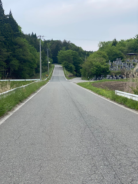 |
| The road turns up, again! |
 |
| Nice countryside |
After what seemed like an eternity, the scramble up the mountain ended, I rejoined "new" road and reached a short tunnel at the high point, and descended the other side toward a plateau at maybe 450m elevation. I was low on water now, and tried a tap outside a town office. ... it was dry. I found water from a tap in a park in Kawauchi, and then a convenience store. I missed the PC (memorial to the "Abukuma Romantic Kaido") and stopped to ask someone after I had gone another 2kms. He gave me good directions back to it -- was a local who seemed on the ball. Leaving Kawauchi on Prefectural Route 112, I started the last real climb of the event. Again, I hoped for a tunnel through the top of the hill, but there was none. I say "the last real climb", but there were plenty of 25, 50, and 75 meter climbs still ahead, some nasty, some gradual, and a lot of nice Japanese countryside with well-tended farms.
 |
| Last PC before the goal |
Finally, I arrived at a spot for viewing a massive
shidare-sakura on a hillside outside of Koriyama. This was the last PC before the goal. Only another 10kms or so from here. The route went into another sakura park and over a bridge across a body of water, twisted and turned, and went up several more hills, before descending past the Koriyama City Museum of Art and into town. It was quite dark now, and I was descending, but the museum looked like an interesting building. Indeed, from what I read it has a small but interesting permanent collection, and the building, cafe, and grounds are worth a visit, if I ever have a few hours to kill in Koriyama.
Finally, I reached the Abukumagawa, crossed the bridge and rode through the flat area of the town under the shinkansen tracks and back to the "goal". Then proceeded to get a receipt at the same 7-11 where I had started, 55 hrs and 45 minutes previous.
I struggled to pack up my bike into the rinko bag and get to the train platfom ... but the shinkansen had me back in Tokyo in no time. I took a local train to Shinagawa and a taxi from there ... no strength to reassemble the bike and ride it even a few minutes home in a sudden rain shower. Thank you JR! (As usual, the two boxes of cycling clothes I had sent from my hotel were delivered to my door in Tokyo by 10AM Sunday, the charge for each under $8 equivalent. Thank you, Yamato! Japanese delivery services ROCK!!)
Was this easier or harder that SR600 Fuji? I don't know. It was not easy. It felt truly wild for much of the area in the mountains west of Koriyama and Fukushima city. I did myself no favors by starting at 1110AM. It is possible to take an early shinkansen from tokyo and start at 8AM. Or stay the night before and start at 5-6AM. That would make a stop in Aizu or Kitakata far easier. But the hard climbs were definitely "front loaded" into the first half of teh course (a good thing), the climb out of Iwaki being the only long/tough climb in the last 250kms. And the 60 hour time limit meant I could ride without the stress of worrying about a DNF due to missing the time cut off. And I could not really ask for better weather. All in all, it was a great, epic ride, and excellent conditioning for Cascade 1400 next month.
I really should be doing several of these each year instead of waiting another five years before trying the next one. There is an SR600 on the Kii Peninsula that is next on my list.