Showing posts with label Okutama. Show all posts

02 November 2024

A Ride in The Dark -- and a WUCA Record Established?!?!

After my ride across Honshu last year, I have wanted to try a few other WUCA (World Ultracycling Association) unsupported record attempts, to try and get this concept established in Japan. 

Since I did my unsupported Honshu WUCA record ride, supported/crewed WUCA records have been set in Japan by 32 yr old Yaofeng Cheng, a Japan resident woman rider going North-to-South and 35 yr old Australian Jack Thompson going South-to-North, in each case including Kyushu and Hokkaido as well as Honshu. But no one has duplicated the unsupported Honshu-only ride. Of course, Thompson, who did Japan South to North in just a smidgeon over 5 days, has a number of other records around the globe, and rides complete with sponsors and a full crew. No desk job. It looks as if Yaofeng Cheng had a full crew of Japan Audax riders and other cyclists with her.

Anyway, this year I am not in as good cycling condition as previous years. I never got in my SR series this Spring, having missed several due to schedule issues, and DNFed (recurring stupid mechanical issues) my 300km ride, and then DNF'ing a Golden Week 1000km ride (lack of preparation mostly). 

So I have had limited ambitions for the Fall. I have tried to build up some more base since August, at least, in order to try a shorter record attempt.

WUCA also registers records for major city-to-city pairs, and for going across a region, or state/prefecture. I thought -- why not go across Tokyo Prefecture. Set forth below is an extended version of my "narrative" ride report to the WUCA.

-----------------

Start.  I started at 10:50PM on October 26, on National Route 411 at the Yamanashi border near the far western end of Lake Okutama.  There is a small bridge over a gulley with a stream into the river. The Eastern side of the bridge has Tokyo border signs, while the western end has Yamanashi Prefecture and Tabayama Town border signs. I started just off the western end of the bridge inside Yamanashi.

Conditions

The conditions were near perfect for this ride.

I wanted to do this ride late at night to avoid traffic. The main challenge of riding across Tokyo Prefecture – population 14.1 million – is congestion.  Many of the most direct routes are no fun to ride during the day, fighting with trucks and cars. The first third of the route to Oume is mostly rural and so congestion is not an issue, absent roadwork, but once you get into the city, congestion would add time to this ride and make it unpleasant. Late at night, with very low traffic volumes, it could be much faster, safer, and a lot more fun.

I spent an inordinate amount of time trying to figure out the best route.  Should I go the straighest line 98.13kms?  
( https://www.strava.com/routes/3273251512526534248 ) 


Or perhaps make a minor alteration and take Inokashira Dori into town - a fast, flat, straight, and low traffic alternative that I know well 101.67km? ( 
https://www.strava.com/routes/3283272140791505062 )


Or swing north and avoid central Tokyo to instead go down the Arakawa 102.98kms
( https://www.strava.com/routes/3273258823699968166 )
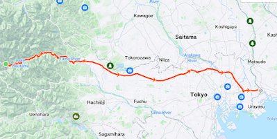

Or even go through Saitama (Tokorozawa ... Wako) and a longer stretch of the Arakawa to avoid traffic lights and take a very fast, dark Arakawa path 105.81kms?
( https://www.strava.com/routes/3283278143772050928 )
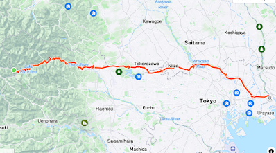

Or down the Tamagawa and in Meguro Dori ... to maximize the no-light stretch along the Tamagawa and then be on familiar roads through town 110.99kms?
( https://www.strava.com/routes/3283461428696622960 ) 


In the end, I opted for a compromise -- familiar roads, and a route with a slight dip to the South, around 103kms.  Rte 411, then Yoshino Kaido, then Ome Kaido, then Shin Ome Kaido, then Rte 20 (Koshu Kaido) through Fuchu/Chofu and all the way to Shinjuku, Yasukuni Dori east to the Sumidagawa and R 14 beyond to the Edogawa.)  

Strava Link

https://www.strava.com/activities/12751175085

I think that route worked out well. In town on Rte 20 and Yasukuni Dori then Rte 14, I could see the traffic lights far ahead, see the walk signal change to flashing green then red, accelerate or relax depending on whether I was going to make it. And when I missed a light, I decided to enjoy the brief respite. The only section where I got really frustrated by the lights and constant stop/start was on the stretch between the Imperial Palace and the Sumidagawa (Sumida River) – the old central Tokyo downtown.

I think a faster rider could do better with the route through Saitama then down the Arakawa. That is only a few kilometers longer and offers 25kms of nonstop time trial down the Arakawa.  But I did not have time to vet it carefully for the stretches between Oume and Wako, and also, is it really a ride "across Tokyo Prefecture" if you take large stretches through Saitama. Somehow that does not seem in the spirit of the challenge, even if it would not violate the rules (I was told I could take any route, as long as the end points are clear). 

The weather was fine -- warm for late October. It was 14 Celsius (57 fahrenheit) and cloudy at the start and this remained nearly constant (12~16 Celsius) even as I rode from the mountainous interior to the plain adjacent to Tokyo Bay.  As I planned the ride, I was concerned that it might be quite cold at the start deep in the interior mountains, even this time of year. So I did not want to ride too late in Fall. On the other hand, the Tokyo weather can remain hot and humid into October and I did not want to ride it too early.  I ended up with Goldilocks weather – just right! 

There was a breeze from the NE at times – it felt a bit as if I was riding into a headwind on Route 20 around Chofu as the road turned from ESE to ENE direction -- but the breeze was not strong and never directly in front.

Why This Record

I wanted to do this to “lay down a marker” so that someone else will beat it. There are plenty of Japanese cyclists who could do it faster than I can, some much faster, some in my age group, some who ride recumbents, and many younger road cyclists. I hope this will encourage them to try.

Equipment Used

I rode my Pelso Brevet “carbon high racer” recumbent. I am slow climbing on the Pelso, but this was a largely flat and downhill course with very little climbing. I now have a 48-tooth oval single front chainring and an 11-50 rear cassette, with a 12 speed SRAM mountain bike derailleur, but it is otherwise set up the same as for last year’s long ride across Honshu.

Since the ride would be entirely at night I used my SP Dynamo hub front wheel, as well as a Busch Mueller Icon IQ/XS front light and several battery-powered rear lights. I experimented some with LED powered front lights, but could not get any to work as well as the dynamo-powered Icon IQ/XS. So it is a no brainer choice – set and forget – even with some very modest drag from the dynamo.

I rode in relatively leg-hugging running shorts, cycling jersey, wool short-sleeved inner layer, reflective vest and ankle bands, and running shoes with wool socks, with rain/warm gear stowed in my Radical Designs rear seat bag just in case.

Eat and Drink

I left home around 1PM and rode the 89.4kms (and 640m elevation gain) to the start.


A quick stop at Y's to replace a bell that broke a few kilometers beforehand.

A cloudy, hazy, and warm (for late October) afternoon climbing from Oume.

The start of Yoshino Kaido, at Kori. I will head down there tonight.

It was after 6PM and pitch dark by the time I approached the west end of Okutama.

I was feeling pretty drained even before leaving home from lack of adequate rest over the past week, and I could feel some burning in the legs at times as I climbed toward the start at Lake Okutama. My Garmin smart watch told me that my "body battery" was empty already that morning ... as it had been the day before. So doing such a long ride to the start was not ideal, not at all ideal … but I had planned to do this effort entirely alone, the Pelso is not easily carried on Japanese public transit, and the logistics of leaving a car at the start and returning to pick it up later were not great, so I just rode to the start and then home from the finish.

The minshuku where I rested, as it looked at 10:45PM.

I booked a room for JPY3000 ($20) at a very basic inn very near the start. I arrived at 630PM and planned to leave around 1030-11PM. The inn seems mostly to host groups of hikers, who do their own cooking. They do not serve food, and most of the nearby restaurants  (including Yagyu-tei where we often stop when we ride the west end of Okutamako) serve only lunch to passersby. So I knew I could not get dinner anywhere near the start. Instead, I ate (carbonara pasta, a rice doria, etc., etc.) on the way out, one stop in Oume and again at the 7-11 at Kori, and took some sandwiches and Japanese convenience store basics with me to eat after arriving at the inn. 

The innkeeper and his wife were both in their 90s, and I was their only guest Saturday evening. I was quite impressed with the 93 year-old innkeeper who spryly walked up several flights of steps on the outside of the building to show me my room. I ate my sandwiches, rested and even got an hour of sleep. In this perfect weather I could have rested without an inn, but in any other conditions the inn would have been a lifesaver. And given my exhaustion I really needed some rest.

During the ride, I ate maybe 4 half-sized “Kind” nut/energy bars, some bite-sized 7-11 apple danishes, and a Snickers bar, with more similar food in reserve.  I carried a 950mm water bottle with a mix of water and sports drink, and another 500mm water bottle in my bag. I felt somewhat de-hydrated from the climb up to Lake Okutama, so I drank a lot of water at the inn to try and re/pre-hydrate in the 4+ hours before the ride. Of course, I wanted to do this sub-4 hour ride without any convenience store or other stop to take on food or drink, and was able to make it. Ideally, I would have had a bit more sports drink with me, but the cool weather and nice downhill section early in the route meant I could manage without. My only stops were traffic signals, plus 2 quick bathroom breaks at roadside (a side effect of having drunk so much liquid before the ride).

Best Part

The best part of this ride was that probably 75% was on familiar roads, ridden in ideal weather and low traffic. I love riding in Japan at night when traffic is low. It helps to have relatively smooth and unobstructed roads and good lighting.

Hardest Part

At the start ... very quiet, but there were actually some people around,
and some cars driving along Lake Okutama late on a Saturday night.

The start was really difficult.  Lacking adequate rest, I felt drained, even after a couple hours of rest. The first stretch along Lake Okutama had me wondering if I should not just give up, relax, ride home, and try again another time. Every time I pushed it a bit, I needed to back off the throttle. But I recovered on the long downhill and so, by the time I needed to really start to work harder again on the remaining two-thirds of the ride, I felt okay.

Entering Chiba, at the sluice on Kyu Edo Gawa

Finish.  I finished at 2:37AM on October 27, for 3 hours and 47 minutes.  I finished just on the eastern side of the Kyu Edo River at the Edogawa Sluice.  Tokyo Prefecture follows the Edo River and, after they divide, the Kyu Edo River, and this is the furthest east crossing into Chiba that I could locate. There is a wide cycle/walking path over the river here (on top of the sluice) that is closed to cars but regularly used by cyclists and pedestrians. Even at the end of my ride at 2:37AM on Saturday night, there were 3 younger men fishing off of the sluice and talking.

I chatted with them a bit, explained that I had just come from the Yamanashi border and was happy to get to the Chiba border.  One of them said that there is actually a dispute between Tokyo and Chiba as to which of them controls the bit of land on the island at the east end of the sluice. ... but Google Maps, Yahoo Maps and others all show the border where I was standing as Chiba.

After the finish, I stopped at a nearby convenience store for some food and a cup of coffee, then rode back to and across the sluice, and home slowly. On the ride home, I went right down the middle of the Ginza -- Chuo Avenue -- the bright lights of the stores on even at after 3AM. The blocks are short and each one has a traffic signal, and they all turn red and green together. It makes for a nice effect ... but that is one street where it is impossible to time the traffic lights!

Approaching Ginza, at 3:30AM.

This felt a bit odd to report this ride to WUCA. It was not my toughest ride this year, not my longest, and I am not in my best shape. But at least I've put down a marker and now someone else can beat it!


16 March 2022

Yanagisawa Pass - First Adventure on the RAMAX

The RAMAX ... looking down at Enzan/Koshu


The sky bridges of Route 411 just SW of Yanagisawa Pass

Jerome and I had planned to join a 200km R-Tokyo brevet on Sunday March 13, part of our qualifying for Cascade 1400.  That was postponed when Kanagawa prefecture extended its "manenboshi" (prevent the spread) anti-Covid-19 measures. Different Audax clubs have different rules about Covid-19, including some rides that have been adjusted to allow a start at any point during a one week timeframe, avoiding any crowds or groups, and so can proceed during "manenboshi". But this R-Tokyo event was supposed to be a traditional brevet with everyone starting on Sunday morning 7AM (in waves 5 minutes apart). So it was postponed to a date TBD.

Jerome rode on Saturday ... so I headed out Sunday morning early with the goal to do a good training ride, at least as much work as the 200km R-Tokyo event (a mountain-free course full of short up/down sections along the eastern edge of the Saitama hills from Kawasaki to Yorii and back). Peter J. had recently ridden over Yanagisawa Pass ... which got me thinking that I had not do so in several years. It is one of the true long climbs in Kanto, to a peak at just under 1500 meters elevation and with lots of repeated up/down in between Okutama-ko and the beginning of the real climb just west of Tabayama. In summer, there are enough sun-exposed stretches that it can be unpleasant, but on a mid-March day, it would be perfect.

This was my first real ride on the RAMAX "(Randonneuring Adventure MAXimum") bike. I had the "loaner" wheels, including the very colorful rear rim, and had not yet changed the Challenge Gravel Grinder tires. They seemed to roll smoothly on my way back to Takasaki a few days earlier -- and they are excellent tires for their intended purpose! Based upon bicyclerollingresistance.com, however, it looked as of they would add 10-15 watts per wheel of rolling resistance riding on a smooth road, as compared to the types of "slick" wheels I would typically ride.  And each one weights 415 grams, plus tubes, so heavier as well. But, I thought, what if I have the energy for a rindo detour onto gravel -- perhaps they would come in handy? And I was not out to--nor in condition to--break any records, so did not mind the marginal loss.

The bike performed well. I like the handling as I climb, especially the neutral, solid feeling as I get off the seat and work the pedals (not quite "dancing on the pedals," but close). I tweaked the seat position -- a bit higher and farther back -- to get closer to ideal.  After the ride, I swapped out the 110mm stem for a 120mm one, moved the seat a wee bit forward, and now it is juuust right.


End of the Tamagawa Path - Hamura, Almost to Oume

It was an uneventful ride up the Tamagawa to the end of the path just before Oume. There was a large group of men standing in the river, some fishing, some watching. I don't recall seeing this kind of spectacle at this spot before. I continued on after filling my water bottles and consuming banana from my back pocket.

Curbside dining in Okutama Machi (in front of Daily Yamazaki)
I stopped again at Okutamamachi near the Station -- last convenience store until Enzan, if memory serves. I chatted briefly with another rider who I had been playing leap frog with. I got the only onigiri in the Daily Yamazaki store, heading out just before he came in.  An hour or more later, as I left Yakyutei at the far end of Lake Okutama after a bowl of udon, the same rider was again approaching.

Entrance to the Nokogiri Climb off Route 411.

The traditional food stop at west end of Lake Okutama

Hazy sunlight at the west end of Lake Okutama

I liked the mix of traditional house, laundry drying, and construction equipment here.

The weather by now was warm enough that I pulled down my arm warmers/covers -- just riding with short sleeve jersey and bib shorts, and changed to the half-finger gloves for the first time this year.  Tabayama was looking very relaxed, people eating lunch on the terrace overlooking the river, flags flapping in the breeze (that seemed, now, as if it might push me a wee bit up the hill). 

Tabayama Michi-no-Eki

Tabayama - onsen from michi-no-eki

Finally on the real climb

A short rest around 1150m elevation ... 

Then I was onto the climb - nearly 800 meters up from here.  There was ongoing highway work on each side of Yanagisawa Pass ever since I first climbed it nearly 15 years ago. I remember climbing Yanagisawa with Jerome in 2009, our last massive training ride before Transalp (we tacked on Odarumi -- nearly 2000 meters elevation gain from Enzan to the top AFTER Yanagisawa on that hot day). I remember riding Sasago/Kamihikawa/Yanagisawa Passes as a series in the other direction once while training for Transalp in 2009, and again in 2011. And I remember riding this pass in the first brevet I ever joined, a 400km Kanagawa Audax event in late 2009. Well, the last tunnels and skybridges are now done and the only work in progress is some minor curve/shoulder improvements that does not involve a tunnel or bridge.  There was at least one tunnel on each side of the pass I have not gone through before ... how many years since I took this route? At least 3 or 4 years. Too long. I should do it at least yearly. 

I climbed slowly. I need to do a lot more rides like this if I am going to be in shape for Cascade 1400. 

At the pass ... I did not stop for food here today, though we often do.

No view of Fuji today ... and a decidedly unfriendly sign warning that for non-customers
the parking (even for bicycles) requires payment. Reminiscent of Wada Pass in the old days.

The descent into Enzan was fun as always. Perhaps I went a bit slower than normal, cautious during my first long descent on the RAMAX. But I felt confident the entire time. I turned left to join a road that goes diagonally down to the "Fruit Line" and continued (up and down and up and down) on the Fruit Line past Katsunuma and to Route 20 (Koshu Kaido). Then I did another climb to the entrance of Sasago Tunnel. I thought about a side trip on the deserted old road over Sasago Pass, as when Jerome and I did this combination of passes in 2016 ... but prudence is the better part of valor. Through the tunnel, I made a fast descent to Otsuki, grabbed some tasty Family Mart "nama pasta", and went fast again to Uenohara. 

At 182 kms, I thought about continuing to Takao to clear 200 ... or riding home from Mitaka or similar to Takanawa, also to get an extra 20kms. But I noticed that somehow three spokes on the non-drive side of the loaner rear wheel had gotten so loose that the spoke nipples had dropped off and into the wheel well. The wheel still felt rock solid ... but there is a limit to the number of spokes you can lose without the wheel becoming dangerous!  I should have checked the wheel's spoke tension before riding it. But I had gotten AT LEAST as much work in as if I had done the 200km brevet course east of the mountains, so I was not going to sit in the dark, take the tire and rim tape off, try to fish out the spoke nipples and re-tension it. Instead I declared my mission accomplished, hopped the train home, and fixed the wheel the following day.


07 March 2022

Start of Spring Training - Tokisaka Pass and Nokogiri Mountain

After not much cycling in January and even less in February when at least I swam over 75 kms), Spring training started with a short Onekan ride on Thursday morning, and a somewhat longer, much harder, classic ride up the Akigawa to Tokisaka Pass, then over Nokogiri and back from Okutama-machi to Oume. 

Looking back from Nokogiri (elev ~1000m)

I met Peter J. at "the toilets" (aka Komae-Shi Nishigawara Park) at 730AM. We headed up the Tamagawa, crossing at Route 16, continuing past the Takigahara baseball fields, then up the Akigawa via Mutsumibashi Dori. After a food stop at the Family Mart on Hinohara Kaido just before Tokura, we continued to make decent time to the "T" intersection at Hinohara Village Hall (Mura Yakuba). 


Tokisaka is a lovely climb -- very low traffic (except some places where hikers were walking on the road), varied gradients, varied scenery, and a real reward at the top.  The 300m vertical gain are enough so that, even if you need to turn around and head for home, you can feel like you did some real work. 

We chatted with some hikers, cyclists, and a couple who had arrived by car. Two young women hikers took Peter and my photo, and we took their photo.  We offered the same service to an older male hiker, but he declined. 


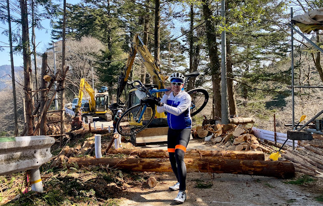
Just after the pass, there was a bit of an obstacle course. The first part was a logging operation that stretched entirely across the road.  But the loggers did not seem to mind our marching through carrying our bikes.


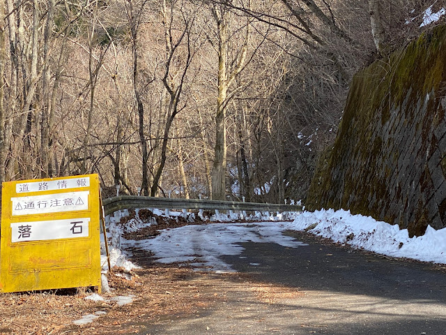
Then there were more obstacles --  a big mound of gravel at the beginning of the descent, snowy/icy areas, rocks in the road of all sizes and shapes. A lot more walking was required than the last time I went down this hill. And I still hit a smaller but sharp rock and got a flat.

Eventually we were down this descent and headed back along the Kita Akigawa to the turn-off for Nokogiri. After a gentle climb for the first few kms, the route became steep and the surface very bad -- lots of gravel and other crap entirely covering the road surface. Peter continued to ride ... but I walked quite a long way. I was slower, but not THAT much slower than if I had ridden. At some points there was snow and ice.  Anyway, it was a slog. I remounted and rode a few kms, but needed to walk again high up for at least 5-10 minutes. Finally, we could see the top, then look down from it!

That visible roadway is just one short switchback from the top.

We relaxed a bit at the top -- not TOO cold. I worried that we might need to return down the south side, if the north had more snow. Peter said a motorcyclist he had spoken to informed him that the north side did NOT have snow or ice, except the first few hundred meters. That proved accurate. 

The north side - snow/ice for a few hundred meters, then relatively clear.

It was still a slow descent, sitting on the brakes way too much, trying to be sure to avoid any rocks and handle the steep, technical sections without coming off the bike (it reminded me of the Gunma descent where I DID come off the bike in September 2020 and broke my collarbone ... at least this time it was dry weather and still hours of daylight).

We ate in Okutama-machi, just across from the train station at the "Hikawa Service Station". a lunch place with soba/udon and a delicious ki-no-ko-gohan (mushroom rice).

After lunch, I never really got my engine restarted. I made decent time with Peter back to Oume, but felt the jet lag from last week's travel and waking up at extremely early hours since. I hopped the train. Including the ride from Yotsuya home, the total was around 116kms, with just under 1500m elevation gain. The average speed was very slow due to all that walking and crappy road surface. 

But it was a lovely day on the bike. If I can do a ride of this difficulty, or greater, every week for the next few months, while interspersing some longer brevets (200, 300, 400, 600, and a couple others), I hope I will be able to get ready for Cascade 1400. 


05 November 2021

Tsuru Toge on a Beautiful Fall Day

I enjoyed a lovely 202km ride on Friday, Oct 29, out over Tsuru Toge via Otarumi, back via Okutama-ko and Oume, with Jerome and Peter J.  Wahoo failed to upload the recording of the ride (though the 202kms was showing in my weekly distance -- from now I am starting up my Wahoo Element app on my iphone BEFORE I click to "end" the ride on the Wahoo unit, which seems foolproof. So I do not have a GPS map of the precise route taken.  But it is a familiar one -- out Route 20 via Takao to Uenohara, then Route 33 and then Route 18 to the NW. Indeed, it is #8 of the Positivo Espresso recommended rides near Tokyo. Route 18 is one of the loveliest, lowest traffic real roads within 100kms of Tokyo, and highly recommended. And this really is the best riding season of the year. Every ride seems precious!

Mt. Fuji visible as we head up the Asagawa toward Takao


View from Daily Yamazaki in Uenohara - more Fuji, barely


On Route 18


We took the local road around Tawa Pass. The hillside field where the little old lady once
farmed -- endlessly weeding and tilling, it seemed -- is now fully overgrown. Sad.

Back on Route 18 and heading for the climb to Tsuru Pass! 

The traditional rest stop on the flat area half way up the Tsuru climb.
Gateball field, picnic table under roof, water faucet, public restroom.

Peter J. (whose start makes it a 23km shorter round trip than for me), wanted to get to 200km, and wanted to get up Matsuhime Pass for the first time on his carbon frame Scott bike. So I went ahead to Okutama-ko for lunch at Watanabe-san's cafeteria, Yakyu-tei, while Peter and Jerome headed up Matsuhime. 

The new town hall at Kosuge has nice exposed wood.

I was tempted by a cafe 3-4 kms up the road toward Kosuge ...
... but went on to our old standby, Yakyu-tei.

Quiet on a Friday. Watanabe-san and Watanabe-san are going strong!


Oyako donburi

About an hour after I left them, I got a text from Jerome that they were at the top of Matsuhime. Let's see ... 35-40 minutes to get down the hill and over here to Okutama-ko, another 20-30 minutes for lunch ... and I realized I would not get back home in time for an evening commitment. 
So I headed out and back down the Tamagawa to Oume, Tachikawa, Fuchu, and Komae, then in Setagaya-Dori and back to Takanawa. Home on time.
On Sunday, Jerome and I joined a Tokyo Cranks ride and got to show off the Seattle Randonneurs high viz kit that I picked up on my U.S. trip in late September.
Now we just need to remember to suck in our guts for photos.

Quite a collection outside the TREX Cafe across from Haneda.


08 October 2018

Okutama 200km brevet

At a stop for water refill near Tachikawa, tree heavy with fruit in the background.
On Sunday I joined the AJ Tamagawa 200km Okutama brevet, my last Audax ride of the year. 

The course was a loop entirely within Tokyo prefecture -- from Koenji down to Haneda, then up the Tamagawa to Fussa, then up the Akigawa to Musashi Itsukaichi, the very popular cyclists' route climbing to Tomin-no-Mori, Kazahari Pass (Elev. 1138 meters or around 3800ft), and down the back of the hill to Lake Okutama. Then back down the Tamagawa to Oume, and along Oume Kaido all the way bak to Koenji.

You can see the ride here on Strava.

What's not to like? Much of this route -- the rural part -- used to be an almost "routine" one day Positivo Espresso weekend sortée, but I have not done it in recent years. These days, if I start the climb up the Akigawa, I always turn left mid-way and go through Kobu Tunnel (Elev. 625m), descending down to Uenohara, with another shorter climb on the return (Otarumi Elev 392m), or maybe instead return by climbing the west side of Wada Pass (Elev. 600m), as these significantly shorten the return to town.

The day before the ride, I printed the cue sheet, downloaded the GPS track and took a closer look at the route. From Koenji to Haneda, we would travel most of the way on Kan-nana Dori. Kan-nana is a major "ring road" and, while cyclists are permitted, it is one of the routes I avoid. Still, with a 6AM start on Sunday in the middle of a 3-day weekend, traffic would be very light, so I thought it must be fine. I looked more. The route would continue via Kan-pachi Dori for at least 7 kilometers, to Shimo Maruko. I had never even considered riding on this part of Kan-pachi, another major ring road and one to avoid. Still, it would be early Sunday, and so must at least not be too dangerous.

The route continued up the Tamagawa, on road, not the cycling path. I prefer road to path on most stretches. But further on, the organizers had us take an almost 10km stretch on Shin-Okutama-Kaido, through Tachikawa and beyond. This is another road I try to avoid, at least the stretch through Tachikawa. Jerome likes it as a fast alternative. I am terrified of the traffic and lack of any shoulder. Still, we would be early on Sunday, and so traffic would be light. ... well, actually, by that point, it would no longer be early, but mid-morning. Traffic might not be so light.
My alarm rang at 445AM Sunday as planned. My bedroom felt hot and humid. Indeed, the passage of a typhoon in the Japan Sea north of Tokyo had brought warm, if sticky weather. The high temperature Sunday would be over 30 degress Celsius. Lack of enough sleep and humid weather had me on the defensive from the get go, but at least I had everything ready to go so just needed to grab a quick bite (and a cup of cold brew coffee), clean up, throw on my cycling wear, get on the bike and shove off, almost sweating from the start. I made it to Koenji by 545AM, well ahead of the 6AM start. 
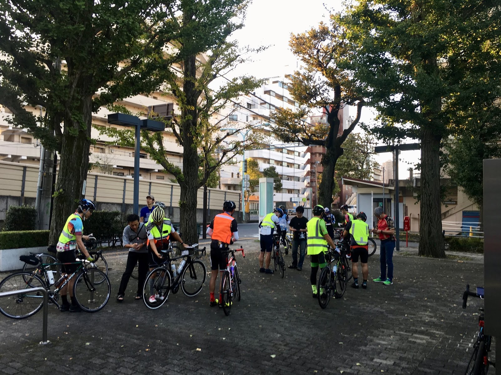
Bike check 
No bicycle parking allowed!


Really, "no bicycle partking allowed"

In fact, I had been assigned to a 630AM "C wave" of riders, so I need not have rushed. I wished I had slept another 30 minutes ...
The C wave was called, and my bike inspected, so I headed out. No one was following, and I made it through the first traffic signal to cross under Kan-Nana and head South just as the light changed yellow. I made the next few signals likewise just as they changed, and for the next 20-25 minutes I saw no one behind, nor anyone ahead from the B wave that had left 10+ minutes earlier.  I enjoyed a side/tail wind and made good time. Of course, it was nearing 7AM, and there was starting to be traffic on Kan-nana, but manageable. And even on Kan-nana, there are traffic signals, and bicycles cannot take the crossing overpasses, but need to take the surface level exit/entrance ramps, and wait at the signal. 

Shrine gate at the entrance to Haneda Airport
Near our turn off from Kan-nana, I caught up with a large group of B wave riders in a line -- maybe 7 or 8 of them. I joined but found they were going too slowly. In Japan Audax riders are very polite about passing each other. But the result is that sometimes one, slower rider, is pulling for far too long. No rotation. And with infinite traffic signals, a large group is awful. The start-up time to accelerate is very long, and it is impossible to time one's speed to try and sprint through a signal, seeing the walk light change from solid green, to flashing green, to red, and the signal go to yellow. You inevitably get stuck. So I passed the group as soon as practical.

Marukobashi
 It was after 730AM by the time I entered Kan-pachi. There was heavy traffic around Kamata (as always), but there were other brevet riders not so far ahead and behind, so at least the cars and trucks would be on the lookout for cyclists. We finally turned onto Tama-dzutsumi Dori and reached the river again at Marukobashi.
Crossing the Tamagawa at Mutsumibashi

Crossing the Tamagawa at Mutsumibashi
From here, the ride upriver was very familiar, and no surprises, just some wind gusting from the front and side to contend with. I made it to Mutsumibashi and the wind seemed to weaken a bit on Mutsumibashi Dori out to Itsukaichi. Our first timed control point was at a Seven Eleven across from Musashi Itsukaichi Station, 79 kms from the start, and over 92 kms from my home. The place was mobbed with cyclists (not from our event) and motorcyclists. Wow. Everyone seemed to have the same idea -- what a great day to head up the Akigawa by bike. But it was getting quite warm now.
Entering the Akigawa gorge area.
As I headed up the Akigawa, I noticed many cyclists coming DOWN the hill already back toward Itsukaichi. Some were alone, but many were in groups, larger and smaller, and many had rucksacks. Cars, motorcycles, and bikes all mixed. Finally, I noticed this sign on the left side of the road:

The road had been closed from 6 to 8AM for the Hinohara Stage, Tokyo Hill Climb. That explained the riders. They had done the Hinohara stage hill climb first thing in the morning, and were headed back down and home. No doubt they had brought an overnight change or warm gear in rucksacks that were delivered at the top. Of course, today no one needed warm gear even on a long descent. The gear stayed in the rucksack.

waterfall at 770m elevation, just past the former tollbooth site.
I really struggled on the climb, overheating if I pushed hard at all on the sections exposed to sun. By now it was almost midday. I had been hot since the beginning of the ride, my feet felt hot. I rested once at the turnoff to Kobu Tunnel. Many riders passed me. ... but as I got back on the bike and continued the climb, I passed many of them. They had just chosen their rest stops a bit further up! I had forgotten that there is actually some up and down, and more up and down, on the middle part of this climb. And the "up" can be steep. I rested again -- laying down -- at a turn off around 600 meters elevation. And rested again briefly at the former toll booth, before a push up to Tomin no Mori. Nothing good about my climbing speed nor these rests, but at least I had plenty of company. The lack of enough sleep, what seemed like a hundred start-stop traffic signals, the heat, and the swirling winds had taken their toll. Still, I knew that once up the hill, I could roll it home, pretty much assured of finishing if I were just careful. So I rested and then continued. 
Tomin No Mori


One reason to avoid the area around Kazahari used to be the motorcyclists who would practice racing through the curved stretches at the top. Then there was a year when motorcyclists were banned, and it was blissfully peaceful.  Well, the motorcyclists are back, and were out in huge numbers on Sunday. I guess after the 6-8AM road closure for a cycling event, they wanted to make sure everyone knew who really "owns" this stretch of road. A group of 6 motorcyclists kept doing a loop between two parking lots near the top -- I think they zoomed past me at least 5 times, some of them passing within inches, as I slogged from Tomin no Mori to their parking lot just shy of Kazahari Pass. I could smell exhaust, and hear their shrill engines, the entire stretch.
Then, I was past their turnaround point. It was like night and day. Peaceful, quiet and beautiful. Then all too soon, I was onto the descent to Lake Okutama, around the lake, and heading down the hill toward Oume. 


The stretch along the lake and the hill toward Oume on Route 411 includes many dark, noisy, damp tunnels. And there was very heavy traffic on Sunday afternoon. At least we were in our Audax gear - reflective vests, good front and rear lights. There were many motorcyclists as well, zipping around the cars and passing, zooming through the tunnels and other stretches. Before long, we came upon the scene of an accident, a car and two motorbikes pulled over, ambulances, police, the whole works. Some time must have passed as the injured were out of sight and the authorities out in force, and the driver of the car was being interviewed by the police. A few minutes later when a Ducati motorbike zoomed around some cars and cut in just in front of me ... I having foolishly left a safe distance between myself and the next car -- I screamed at him. I doubt he could hear. Another ten minutes, and I could hear more emergency vehicle sirens ... they seemed to be coming from across the river, on the bypass route. In Okutama-cho, near the train terminus, I passed a huge new fire station that has been built in recent years. At least the emergency vehicles do not have so far to travel now for these inevitable motorcycle accidents. Another 10 minutes on, I passed two motorcycles with sirens, ridden by blue-uniformed firemen/paramedics racing up the hill. These fire department motorcycles looked outfitted for medical care. I don't remember seeing them before. How many accidents in total?
I once knew that it is best to avoid Route 411 between Oume and Okutama mid-afternoon on a warm weekend day. This was buried somewhere in the depths of my local cycling knowledge. I needed, and got, a reminder.

Wow, Sunday's route included long stretches of Kan-Nana, Kan-pachi and Shin Okutama Kaido, as well as Route 411 (Oume Kaido) tunnels around Okutama and down to Oume ... so many roads that I usually want to avoid, all in a single event!

From Higashi Oume, we cut inland less than 1km on Nariki Kaido then took a road along the edge of the hills. This was a nice route, at least in the Sunday late afternoon. It was noticeably cooler, with the sun far down. I missed the next control point -- a Family Mart across the road -- as I focused on traffic congestion and turning cars at the relevant corner. A few hundred meters further, I approached a brevet rider at a red light. I said "we should be at the control point soon." His response "we just passed it". I thanked him and turned back.

After the control, we took Iwakura Kaido, which goes just along the western edge of the Oume tea fields (茶畑). The sky was beautiful and blue as dusk neared, the fields stretching out to my left. 

The last 30 kms back to the finish was unmemorable. Many, many, endless traffic signals, and long lines of cars. We took Oume Kaido most of the way. The last ~10kms it was a wide road with several lanes each direction, and a real tailwind. But before that, there were long stretches of standing single-file traffic, and bicycles needed to pass in a narrow space wedged against the curb. It was impossible to make good time. At least I felt strong again, fully recovered from the earlier struggle on the climb.

What can I say about Oume Kaido? Well, it is better road into town toward Shinjuku than Koshu Kaido. But not much better. I think there is a very good reason we take the Tamagawa in and out of town to the West and NW.

At the finish there was a party going on. The always professional Yoshida-san logged me in. Naito-san and a team of volunteers were serving us ramen wearing "Ramen Naito" or ラーメンないと t-shirts.  I wondered, is this "Naito" a play on his name and "Knight"? They were like knights to us.

I sat at a table of Audax regulars - Ryuu-san from Saitama Audax, Yoshiaki Philippe, Sugibuchi-san and others. They all did the 5AM start, or just came by for the ramen and company.  The ones who had ridden looked as if they had been at the finish already for hours by the time I arrived. Takemura-san, the head of AJ Tamagawa (now Vice Chair of Audax Japan), sat down and joined me. He said he welcomed me participating and sounded eager to get my help. He struggled in English, but I got the general idea. I think realizes that with a role in the AJ leadership, he will be called upon to coordinate with the global Audax organizations, and he will need help when they hold events that are open to riders from overseas. He said AJ Tamagawa wants to host a 1400km event in 2021, with international participation. I told him that, subject to time, I am delighted to help out.

The ramen was delicious. What type of ramen, I asked Takemura-san? Hakata? Sapporo? Some other region? He said it is "Jiro-inspired".  Jiro-inspired?! Jiro is the famous Tokyo ramen whose HQ shop is just next to Keio Mita campus. A Keio institution, where the line forms before the shop opens in the morning. But if this is Jiro-inspired, where are the bean sprouts? Where is the garlic? The massive portions? Well, he explained it is all in the style of noodle and the broth.  In any event, it tasted delicious:  Perfect noodles, delicious pork (cha-shu), and the salty broth really hit the spot for a dehydrated rider.
I chatted for quite awhile, then got back on the bike and rolled home, bathed and slept.