01 April 2019

My Day to Ride

On lower Doshimichi. Clouds to the East at sunset.
On Sunday I woke too late to join the Tokyo Cranks annual sakura viewing ride. But I had been hesitant about going in any event. Today I wanted to ride to beautiful places, and up some real climbs, and the Cranks' plan to see sakura en route to Koganei Park, then get coffee nearby, would have wrapped up late morning with me at least 25kms from any the entrance to mountains, leaving only a half day to ride out of Takao, Musashi Itsukaichi, or Oume.
The reward for a climb.
Yes, I wanted to view sakura, but today I wanted to climb, and I wanted to see beautiful scenery. And I wanted the freedom to go where the weather was good, to alter my plan as the mood struck me. Freedom; a good sleep instead of the usual early alarm to meet others; no set course, no Audax time limits; and no afternoon or evening plans that would make me watch time carefully.

I decided to go to Odawara and try the Ashigara Pass climb that ice and snow had prevented me from completing last year. I have only been over it once, coming from the other direction.

Path along the Sakagawa. 
I packed my rinko bag and a thin rain/wind shell and headed for Shinagawa. Out the door at 830AM; at Shinagawa and starting to pack the bike at 835AM; heading into the station at 842AM; and on the platform and into the train at 847AM. I took a Tokaido local since I would have needed to wait until 9:04 for the next Kodama, and I enjoyed the flexibility to pick my station.

Kamomiya was a sleepy local station with flat, easy access roads through mixed farm, residential, industrial areas to get to the Sakagawa, which I remembered had a path I could ride up to get very near to the Ashigara climb. I thought about just riding on the roads, which had little traffic on Sunday morning, but the path and river seemed more consistent with a sakura ride, even if slower.


The sakura were starting to blossom at points along the Sakagawa, but still early. The peak will be over the coming week here as in most of Kanto.

I had not planned my route, but decided to try to stay off the main road and take a short cut up the first part of the hill and merge into Pref. Route 78. Looking at the map now, I see that Route 726 would have been much more direct. And I made a wrong turn, taking a lovely quiet local road up the hill past the Asahi Beer brewery (which, by the way, was hidden away down the hill, and had some beautiful sakura planted along the road in front). The road ended abruptly.
Glad I am not driving or the lack of road would be a serious obstacle.


My work in solar PV development trained me to find the path through places like this.
There always is a path, even if just a footpath a meter wide or so.
There were farms here, nestled in the valley along a stream. I carried my bike down the steps, walked along some paths between fields, waving at the few farmers I saw working on their fields. In a few hundred meters there was a concrete path. I took this until I finally returned to a real road and then onto Route 78 and the lower part of the climb.


The scenery was spectacular. Lots of photo stops. At one, I chatted with a local who had come out from across the street and was enjoying a grove of sakura surrounded by yellow na-no-hana. He asked if I was going to Ashigara Pass. Well, I was not sure. I said, perhaps Ashigara Pass then Mikuni Pass/Yamanakako/Doshi Michi. Or I might go over the closed rindo to Kintoki Shrine and Sengokuhara, then Hakone Pass and along the skyline and down to Atami, or west to Mishima. Or maybe Ashigara Pass then back down the valley along Rte 76 -- parallel to Rte 246 -- and then west to Hadano and home via Yabitsu Pass.

In the end, I decided to avoid Hakone and its traffic, and stick to the plan to do the Ashigara climb. As I had last year, I saw many trail runners going up and down this hill -- but only a few other cyclists. This must be a mecca for trail runners, the way that Yabitsu Pass and Tomin-no-Mori are for cyclists.
Kintaro always wears a top with the character "kin" (gold).
... as if I were always to wear a shirt with a big "D" on it.


At various points along the road there are signposts pointing to a path labeled 足柄古道 or Ashigara Ancient Road. Indeed, Ashigara Pass along the Tokaido is mentioned in the Manyoushu (万葉集) from the 8th century. It was later replaced as the "main" route by Hakone, and the sense that this is an ancient place is quite strong. The mythical boy hero, Kintaro, was said to be raised by a witch queen who lived up here on Mt. Ashigara. And the story of Kintaro, the boy of super-human strength, is apparently based upon a real person. At the entrance to the shrine at the top, there was a statue of Kintaro, with his hammer, riding a friendly looking bear cub. In fact, the bear statue reminded me of a wombat!


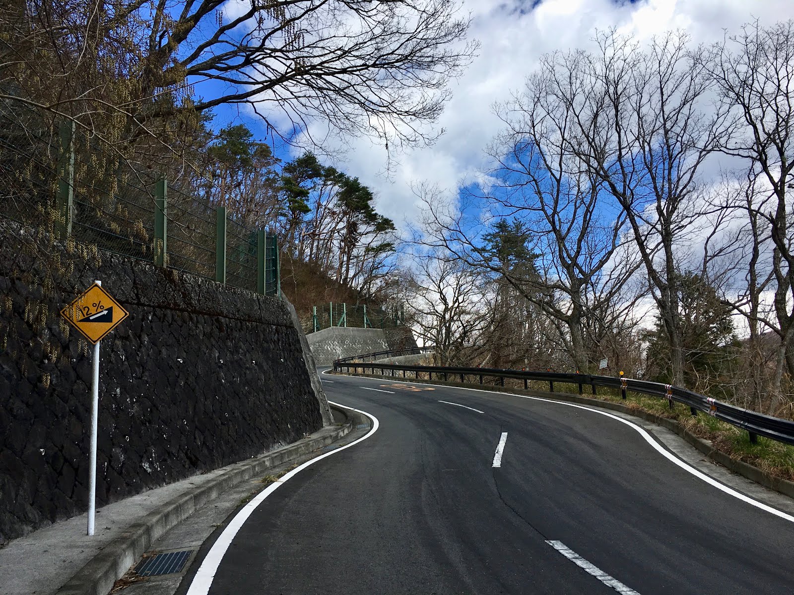
The climb is steep, 12% or more for stretches, and tops out at around 750 meters elevation. Over the top, the sky was a deep blue to the west, and I could see Mt. Fuji. I took a minor forest road on the descent through dappled sun toward Ashigara Station. More photo stops!

Looking down toward Ashigara Station and Mt Fuji.
I decided to go for Mikuni Pass. Mikuni is on the Olympic men's road race course for 2020. This pass is crazy steep -- like Mortirolo in Italy, or Kazahari Rindo. Not quite like the Angliru or Zoncolan in Spain, but definitely more than 2x Wada Pass.

I had only climbed it once before ... after doing a hill climb race up the Toyo Tires Turnpike out of Odawara. That was miserable, legs already quite tired from the race, and there are parts of the climb that are not only steep, but lack shade. Today was cool, but the climb still defeated me. Ashigara Station was around 325m elevation, and the top of the climb was 1150m or so. The real climb starts just west of the Fuji International Speedway and includes 700 meters vertical, immediately exceeding a 10% grade. Much of it is 12-18%. The famed "concrete donuts" are the steepest 18% part, but I had not remembered all of the other steep parts. I rested, and I walked, defeated by the grade. I remounted and finally made it to the top of the steep section, on the border between Shizuoka and Kanagawa. From there it is only a few km of more reasonable (5-10% grade) climb to the border with Yamanashi Prefecture.

No place to go but up.

The infamous concrete donuts. Lots of 16%, 12% and other warning signs too.
At the Shizuoka/Kanagawa border, end of the torture, now just a normal grade ahead.
"Mikuni" (三国) means "three countries", and is a typical name for a pass that borders three different jurisdictions. There are other Mikuni passes, just as "ryogoku" (両国) pass is for a pass the borders "both countries". There are plenty of those also. And of course, there are multiple Wada Passes, and Yamabushi Passes. And plenty of Mount Myojin's as well.  I think we need a re-naming initiative. Maybe this Mikuni Pass, or the nearby Yamabushi Pass, should be "Yamanaka-ko Gateway Pass" (山中湖ゲートウェイ峠)?


Anyway, the view over Mikuni of Mt. Fuji close up was spectacular. Every time I come to Yamanakako it seems a different Fuji is on view. From here I took a much more familiar route -- the short climb over Yamabushi Pass, down Doshi Michi, then a right turn to Miyagase ko and Atsugi where I hopped the train home ... with a short ride from Nogizaka on the Chiyoda Line back to Takanawa.


Doshimichi also looks like "Olympic Road Race Central".
They even have added lots of bike parking racks at the michi-no-eki.
The last light faded as I climbed to Miyagase-ko.

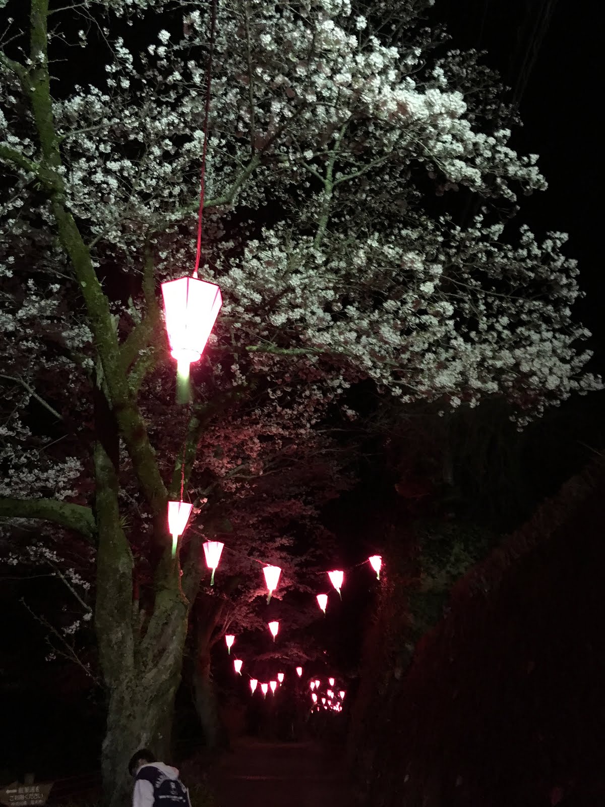
On the dark descent to Atsugi, I was drawn by lanterns up a side road and a hillside as far as I could see. This was Iiyama-san. The lanterns were to light a row of sakura that climbed along a stream and then up to the temple. It was not crowded, but there were families and individuals strolling. I walked my bike under the lovely canopy. Then rode back down the hill and into Atsugi. A perfect surprise end for a spectacular day on the bicycle.


Only 121km for the main ride, but 2300-2400 meters of climbing, not easy climbing.


28 March 2019

electronic wireless shifting - SRAM Etap first impressions; others

In January I installed SRAM's etap wireless electronic shifting system on Voyage Voyage, the Titanium travel bike. I used the bike in Tasmania, and have continued to use it for my local riding and trips around town in Tokyo the past month, and you may have noticed it mentioned in various posts.
Lots of box, quite small components.
I guess the box helps justify the price?

I bought an "upgrade kit" so kept my current crankset (installed a Shimano Ultegra 6800 crank), rim brakes (I am still using Shimano Dura Ace 7700 brakes which I like far more than SRAM Red rim brakes), and my own 11 speed cassette (a SRAM Red etap cassette would require a second mortgage on my house). I got the "wifli" version that has a longer cage rear derailleur so will work with an 11-32 rear cassette. After changing from 52-36 to 50-34 chainrings, I had gearing for the hills.

The upgrade, from a German mail order shop, cost E1007 or around JPY125,000. Expensive, yet still far less than within Japan (I can find a SRAM etap groupset from Worldcycle, including hydraulic disk brakes ... which are NOT wireless nor usable with a couplered bicycle, for JPY279,000). The same German retailer has a Shimano Di2 Ultegra full groupset for the same price, E1007, including crankset, brakes, cassette and chain. Would it be worth it?

So far, the answer is YES!

My thoughts:

--The set-up is incredibly easy. This is a significant differentiator with Di2, Shimano's electronic shifting groupset.

--It shifts smoothly, effortlessly, and accurately every time. I did have a few chain-drops to the outside, but fixed that with some modest adjustments.

--No shifter cables! No fraying cables. No stuck cables. No jammed cable in the brifter that renders the brifter unusable. No twisted cables. No weight of cables and outer cable housings. And for a bike with S and S couplers, no more cable splitters. SRAM Etap feels to me lighter than the bike did before. (In contrast, Di2 feels (and is) heavier than a normal Shimano groupset. )
Ready for re-assembly
Especially for Voyage, Voyage, the shifter cable guides onto the downtube are in a location such that the cables sometimes interfere with a dynamo light mounted at the front brake mount on the fork crown ... when the wheel is turned far left or right. No cables = no interference and no friction. No bumping the dynamo light off of center.

--Batteries

Shimano Di2 uses a large-ish cylindrical Li Ion battery that fits in the seatpost, with cables down to a junction box in the seat tube just about the bottom bracket, and further cables to each derailleur and through the down tube all the way to a second junction box under the stem, and more wires to the brifters. Lots of cables to plug and unplug, requiring a special tool. Wiring instructions that one must follow.

SRAM etap is far simpler. No junction boxes. And did I mention no cables? (Just hold some buttons down to "pair" the components electronically the first time you use them. Done.) SRAM has detachable batteries that plug onto each derailleur, plus button batteries on the brifters. The button batteries on the brifters are CR2032 -- available in most stores -- and should last at least a year. (The batteries on the derailleurs are proprietary, but front and rear derailleur batteries are quite small and light, they are the same/interchangeable, and the accompanying USB docking station is also small and light. The one in the rear derailleur lasted me nearly 1300km in Australia, while the one in the front derailleur was still fine after 1500km. If the rear one dies, shift into the small front ring, then swap the usable battery to the rear and you will be able to ride home with plenty of gears. Better yet, on a long ride like PBP, just buy and carry one spare SRAM battery. Really simple and easy.

To stow a bike with couplers, I just take the chain off, unscrew and store the rear derailleur, and I can take the bike apart. (*one cable splitter still for the rear rim brake).

So far, so good. I love etap and am very happy with the upgrade.

I have heard many people who love SRAM etap, but a few who have had trouble with SRAM rear derailleur shifts after break-in period a four or five months ... not sure the percentage, but I will check back in. I am planning to use etap in the summer, for PBP.

So far, Shimano and Campy do not have comparable products.

---------------------------

Meanwhile ... SRAM has already come out with a successor to my version of etap. It is called Etap AXS, and has a 12-speed cassette, and smaller front chainrings with a newly designed crankset including, as an option, integrated powermeter. But that set would be $2000 plus another $1200 for a crankset with integrated powermeter. A $3200 upgrade. Ouch.

--------------------------

I would much rather go in the other direction. Cheaper, simpler.

I  see one really nifty idea for eliminating 90% of shifter cables but keeping your existing rear derailleur. It is from a company called Archer Components and appeared on some review sites last year. It is a hybrid -- wireless from your handlebars to a device on your seat stay. You connect your rear derailleur, and the device handles the shifts.

https://www.bikemag.com/gear/tested-archer-components-d1x/


GCN mentions it (or a similar product) in their report from this year' 2019 Taipei cycle show.
https://youtu.be/-zGkaPEJ-K8?t=32

The only complaint from reviews is that it shifts a bit slower than manual or Di2 or etap. The GCN report says this new version allows adjustment in shifting speed (and other features) via a smartphone app.

Last year's version was only for a 1x drivetrain -- single front chainring (no front derailleur). This year's seems for use with "normal" road setups, based upon the GCN report.

That said, 1x may be in my future. Tim Taylor used a nice 1x setup in Tasmania. And there are some attractive 1x setups now out there, with massive rear cassettes in 12 speeds. Maybe 11-42 or even 10-50 12 speed rear and 42 or smaller in front chainring.

The simplicity of the 1x is ideal for randonneuring, not to mention the ease of shifting without doing any mental calculation of how to match front/rear simultaneous shifts when really tired. And 1x is easier to fit with wider chainstays for fatter rear tires!

For my next bike, not this year ... sometime like the Thesis bikes or one of these 22 models ... but from a preferred purveyor?
https://road.cc/content/buyers-guide/237160-22-road-gravel-and-cyclocross-bikes-1x-gearing-can-one-chainring-do-it


18 March 2019

Jerome is on the road to PBP

Yesterday Jerome did the first of his PBP qualifiers -- a 200k ride to Izu and back. Well, not just to Izu and back, but over the eastern Izu mountains/ridge on one of the passes south of Atami, and then back over again. 2500m of climbing, almost all bunched into the middle 50% of the ride.  When you throw in the heavy traffic, this was I think a harder 200k than the one I did in Tasmania ... only made a bit easier because it was on familiar turf.

Elevation profile of the section from 50km to 160km - two climbs to 500m and back and some other bumps.
Climbing on Izu Peninsula

That's the Izu Skyline up there.

That's the Izu Skyline the route crosses.

Back down near the sea ... and the heavy traffic.
Next weekend, his 300k!

10 March 2019

Tour de Tasmania Days 8 and 9 -- The Big One 600k

I slept early and long, but not deeply, and woke well before my planned 4:15AM alarm on February 24. I ate a very simple jam & toast breakfast (and savored my last individual serving of espresso coffee-in-a-tea-bag). My luggage packed, sunscreen slathered on, bike ready, and I was out in front of our backpacker hostel at 4:50AM ready to go. This is a serious ride, and I prepared in that spirit. It is the big one. ... oh, and not many photos this time. Focus on the goal.

Two climbs to the central highlands, one on each day, and lots and lots of other climbing.
Around 8500 meters of elevation gain overall.
I pull on my brake levers to stop the bike after riding around in the street in front of the hotel, and feel a "thwamp" from the rear wheel and a pulsing sensation through the brake lever. Upon inspection, I have a crack in my rear rim. I point it out to the organizers in the hope someone might just might have a spare rear wheel ... maybe even one with an 11 speed cassette already on it. No such luck. I would just have to ride and hope the wheel holds up. And avoid the rear brake as much as possible. This approach would not be possible in a race or similar event, but in Audax, I think I could make it, safely. I have fresh brake pads on my front wheel's brake, and the weather would be dry the entire ride, so no reason to think otherwise. I am still more worried about getting up the hills than getting down them.

We start this ride in a group as we had leaving Hobart, with one of the faster local riders setting the pace as we take a relatively major road to climb out of Launceston. There is little traffic at 5AM, but it is nonetheless nice to get a start in the group.

Having made it up the first hill together, I hung on to the lead group for awhile, always eager to get a fast start. The pace was a bit stressful, but I manage to at least suck their wheels and hang on. After a half hour or more of this, I feel confident enough to stay in the line with them and work my way up as they rotate. I figure I would get one pull at the front to repay them for their work, then drop off. But I had not counted on James Nitis. James had been the fastest rider in each of the earlier rides, no contest. And he is ahead of me as I work my way toward the front in the rotation. But once he starts his pull the pace accelerates. I am quickly winded and in pain, and I wave another rider past.

Just after Westbury there is a dip down across the river, and a climb up the other side that I remember from our rides toward and away from Deloraine. I relax and let go, knowing that to push hard further and try to stay with the fast boys any longer would risk trouble later in the day. I am still making great time. By 7AM I am already 50 kms into the ride and past our Deloraine lodgings at 300 meters elevation. From 55 to 75km there is even some downhill as we lose most of the elevation gained to Deloraine. 75kms in 3 hours -- a good pace for Audax. I even pass a number of riders from the lead group somewhere ... only notice it when the pass me again. I guess they stopped to remove clothing? Then we get some really nasty hills on a secondary road as we climb again to nearly 300m elevation, and then ride into Sheffield at 87km and the first control for breakfast. I try not to dawdle, but of course, many riders come in while I am eating, pretty much the rest of the group.

From Sheffield we climb up, then plunge down to a river crossing, then climb up the other side of the steep valley. This climb, from 133m to over 700m elevation, takes us onto the central highlands. From here we are "up" and will spend the next three hours between 700 and 900 meters elevation. I make it to the Cradle Mountain Lodge control in good time, order another grilled sandwich "to go", eat half and take half in my rear middle jersey pocket. Mark/Kevin/Catherine arrive, as usual, while I am in the control, and as I head back down from the lodge to the main road I see Rick, Tim Taylor and others coming in.
Looking back at Cradle Mountain after a short, unshaded nasty climb
Near Tullah, denser vegetation in the west
Surely the ride will get easier, now that we have reached our high point for the first day? Unfortunately, no. There is a lot of up and down on the next stretch, and it is getting warm, and the wind is more in front than anywhere else. There is one painful climb over the edge of a bowl, with the reward being a look back at Cradle Mountain. Finally, I see a live echidna just off the road. It must see me as well, since it goes into a defensive spiny crouch. I don't stop for a photo ... regretting it soon after, but not soon enough to go back. Then I make the left turn onto Murchison Highway. 170kms done so far, and heading downhill! Actually, there were soaring descents and then ugly climbs on this stretch. But I could not fully enjoy the descents, fatigue showing, a bit worried about my rear wheel rim (which seemed to be holding up fine), and with just enough trucks on the road to require care and riding when possible on the shoulder.

Finally, between Zeehan and Strahan, we see the western sea. Southern Ocean?
After 10 hours, at 195km, I pull off in Tullah to use a public restroom and get some water. I end up resting, lying on a bench in the shade under a canopy, for 15+ minutes. Time well-spent, but I am away from the road far enough so I do not notice riders passing me. Tara pulls in as I am about to leave. Just after I get going, a few hundred meters up the road, one of the volunteer cars has pulled off and is serving out water by a cafe.  Ahhh, I should have stopped there instead. Anyway, too late now. I push on and, only a few km further, start a 300+m elevation climb on a road with no real shoulders, plenty of mid-afternoon traffic, and a 9-10-11% grade. Ouch. More nasty smaller "bumps", then through the mining town of Roseberry, and, mercifully, a flatter stretch and a tailwind for the final 5-10km into Zeehan. Zeehan looks noticeably more downtrodden than the other towns we have seen. It is isolated, seems home to miners and other workers, or maybe it is just the hot, dusty afternoon or my condition that makes it seem a bit worse for wear.

From Zeehan the route continues south, with a relatively favorable wind and not much up or down, so I get to Strahan by 745PM. Many riders are in the control. From Strahan we need to do an extra 12 km "6km out and 6km back" again, to compensate for another course change that brought the total below 600km. I pass Mark, Catherine and Kevin outbound on their 12km on my way into Strahan and again inbound as I head back out for my 12km. At Fred's and Errol's suggestion, I order dinner before doing the extra 12 km (chicken burger), and my food is waiting when I get back.
Sunset at Macquarie Harbor
I leave Strahan at 840PM, only a few minutes behind Mark, Kevin and Catherine. I snap one photo of the sunset over Macquarie Harbor, and head uphill toward Queenstown and our motel. The road is very dark. No more full moon, no more moon at all until the wee hours, and I seem to be riding through a dense forest now. Over the first hour only a couple vehicles pass, including a public bus. If I had known how dark and deserted this road would be, I might have left with the group, even at the expense of some rest. I finally come out on top of a rise, heading north. Suddenly in an exposed section, a gust of wind hits me and nearly knocks me down. But it is no gust. I push forward slowly, the wind continuing. It only lets up after I turn a corner and get into the lee of a hill.

The rest of the ride to Queenstown is uneventful, though I can only see hints of large mining operations on the hillside to the left -- what appears to be a lighted conveyer or path at a steep angle up a darkened hillside. I roll into the overnight control just after 11PM. 18 hours from the start, 335kms out of 600, and more than half the climbing done. Tomorrow will be 265km. I am "on track" -- anything before midnight was "on track", based upon my rough ride plan.

I shower, change and fall to sleep almost immediately, leaving on the bathroom light for my "roommate", Robert N. from Atlanta, who is at least an hour or two back. I am awake at 3AM, dressed, breakfast, and ready to go by 330AM. I think I saw Robert crossing the room and going to bed sometime around 130 or 2AM, but went back to sleep immediately. He is still asleep when I leave.

Andrew, our organizer, had warned that slower riders should start 3:30 or 4:00AM to be sure of making the 86km to Derwent Bridge by the cutoff time. I could see Errol had started 5 or 10 minutes ahead of me, but I seemed to be the second starter of the morning, with Mark's group probably ten minutes back. Right from the start, we climb 300 meters, then descend, then a long flat stretch along a lake, then another 300 meter climb, another descent, more bumps, and finally 400 meters up to the central highlands again.

Some faster riders pass me on the flat stretch, though I leapfrog two when they stop to put on jackets. It is quite cold here, and some places are noticeably colder than others, only a few degrees C, under 40 F. I have arm and leg warmers, and zip up my thin Audax Japan vest over my jersey. But otherwise, only very thin gloves, a thin headwrap, and double wool socks but no shoe covers. I channel my Wim Hof, and ignore the cold. It is invigorating! It wakes me up! And as soon as my hands start to numb, another climb starts and my entire body warms.

I pass Errol, who is getting water from a stream. Mark et al. have caught up with me, but pull over to join Errol. They pass me soon after. On the last big climb, all the remaining fast riders pass me early, Mark et al. are ahead. Errol is within sight, but also ahead, Tom, Fred and Scott, ahead. I have not seen Tara, nor Tim Taylor, nor Wolfgang, Robert and Brian.

It look as if I will get to the top of the climb around 8:15-8:20AM. According to Andrew, we still have 13km of relatively flat riding, with a few short descents, from there to Derwent Bridge. My brevet card says the cutoff at the control is 8:52AM. The note from Andrew by email a day earlier had said the cutoff is 8:45AM. He said something about the cutoff at our pre-ride briefing, but I do not recall what. Anyway, I want to be there by 8:52AM. I haul ass, pushing up the last km of the climb and then going on a kind of tired time trial. By the time I get within 5km of Derwent Bridge, I can see Mark et al. ahead. I get closer, but am still a couple hundred meters back as I pull into the control at the Hungry Wombat Cafe. I hand over my brevet card at 8:45AM on the dot. Riders continue to come in over the next half hour. It seems the cut-off was 9:15AM or later ... and even that was applied liberally. I will pay later for my exertion.

At the top of the climb I had rounded a corner just as one of the cars with volunteers in it passed me. They swerved into the opposite lane to avoid something ... and then I see it, a very big wombat, lying in the road. The shape reminds one of a hippo, or a large pig. It must have been hit in the last few hours. It lies still, a small trail of blood or fluids running to the side of the road. Very sad. I did not stop.

At the Derwent Bridge control, I am in a long line for breakfast. Not only 10-15 riders ahead in line or waiting for their food, but also locals, and a group of motorcyclists. The staff are overwhelmed. I stay calm and try to be patient. I get my breakfast maybe 35 minutes later, and end up leaving the control after nearly an hour, still wiped out from the effort to make the cut-off. I sit with Catherine, Kevin and Mark in the cafe. Mark warns that we still have the climb to Tarra Leah ahead. He says it is the only climb from his past ride in Tasmania that really stands out in his mind! I file away the information. I still have over 11 hours, with less than 180km to go, I am at 730m elevation, the finish is at sea level, and the last 70 km is very flat. Plus, we should not have headwinds ... maybe even tailwinds. Should be a piece of cake.

It is a lot harder than I had expected. The central highlands have plenty of bumps, the wind is not from our rear but from the side (and later will shift to the front). And it is really hot. To get to Tarra Leah we descend 300 meters, then climb back up 300 meters. At the bottom, I stop and rest on the bench of a picnic table, filling my water bottles at a tap in the restroom. The climb back up is very painful, hot, exposed, and seems to go on and on. After reaching what seems like the lip of the valley, the climb continues. Then we ride a gravel section into town, stop at an (oddly) upscale cafe, and ride more gravel and uphill heading out of town. The next section includes lots of too-steep up and down. By now, I am riding at the back of the pack, with Wolfgang, Rick, and Tim Taylor the only riders I see.

There are lots and lots of steep, painful  climbs, even as we head from 600m elevation down. Downhill I just feather my front brake and try not to go too fast. Still, at least now I am seeing road cyclists across the road! They look as if they are out on day rides from Hobart and environs. Indeed, as we pull into a roadside cafe at Ouse, we are within 100km of central Hobart. Rick, Tim, Wolfgang and I are all there, and we must look like the walking wounded. Rick gets a large bag of ice. I put some of the ice in my bottles with water. He puts ice in his jersey, his bottles, everywhere he can think of. The heat is still miserable, and we go over some "bumps" then a real climb after Hamilton back up to 265m elevation, then down through a dip, up again, and then we go into a 13km gradual downhill.

Ahh. Finally, there is cloud cover, I think I see rain showers off over the mountains to the south, and it gets cooler. I pull ahead of Rick and Tim on the long downhill, but we are back together on the next, final real "bump" -- up 75 meters. Andrew warned me about this when I chatted briefly at the top of the climb after Hamilton as he had pulled over in his car. Indeed, it is short but very steep and nasty 12% for awhile.

As we reach and start to travel down the River Derwent (the same river as early in the day!), we face our strongest headwind since the 300k last week. Only 55k left, flat, headwind, and 3 hours and change in which to complete it. But for the headwind, it would be very easy. Tim and Rick are behind me, Wolfgang is up ahead somewhere, and I am in between. Every so often one or more of us stops briefly or slows and the order changes, but by the time we approach the bicycle path west of MONA, Wolfgang is out of sight ahead, Tim and Rick the same to the rear (I think I see their headlamps, but only once), and I push it home, repeating the route back from MONA of ten days earlier.

The "goal" is at The Whaler, a pub with outdoor seating. Beer is waiting. Cowbells ring and people cheer my name as I roll in with half an hour to spare -- the cheers reflect the camaraderie of a long, shared experience. The evening is a bit of a blur. I remember the beer and burger but the conversation is not so memorable among such an exhausted group. I get back to my hotel, take my bike case (and bike) into the room, but immediately fall asleep.

I wake up early, remove the rim of my rear wheel (it takes awhile since I unscrew the 32 spoke nipples, saving the spokes and of course the hub). I clean carefully and pack the bike and my gear, deposit my luggage/check out, and walk to our closing breakfast at a cafe down on one of the piers.

Everyone is in a good mood. A few of the riders did not make the full 600k, but most of those figured it out on the first day, skipped a long segment, and joined the ride into Hobart from Derwent Bridge onward. Everyone survived. No injuries, no catastrophic mechanical issues (my rim and Scott's seatpost being the most iffy I hear of. I pass around my discarded rim for inspection). I could not be happier with the way things worked out. I've seen a really interesting and beautiful part of the world, made some new friends I hope to see again in coming months and years--in Australia, the USA, Paris, or Japan. And having done these rides, I am fully qualified for Paris-Brest-Paris. Now I can plan my riding and other activities for the year without worrying about that.
Our breakfast is on a pier in Hobart, across from this vessel
Simon M. and I share a taxi to the airport, as we are both on the same flight to Melbourne, as is Wolfgang. He runs a travel business with tours to exotic places like Mongolia and the trans-Siberian railway.

Somehow I manage to sleep in economy class on the flights to Melbourne, then on to Sydney, then on to Haneda. Only the transfer at Sydney is a bit stressful, with a late arrival and a move between terminals. On the Sydney-Tokyo flight I was sleeping even before the meal was served.

Thank you, Rim

(Reposting here from Feb 26 2019 Facebook post).


Thank you, rim.
You were a beautiful looking H Plus Son 32-hole black rim -- quite something to look at in your younger days. Sure you were only aluminum, you did not have the "bling" factor or aerodynamics of carbon, but let's face it, you were perfect for my kind of riding. You got me through Paris-Brest-Paris in 2015 and many rides since. Your braking surface was very well-worn, concave now. It was already clear that you would not be "part of the bike" for PBP 2019 this summer. But you did get one last chance to prove yourself. You helped me roll smoothly through the Tour de Tasmania 200, 300, 400 and 600km rides this week, qualifying me to return to Paris Brest Paris!
When I brought you to Tasmania, I thought we might get in a few more rides after this trip, but alas, some large bump in the night ... a pothole on the road as we descended to Launceston at the end of the 400km ride, left you dimpled and quite severely cracked. You did your best to pretend everything was okay, and I did not even notice until the beginning of the next ride, the 600km. The first time I pulled on the rear brake, I could tell -- your brake track was no longer smooth, but made a loud thwamp noise and disrupted the brakes so badly I could feel the pulsing in my hand through the brake lever. You were mortally wounded. Still you rolled smoothly and held up structurally until the end of the two-day event, you travelled another 600kms, you got to see Tasmania's North, West, and Eastern seacoasts, to climb over 8000 meters, and to cross the central highland twice, all in 39 hours and change.
So I will lay you to rest here in Tasmania, the site of your last triumph. Spokes, spoke nipples, and rim tape all removed, grime and dust cleaned off one last time, you return to the way I first saw you.
Thank you, rim.

-----------------------

Update -- rebuilt the following week with a new H Plus Son Rim from my inventory, reusing the Dura Ace hub and CX Ray spokes (with new, brass spoke nipples)! 

09 March 2019

Tour de Tasmania - Days 6 and 7 - rest in Launceston

Day 6 was spent quietly sleeping in late after the wee hours arrival from the 400k. In late morning, I made it as far as a nearby supermarket, but not much farther. Our lodgings were a "backpackers" hostel in an old building with high ceilings and spacious rooms, across from a city park.  Some of the surroundings are shown below.
The park

Just down the street from the park
An old row of residences with commercial building on the corner.
More old residential row houses ... one with solar.
(Here the put the solar panels on the north side of the roof!)
The backpackers place was full of photos of Cradle Mountain and Dove Lake ... another iconic scene from Tasmania. You may have seen it if you watched the series "Please Like Me" on Netflix where, as a friend told me, in Season 2 Episode 7, the main character, a gay teen, takes a hiking vacation in Tasmania with his deeply troubled mom. On our 600k ride, we would be going to the Cradle Mountain lodge, only a short distance from the lake, but not get to where these spectacular photos are taken, or see the actual iconic scene. I guess I will need to go back again for that!

A scene even more iconic than Wineglass Bay
On Day 7 many of the TdT riders and staff headed for the Evandale Village Fair and National Penny Farthing bicycle racing championships. A penny farthing is the dangerous bicycle with "direct drive" and a huge front wheel. They are the dangerous "bone crushers" that caused the bicycles we ride to be known first as "safety bicycles".
Would hate to fall of one of those!
(At least they have helmets ...)
Anyway, I decided to stay in Launceston and get a haircut. I ended up going to a hipster place in the middle of the shopping district, on a street otherwise full of outdoor gear shops. Kathmandu, Macpac, and bike shops also!

The barbers were all twenty something, lots of "ink" (tattoes) and bearded, muscular strapping young folk. Their beards were very dense and neatly trimmed -- maybe they are brothers?
A$25, so less than US$18, or JPY2000.
Not quite QB House (1000 yen), but "free beer or nip of liquor with every haircut"


There was a Portland-style food cart in front of the barber shop.
In fact, the whole hipster vibe was very Portland.

A cheesesteak and fries while waiting for the barber.


On the way back to our lodgings, I stopped in at a bottle shop.
They had a "mix and match" discount on four bottles ... so I got four. I recommend Wizard Smith's Ale.
My other main "to do" for the day was to redo the wiring on my hub dynamo light connector. I did so, and it seemed to be working fine. I was relieved that the problem was so easily resolved. Nonetheless, I borrowed Mark Thomas' spare battery powered front light -- far brighter than my small spare Gentos light. Better safe than sorry.
530PM rider briefing before dinner.
Everyone looked as if they planned to take the 600k seriously.
The next day's 600k ride had around 8500 meters of elevation gain. An Audax 600k has a 40 hour time limit. A number of years back someone came up with a special category of "SR600". These are 600km courses with at least 10,000 meters of elevation gain. They are not for group rides, but rather "permanent" courses that can be completed by individuals or small groups who register in advance. When I did the SR600 Fuji, it had a 52 hour time limit and 12,000 meters of elevation gain. Subsequently, all SR600s have shifted to a 60 hour time limit.  A 600km ride with 8500 meters of elevation gain is at the difficult end of the spectrum for non-SR600 rides. And 40 hours is not so much time when you factor in sleep and endless climbs.

Still, I was optimistic after having made it through the earlier rides without difficulty, and feeling as if I was coming into climbing shape.

So we went to bed early.

08 March 2019

Tour de Tasmania - Day 5 - 400km around the Northeast

Route for the 400k
5AM, still dark, we mount our bikes and are off! As usual, I go out too fast, staying with or near the front group en route from Deloraine to Westbury, then I am alone. A couple riders pass, but I am still basically alone through Longford, 44 km in and headed to the first control at Epping Forest, 87 km, enjoying what is mostly a tailwind on a relatively flat course, for once! Soon after Longford I pass the entrance of the Brickendon Estate, a "world heritage" listed colonial farm village. I cross the Macquarie River, then go by an entrance to the National Rose Garden/Woolmer Estate. This apparently is the neighborhood for Tasmanian gentry. Big houses with servants and horses for racing, not just ploughing a field or hauling gear.
After Longford, sunrise is close

Just a glorious time of day to be riding ... if you can get out of bed
Eventually I stop to take off a layer of clothes and respond to nature's call. As I am getting back on my bike, Mark/Kevin/Rick/Catherine and several others come by. I join in and try to ride as part of the group for the next 10km or so.
Not a lot of social chit chat, but riding in a group does have its advantages ...
It works relatively well and we make good time until I work my way up to the front and take my pull, Catherine immediately behind me. I get to a slight downhill and, ZOOM, with a tailwind and downhill I accelerate, even though I am just coasting. I looked back and Catherine and the rest of the group are 20, 30, 50 meters back. I brake and reach the flat, and eventually the line comes up to me. It happens again in a few minutes, and again.  Each time we go down a gentle roller I am way off the front. Then as I we top a short upslope and I am about to rotate around and let someone else take the front, everyone pulls off to remove their outer layers ... as I had already done 30 minutes before.  I wait a few minutes, but there is not really any sign of the group restarting. Energy bars are coming out and people are fiddling with gear ... so I continue on alone and arrive at the Epping Forest control somewhat ahead.
On the way to Fingal


More of the same -- just sky and field today
Out of Epping Forest we are on a major road with a lot of traffic, THE main road (highway #1), for 12km, then head east on the A4. The A4 is fast, with less traffic but still paved and graded like a highway for fast travel. Usually I slow WAY down during the second 100km of a brevet, but not today. I've got a tailwind. Errol and one or two others pass, but otherwise I am pretty much alone until Fingal (over 150km into the ride), where I pull over for a toasted sandwich and coffee at a nice cafe where some other riders have stopped. Mark et al. pull in before I leave, a rotating roster of riders eating there no doubt for an hour or more today. I push on to St. Mary's, then over a slight hump and down a curvy descent to the Eastern coastline, emerging near Scamander.
A coastal inlet at Scamander ... beautiful white beaches visible near here. Sorry I did not get a good photo...
There is no more tailwind, but by 1:05PM I have already done 200km. Half the ride in just over 8 hours, including several sit-down food stops. Wow. At this rate, it would only take me 16 hours for the 400km, and the time limit is 27 hours!

But the ride is about to change, pretty dramatically. It is getting hot. And the wind is now from the side, veering to the front. And soon we will be done with the flat and downhill sections. The second half of this ride is a lumpy and bumpy as the first half was smooth. It is already 1:30PM by the time I pull into the St. Helen's Control, 7 km further up the coast. I get another sandwich at a (less nice) cafe in town, and head out.
St. Helens - view from the cafe where I ate.
At the Control, Andrew had told me that we had some rollers out of St. Helens, then the real climb starts in 20+km. In fact, only 2 or 3 km from town there was a 100m climb. THEN there were many ups and downs, including another bump that took us to over 200m elevation, and back down to 100m, before the start of the "real" climb up to elev. 600m. I stopped at a gasoline station and got some chocolate milk to drink, deciding to rest a bit before the climb. It did not work. My stomach got a bit sensitive -- perhaps the cold beverage and sugar? Several riders passed. Mark, Rick, Catherine and Kevin came into the service station, got a snack, and left. I moved to a chair outside that Rick had vacated ... and in a few seconds was stung by a bee on my left upper arm. Ouch. Really ouch. I took an antihistamine (it had been 12+ hours since my "one a day" hay fever pill, so I figured I could handle a second one), and after a few minutes I started the climb.

Fern trees - Tasmanian rain forest. Not like Pacific NW ferns!

More beautiful country
Tim Taylor, who was both the heaviest and most steady rider in the tour, usually bringing up the rear but never in doubt, had passed me while I rested, dealing with the bee sting and stomach. I caught him on the climb, but he passed me as soon as I rested further up the hill. That was a long climb, and I was now at the back of the pack. What a change from two hours ago!

Elevation profile. Nothing higher than 600m, but 4400m climbing in total!
I passed Tim's bike in the hamlet of Weldborough -- he seemed to have gone into a restaurant for some food. This town was part of the way down from the pass. And then there was another long descent. Great to be through that!  But the next 55km to our control at Scottsdale was one hill after another, up, down, dip, soar. There was a lot of steep, nasty short stuff, or so it seemed in my tired condition. 
More nice counry and blue sky!!

Looked a lot more hilly when I was taking this photo!

And more beautiful green and blue
Half way from Weldborough to Scottsdale was the town of Derby. A tiny town, there were two mountain bike stores, bike cafes, MTB tour operators, bike themed restaurants, and more. I even saw a few tourists riding bicycles. But most establishments were closed, at was 630PM already. Tim passed me again as I rested once ... and I passed him on the longest climb of this segment, after Derby, that peaked at 300m elevation.
Derby -- bikes, coffee, culture?

More Derby -- food at the "Crank It" Cafe
By the time I got to Scottsdale it was 830PM, and I did not leave until 910PM. Tara was still in the control so I made some lame joke about Scott having not been there to greet us at Scottsdale. (This did, however, set up further lame jokes about Tarraleah aka "Tara Leah", a town we went through on the 600k). Some "new" volunteers who had joined for the last half of the week, including a couple with another Andrew, the head of the Tasmania Audax group, had cooked us lentil stew and pasta. I needed the rest. The last couple riders came in while I was still in the Scottsdale control, including Tim. 
Sunset, as I near Scottsdale
After Scottsdale, riding in the dark I went slowly, knowing I had lots of time to finish. In the dark, I stopped once and could see small dark animals scurrying across the road. I could hear more in the woods. Possums, I think. A dog barked at me from across a valley -- hundreds of meters away. I got to Piper's River around 10:50PM. With only 50km to go, I thought I should be at the goal by 115 or 130AM. But it took until nearly 2AM. There were more "bumps" and one nasty climb up to a plateau above and to the north of Launceston. And at some point my dynamo light started to flicker again, and eventually shut down -- I just switched on my spare battery light. I would work on the diagnosis the next day. Finally, a fast 5km descent, and a final 5kms or so into town from the North on a main route that fortunately had NO traffic after 1AM. The first 200km had taken 8 hours, the 3rd 100 had taken another 7 hours, and the final 100 had also taken almost 7 hours. A ride of two very different halves.

Still I was happy to finish a 400 km that included 4400 meters of elevation gain in just under 22 hours compared to a 27 hour time limit. I had told myself that as long as I could do the 400km in under 23 hours, at least 4 hours to spare, I would feel it worth a try for the 600km, despite its over 8000 meters of climbing. And with the 300 and 400 done, in beautiful weather, the trip was already a success.