Showing posts with label Kofu. Show all posts

27 September 2014

R-Tokyo 1000 km Randonee - to Ise Shrine (and beyond, and back)

I have now had a few days to catch up on my work and sleep since last week's 1000 km randonee.

As in the past, I enjoyed many stretches of the ride and felt elated at finishing the event.  There were many familiar riders on this 1000km.  At the 9AM start, I saw Jun Sato and friends from Audax Saitama/Cascade 1200 etc.  And Higuchi-san and Kozakai-san from our Fleche team were there.
Messrs. Kosakai and Higuchi - R-Tokyo photo along the road
Jun Sato signs in. 
Jun's Calfee S&S coupled carbon speed machine, complet with disk brakes and Enve wheels.
With his Randonneur USA-branded reflective triangle. 
Higuchi-san models a reflective vest and bandana.
I think he learned the "sandwich in back pocket" from Tanaka-san, our Fleche team leader.
The event is way too long for a blow-by-blow trip report, so let me focus on some highlights. R-Tokyo's 500 or so photos can be found here.  There are lots of photos of the riders and their bikes -- which is good since I did not get many.
R-Tokyo photo of me
And the ride results are available, at least for now, here.

1.  Weather.  The weather was fantastic the entire trip.  It was a bit cold after dusk on Odaira Pass at 1300 meters elevation, and a bit hot on Sunday and Monday afternoons, but basically perfect riding weather.  Such good weather is an entirely new experience for me on rides of longer than 600 kms.
Blue sky ... as I take a rest on the climb to Odaira Pass
2.  Climbing.  The course was challenging, as the first 225 kms included over 4000 meters of climbing and the total was near 9000 meters.  I was very fortunate to have done Tsuetsuki Pass and Iida Pass/Odaira Pass last month, so I knew exactly what to expect on those stretches, which were the two highest passes.
Early on the climb out of Chino -- no traffic here

The organizers helped us out some by including a 50+ km flat stretch into Ichinomiya after the end of the hills and before the next timed checkpoint.  This allowed some increase in average speeds and made it easier to avoid a DNF at the checkpoint.  Still, many riders did not make it through the initial 225 kms of the course or dropped out before/at Ichinomiya.
R-Tokyo photo of me climbing Tsuetsuki Pass.  Still smiling.
3.  Backroads.  Even though we did travel some crowded roads, the main designer of the course, Tsumura-san of R-Tokyo, made a great effort to get us off of main and onto back roads.  I wish all Brevet courses were designed like this!  The nasty climb after Nakatsugawa was essentially a 2-3 meter wide track.  Likewise, on the return from Minami Ise toward Ise Jingu, we climbed a tiny road up to Tsurugi Pass, then enjoyed an approx. 20 km descent and emerged at the back of the tourist bus parking lot for Ise Jingu, Japan's most important shinto shrine.  On this entire stretch I think I saw 2 moving cars.
Looking back toward Chino as we start the climb to Tsuetsuki Pass.
And whereas on another brevet I have gone between Iida and Ina in Nagano on one of the main roads, this time I went the opposite direction on a small road that hugs the eastern side of the valley -- minimal traffic and nice views.
Looking across the valley between Iida and Ina, from the quiet road along its eastern side.
4.  The course also managed to pass through or near many sites of cultural or historical interest.  As noted, we emerged at the back entrance of Ise Shrine. We also traveled along old Ise Kaido for a long stretch going both to and from Ise, a street that is lined in many places with beautifully maintained traditional wooden buildings.  On the way south, it was light and I could see that I would really like to have taken more time and looked at some of the buildings.  On the way north, I pulled Midori Shiroki, former Audax Japan chairwoman, who was part of the 7AM start group and looked like she was in some trouble.  At least I helped give her a chance to get back to Aichi in time for the checkpoint cutoff.

Earlier on the way into Inuyama we took a similar "old road".  And passed this historical site (though it must have been dark at the time, or perhaps I just missed it).
(photo from the R-Tokyo collection -- see link above).
And on the way through Shizuoka on our return, instead of just taking the main road (Route 150) between Omaezaki and Shizuoka, we wound our way along minor road, then went through the town of Yaizu and up an "old road" climb near Route 1.
Sunset at Yaizu, Shizuoka 
On the old road next to Route 1 between Yaizu and Shizuoka Cities
5.  Sleep accommodations.  Given the nice weather, and many "kenko land" 24-hour hot spring accommodations along the way, I did not reserve any business hotels.  I ended up stranded when, at Ichinomiya the first night I could not find a good place to sleep.  After an hour at the checkpoint lying down outside, I got cold enough so I woke up and knew further efforts at sleep there would be counterproductive.  I rode on another 30 kms, most of it along the levy beside the Kiso River, and ended up taking another 90 minute nap at a manga cafe just at the east end of Tachita-Ohashi, the bridge we crossed from Aichi into Mie Prefecture.  This, and a sit down breakfast at a family restaurant a little later, were sufficient to get me to the Minami Ise turnaround point, where I again slept for an hour mid-afternoon.
Sunrise day 2, after a nap and just before I cross Tachita-Ohashi, the bridge into Mie Prefecture
The second night I had planned to sleep at the "kenko center" in Nisshin City, just east of Nagoya, that was highlighted by the organizers on the cue sheet and the website for which I had checked. Unfortunately, it was closed at 230AM -- no longer a 24-hour facility.  Another randonneur was sleeping on the front porch under the awning, so I joined him a few meters away.  Again, after less than 90 minutes I got cold and awoke.  The first rider was gone, but a few minutes later someone rode up and I was pleasantly surprised that it was Kozakai-san. He had stopped by his home nearby (I was envious!), and was looking for Higuchi-san, whom he said also had planned to sleep at the Kenko center.  When he called Higuchi's mobile phone, we learned he was just 200 meters up the street, resting in front of a Family Mart.  We went there and found him shivering cold, so the three of us rode on together for an hour or more to Okazaki City, where the two of them entered yet another 24-hour manga cafe and I continued slowly ahead.

I got a number of short rests on the third day, including an evening hour-long nap on a bench on the coastline in Shizuoka City, which made the R-Tokyo photo album, and another pre-dawn nap after Atami Pass/Yugawara.

In all, I got barely enough sleep to get through the event without collapsing or losing all speed.  But it created a massive sleep deficit, so that when I got home at 9AM Tuesday morning, I slept until 6PM, went out to dinner, then slept again from 10PM to 6AM, but still felt a bit sleep deprived through into Saturday.  As with similar efforts, the deep sleep that follows is fantastic.

6.  Atami Pass.  I knew the descent from Atami Pass to the east is steep.  But the route we took, via the Atami museum of art (MOA) was crazy.  I got off and walked at points, it was so steep DOWN.  I thought I would fall off over my handlebars, doubtless the actual terrain seeming even worse in the pitch dark exhaustion of the third night of the ride.  I avoided the inside of curves just to stay on the bike.  It was a painfully slow and painful-on-the-hands descent, even though the concept was good -- to avoid the need for us to descend all the way below Atami Station and then climb back up again over 100 meters to head toward Yugawara.

7.  Yokohama.  After following the coastline as far as Enoshima, the last part of the route went to Motomachi through much of southern Yokohama.  At the time, I thought the organizers were playing a cruel trick, forcing us up so many steep hills and through so much congestion, on an early Tuesday holiday morning after more than 980 kms of effort.  The hills seemed crazy steep and plenty long.  No wonder I have never ridden under the monorail between Enoshima and Ofuna!  No wonder I avoid this part of the world except for the occasional Hakone Ekiden event.  But as I look at the map, I see that the route merely took a relatively short distance between two points.  And as we neared Motomachi, we entered a narrow, old road that reminded me of some earlier parts of the ride, even if it was lined by 5+ story buildings on both sides.

After we reached the goal, we needed to ride a few more kilometers to Minato Mirai (Manyo Club) for check-in.  I had never seen Minato Mirai from the S/SE sides, and it looked spectacular on a sunny day, even better than this from a more southern angle and much closer up:

8.  Results.  There were 76 finishers, 42 DNFs and 24 DNSs.  So this was a hard event, despite the good weather.  I think 1000 km brevets are, next to SR600s, the hardest events.  The time limits are unforgiving.  I finished in 70 hrs and 53 minutes, out of a permitted 75 hours.  But at various points I had less than two hours "on the clock" even though everything was working perfectly.

There were 56 finishers with slower times and 19 with faster times than I.  But of the 56 slower riders, all were within a few hours of me, essentially the same time.  Most of them probably signed up for the post-ride party and decided to sleep a bit before the finish! Among the 19 faster riders, one managed a very fast time of 54 hours 41 minutes.  I saw him zooming UP old Ise Kaido as I was going DOWN it.  Another rider finished in under 59 hours.  Everyone else was within 10 hours of me.  I was just relieved to complete a single long audax event this year.

Part 1 -- Isawa Onsen to Ichinomiya
Part 2 - Ichinomiya to Shima/Minami Ise
Part 3 -- Minami Ise to Nisshin via Ise Jingu/Futami
Part 4 -- Nisshin City to Omaezaki (missing track for last portion)
Part 5 -- Omaezaki to Yokohama via Atami Pass

05 November 2011

Tokyo-Hiroshima Day One -- Norikura in November

Jerome waits for me at the top of Norikura Rindo (2700m elev in the Japan Alps), wearing his new Rabobank helmet and all the warm clothes that he brought on this trip -- the only time I've ever seen him bundled up like this.
Over the past week, Jerome and I made plans for the previously announced trip from Tokyo to Sanda/Kobe, taking advantage of the Culture Day" holiday Thursday and a day off work Friday.

First, Jerome contacted Yazaki-san, a longstanding Beeren member who lives in Kofu at least part of the time, and who also has a small farm plot and house where he grew up in the country just west of the City, off of Prefectural Route 12 between Minami Alps and Nirasaki.  Yazaki-san seemed happy to give us a place to stay Wednesday night, and mentioned that a few friends were already coming over in advance of a volunteer event on Thursday.

Next, the destination was changed to Hiroshima, as Jerome had business meetings there scheduled for Monday.  We debated the details -- would we go through the Kiso Valley along Nakasendo, or over Norikura (2700 meters elev), or compromise with Nomugi Pass (1675 meters elev); would we stop in Takayama after 200 km and 3300 meters climbing, or press on so there was hope to get all the way to Hiroshima?  In the end, we agreed only that we would need to stay flexible, adjusting our plan based on weather and progress.

Finally, I stayed up late Monday night waiting for sign-offs or comments on a document from client teams in NY and Tokyo, and awoke Tuesday with a sore throat.  I took the train in to work, and it seemed like half the people in the train car were coughing or sneezing -- cold season is here, even though the weather outside feels more like September than November.  I felt marginally better on Wednesday, and hoped that if I just did not get worse, I would be able to ride on Thursday.  I needed to at least try.  The weather forecast promised 3 days of mostly dry, warm weather for all of our route -- the last best chance to ride in higher mountains this year -- and I could not let Jerome down lightly.
Yazaki-san (on the right) and one of his Sophia cycling buddies.

The Yazaki collection.
A late night "snack" of tempura, persimmons from the garden, eggplant from the garden, and a range of other foods and drinks.
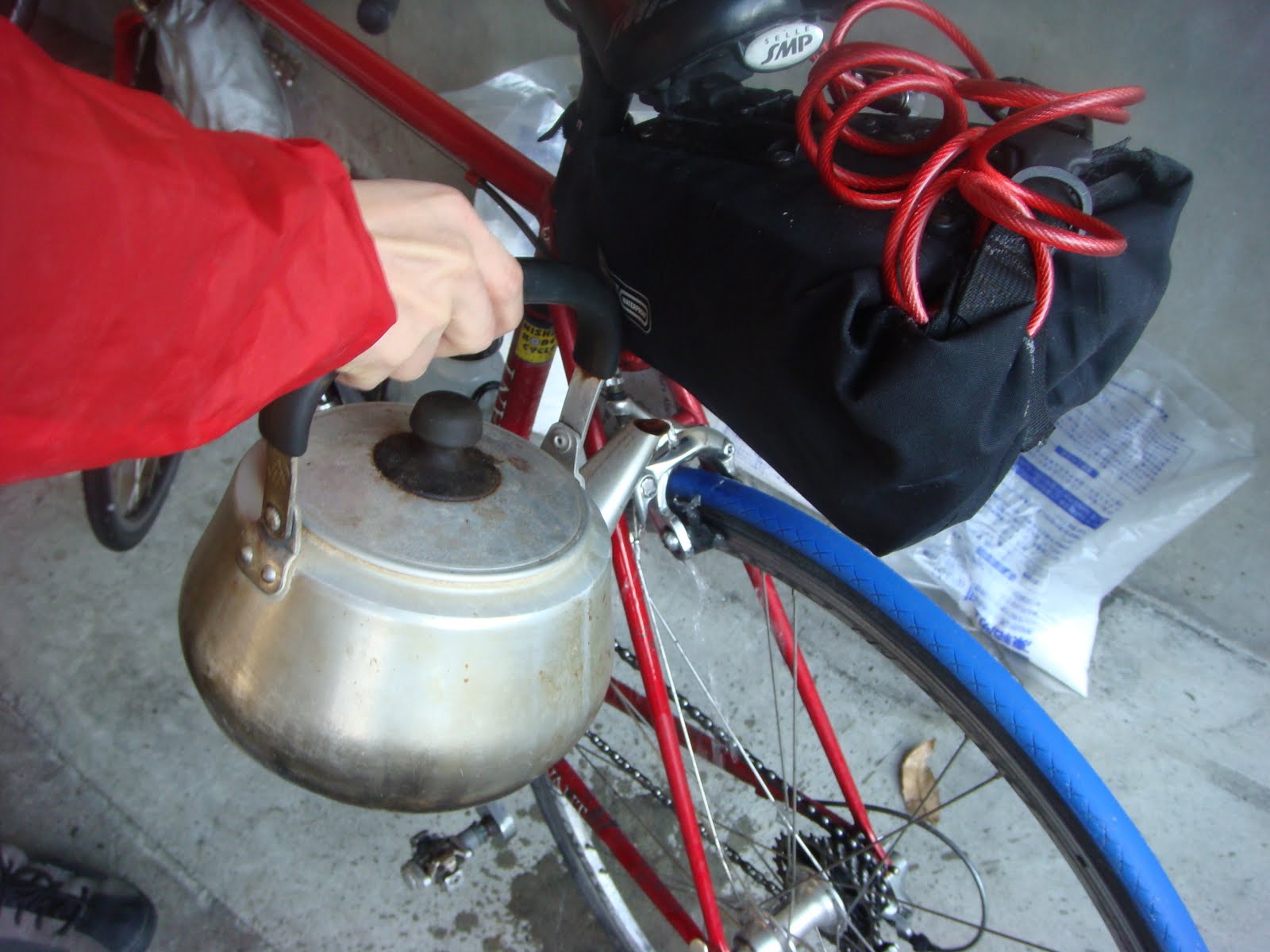
Yazaki-san picked us up at Nirasaki Station before 9:30.  He and his friends seemed like a great group -- all of them cycled together at Sophia University 40+ years ago, they are now between 65 and 68 in age, and still ride together at times, even those who spent decades off the bike.  When we arrived, just before 10PM, the table was laid for us with lots of dishes prepared from Yazaki-san's garden, including a large plate of delicious sliced up persimmons, and several tasty eggplant dishes.  (Thursday's volunteer event consisted of a potato digging/harvesting experience at the farm for a group of handicapped persons from Tokyo -- some of the same members who had done the running leg of a triathlon, with Yazaki-san and his friends taking bike and swim segments, in Akita Prefecture last summer).  They were enjoying a night of eating and drinking going strong when I awoke briefly at 1:30AM, two hours after I had gone to bed to try to get enough sleep so that I could ride early on Thursday. 

Jerome and I woke early and left as quietly as possible, grabbed breakfast at the Lawson down the road, and were on the road in earnest by 5:45AM.  I felt a bit weak and achy despite a decent night's sleep, and decided to try to ride well within myself and just not "blow a gasket" that would take me out of the trip before I managed to complete at least a day.

Route 12 is a very nice, quiet road for cyclists running North-South around the western edge of the Kofu metropolis, especially at 6AM on a holiday.  I remembered taking it the other direction at 11PM on a Saturday night, on the first Brevet I rode in 2009, when it was equally quiet and smooth -- the experience that made me decide that riding at night in Japan was something I might enjoy a lot, though I had always avoided it before.  We made good time over the first 12-13 km to the North, where Route 12 ends at National Route 20 -- exactly at the Nirasaki checkpoint for the Tokyo-Itoigawa Fast Run Classic.

The first two climbs of the trip, from Nirasaki up to Fujimi, and then from Suwa/Okaya up to Shiojiri Pass, seemed very easy and gradual, despite my cold.  I realized that every time I had done these before, it was after coming from Tokyo.  I had never done them "fresh".

We left the main road after the descent into Shiojiri from the pass, and wound our way up an down through the farmland, eventually joining the "Japan Alps Salad Line."  I had ridden the "Fruit Line" on the hillside between Enzan and Katsunuma in Yamanashi, but never the "Salad Line" in Nagano!  True to name, there were lots of stands selling fresh vegetables, and persimmons ... all too heavy to carry onward.

We met Route 158 and headed west up the valley along the Nagawa, past several dams and across the big one at the top of the valley, then through several kilometers of tunnels and toward Kamikochi, our third climb up to the 1000 m elevation range.

This trip offered a mix of massive Japanese infrastructure, huge gashes across the landscape, massive eyesores, and spectacular natural beauty.  The climb up the valley was no exception, with beautiful fall colors on the slopes and a free running river full of rocky rapids, but the most impressive sight by far the incredible concrete monstrosity at the top.


The tastefully designed "water and electricity" exhibition hall at the tunnel entrance.
 We made it onto the Norikura climb by 11:30, pretty much on schedule, and left tunnels and dams behind.  We rested around 1400m elev, where there were some restaurants and shops, near many resort homes in the woods.

Our next rest was at 1800m, where a "rest house" was closed and a gate blocked any further progress by automobile.  A few older couples wandered around the parking lot snapping photos before hopping back in their cars and turning around.
Looking back down the valley -- too late for fall colors at this elevation.
From a bit higher up.

I climbed the last 900m elevation as slowly as I have in years, no power at all when I tried to push too hard, but not giving up.  It was not particularly steep, or hard, just long, and I had no power at all today. More rests and photo stops at various points along the route, then gradually adding clothes -- leg warmers, shoe liners, arm warmers, full fingered gloves, a skullcap that covered the ears.  
A long and winding climb.
The Canyon stops for a look at the view, in its Brevet incarnation today - Topeak Dynapack seat bag, wheels with the wide Velocity A23 rims/White Industry hubs/Vittoria Open Pave 24mm tires, and, most important, 36 rear spokes.  Also, double front and double rear lights (plus a third front and rear light on my helmet).

Jerome climbed ahead and waited for me at the top.  I had warned him he might want to wait a little below, so he could warm up when he started to ride again ... but he found a place in the lee of the wind only a fwe meters from the top.  The temperature was just slightly above freezing, and a howling wind hit after we rounded the corner and started down the other side.

The top of the mountain and everything down a few hundred meters below the pass was in the clouds. It looked nothing like the beautiful summer scenery I remembered from Half-fast Mike's video of the same descent on a warm sunny day in July.

Other than Jerome, I saw only one hiker -- heading downhill within a kilometer of the first gate -- for almost 30 kilometers of riding.  Great not to worry about tourist buses when rounding the corners on the descent ... but a little bit scary if we had somehow gotten stuck.  The huts we passed were all boarded up tightly for the winter -- not easy to pry open, even for shelter from a storm. Jerome kept well behind me on the downhill -- the worst case I could think of was that I would crash, he would ride into me and go down, and then we would both be lying wounded on the mountain as dark and cold set in.

Before we knew it, we were down the hill and onto a long, fast stretch down a beautiful river valley to Hida Takayama.  We coasted around the town, enjoying the scenery and noticed it seemed bustling with tourists, including plenty of foreigners.  After almost giving up on finding any restaurant appropriate for two sweaty cyclists' early dinner, we finally saw a yakiniku (barbeque) place, Rokubei.  We picked the "all you can eat - 90 minute Gifu beef" course, and consulted the cook about our route.  I was ready to stop and get some sleep, check into a business hotel and try to recover for a stronger second day.  But the yakiniku master said we would be very, very lucky to find any rooms free in Takayama, where the holiday overlapped with a festival (not the main autumn "Takayama Matsuri", a few weeks earlier, but something more obscure yet still sufficient to pack the hotels).

Rokubei's master
We left town and continued west on National Route 158, hoping to get a further 80 km to Shirotori ("White Bird"), which looked large enough so it might have accommodations -- as confirmed by the yakiniku cook.  The map showed we would need to climb 3-400 meters up and over Odori ("Little Bird") Pass, 1002m elev, then down and up over a Matsunoki  ("Pine Tree") Pass, 1086m elev, down again and up a third (1150m elev) pass, on the first half of this ride.

There was a 4-km tunnel under the first hill, but it was marked "closed to bicycles" and on the map it looked as if it poured right into the expressway at the other end, so we did not chance it and instead headed up and over the climb.  Again, we found ourselves on a perfectly good road with almost no traffic.  I plodded along.  Jerome waited at the top of each little climb. 

Mounting up in the dark after
finishing dinner.
The temperature dropped down to 7 or 8 degrees C.  Finally, we got a lucky break, as on the third climb we reached our own tunnel entrance, at least 30-35 meters below what we had expected would be the last pass, then headed onto a descent.  In the dark along much of this route, we could see the shady outline of an expressway, high in the sky, emerging from one side of a hill, crossing open space, and disappearing into another tunnel.   The Tokai-Hokuriku Expressway -- it must have been a very expensive road to build.

After the descent from the third after-dinner climb, we pulled into a "michi no eki" (rest area) at Shokawa, near an entrance to the expressway.  The rest area was cold and dark, only a few camper vans in the parking lot with people sleeping overnight, and the restrooms and vending machines functional 24/7.  After getting hot "banana au lait" drinks from the vending machine, and using the facilities (heated toilet seat!), I noticed a darkened board with a list of hotels and ryokan (Japanese inns).  It was 9:45PM.  After almost 250 km and 3500+ meters of climbing, I needed to stop.  If we kept on to Shirotori, we might be too late to check in anywhere.  Even now, in the countryside, the odds were against us.  Jerome called at least half the 20 places on the board.  They were closed for the season, or full, or "already preparing for tomorrow", or asleep and not answering the phone.

Eventually, he found a kindly innkeeper, the lady who runs the Sakaeya Ryokan (栄屋旅館, tel 05769 2 2016), together with her husband.  She took pity on us and agreed to take us in, for "su domari" (just a place to sleep, no meals -- she did not have extra supplies for breakfast).  We enjoyed rice crackers and tea (or, in Jerome's case, beer), a hot bath, a place to rinse and hang our clothes, brush teeth and shave, all the comforts of life, even a nice futon and a TV (sorry, no cable), and most important, a full night's sleep, so we could continue the next day.

30 December 2010

The Missing Expedition - Updated Photos

Zen. Bike leaning against rock in garden on the shores of Lake Suwa, Nagano Prefecture.

After a delicious and filling dinner at Jerome's house, some preparations and about 4 hours of sleep, Jerome and Yutaka appeared as scheduled at 3:15AM outside my house, as they went ahead with Jerome's crazy plan to ride to Kansai on the 30th and 31st to see the sun rise for the New Year from Mr. Rokko above Kobe. I had agreed to ride out with them today and see them well on their way.

And Yutaka seems to know how to take care of himself in these kind of cycling adventures -- he is one of the Kinki Audax organizers in Kobe, rides around 20,000 km in a typical year, and has done 1000km+ ride events in Canada, the U.S. and Germany within the past year or two. (he mentioned something about a Canada event which involved three 1000 km rides in succession, with a day or two off in between, and also the Cascade 1200 in Washington State).

The only problem with the plan, what made it crazy, was Jerome's insistence on taking the "interior route" through the Kiso Valley via Nagano Prefecture -- a region recommended more for ice skating and downhill skiing in winter than for cycling. And after a fairly dry and warmer than usual early season, normal seasonal conditions had appeared in recent days and weeks.

In any event, the temperature gauge on the hill west of Takao read -1 degree C before 5AM, and as we had passed Uenohara and headed toward Sarubashi and Otsuki, another gauge read -3 degrees C. Our water bottles started to freeze, and it became impossible to get any liquid from them. We pulled in to the 24 hour family restaurant "Gusto" just at the far end of Otsuki, 80 kilometers into the ride, and enjoyed the breakfast special, with an extra order of pancakes and many refills of hot soup and coffee.

Thawing the water bottles as we wait for our breakfast.
Yutaka and David -- guess who is faster going uphill?

The climb toward Sasago tunnel was welcome after we remounted our bikes. I pounded my pedals in a bigger gear than usual, the work generating heat and warming my extremities. The tunnel was warm and almost empty -- only a few cars and trucks passing us each way during the 3.9 kilometers. Then the long gradual descent toward Kofu, blanketed in a layer of thick smoke from wood burning fires -- reminded me of the view of Los Angeles on a summer day, except the smog was greyish white and lacked any brown tinge and, of course, this was no time for shorts and flip flops. We pulled off Rte 20 and headed North into Kofu, seeking a less unpleasant, alternative route through town, eventually (after a quick stop for me to tighten a spoke on my Fulcrum "2 way" tubeless wheels) passing around Kofu Station and heading out to Nirasaki on Route 6 (Yama no te Dori), to rejoin National Route 20.
+1 degree in Nirasaki!

We stopped at a Lawson just a few hundred meters from the Nirasaki checkpoint location for Tokyo-Itoigawa. The store had a counter and chairs INSIDE, where customers could eat their food and drink their drink -- Now after 11AM, and as warm as it would get, the temperature gauge outside the window showed +1 degree C. A Positivo number and the only one we would see!
Then we continued up the long gradual climb toward Fujimi at the Nagano border. At the top, the few flakes of snow flurries picked up, and mixed with some drops of rain. The air was clammy and damp, and getting even more so.

Jerome, after lagging behind on the climb to Sasago and again when he ran out of fuel just before Nirasaki, was getting stronger as usual, and he and Yutaka waited for me at the top. Yutaka always patient with us ... when he no doubt could have zoomed ahead at any point.

On the climb to Fujimi, looking back down the hill toward the South.

The weather ahead looked pretty bleak and there were at least a few centimeters of snow continually along the side of the road -- narrowing the "rideable" surface and making it more difficult for cars and trucks to pass us as we stayed on the dry pavement. I decided to ride as far as Kami-Suwa (190 km+ for the day) and hop the train home for a 5:15 arrival, a hot bath and then dinner with family. I gave Jerome my photocopied map pages -- a lot more detailed than what he had printed from the Internet -- said my goodbyes, and took one last photo of the expedition.


As I took the Azusa limited express train back, looking up at the first of the many lines of mountains that separate Chino from the Kiso valley further west, I could not but wonder whether they would make it, or disappear into the white void and end up on a list of missing explorers and adventurers -- Amelia Earhardt, John Franklin, Jean-Baptiste Charcot -- or whether they might, like the great Norwegian Amundsen, reach their destination, or at least like Ernest Shackleton, eventually make it back to civilization, to try again another day.
The weather closes in on Chino. Not really riding weather in the mountains toward the West.
UPDATE 12/30 10PM: A telephone call this evening reports that the expedition struggled up over the little hill North of Suwa -- as snow was sticking at the higher elevation, descended to Shiojiri, and made the turn onto Rte 19/Nakasendo and headed into the Kiso Valley. They made it about 275 km for the day, through the one longer tunnel, into the valley and to Kiso Village. By then dark was coming and the road was too icy and treacherous even for them. They have found shelter and sustenance for the night and will assess the situation in the morning -- whether conditions permit them to press on, or whether they will use their last remaining lifeline -- the conveyance known as the "Chuo-sen", which can magically extract them out of the Southern end of the valley and to the land known as "Aichi", from which it should be possible to continue by bicycle. Unfortunately, the weather forecasts suggest that even if they can get out of the mountains, more snow may await them.

Ice and gunk stuck on Yutaka's rear brake.
Nothing a little hot water won't cure.


Is this Jerome's host mom in Gifu?
UPDATE 12/31 11:30 PM: An email "where are you" inquiry gets a response, after midnight, of "stuck in Ritto" -- a city in Shiga Prefecture on the SE side of Lake Biwa, near Kusatsu and entering Kansai. The NHK TV midnight broadcast welcoming the New Year shows the monks ringing a huge bell at a temple in Kyoto. There is snow on the ground and on the temple roof. Other live broadcasts show ... more snow in Western Japan, Northern Japan, huge snow being dumped along the Japan Sea, even in Kyushu (Saga). Just about the only place without any hint of snow on this last day of the year seems to be the Pacific Coast within a few hundred kilometers of Tokyo each direction.
Suzuka Pass -- 11:45PM New Year's Eve

UPDATE 1/1 8:00 AM: After waking and going back to sleep early, I am awakened a second time just before 8AM to the ringing of my cellphone -- a New Year's greeting from both Jerome and Yutaka. They are in Yamashina, in Kyoto (if I heard correctly), and are taking the train, having abandoned due to the icy roads. They were stuck in lengthy traffic jams because of the weather, unable to go around the cars as usual b/c of snow and ice on the shoulder.

I will get the full report when Jerome is back in Tokyo -- he is driving back with his family after celebrating the New Year with his wife's parents (and no doubt some time with cyclist friends) in Kobe.

The plan may have been crazy, but the riders demonstrated sanity, at the margin. And you don't get the memories of a lifetime from an easy spin on a warm day.