Showing posts with label utsunomiya. Show all posts

13 June 2025

A Beautiful 600km ride ... Streams, Forests, Mountains, Fields, Biggest Dog Ever, Sea of Japan, Pacific Ocean ... and some Nuclear Waste along the way

Heading toward Aizu


After a 300km+ attempt at the Aoba 600, plus a lovely Amariyama ride (1600m gain) and some shorter spins, it was time for my next 600km brevet. I hoped the recent efforts had my legs ready. Only one way to find out.

This was an Utsunomiya Audax event, starting and finishing in Tochigi (Yaita/Otawara). I used to ride their events often—signups didn’t fill up in 30 seconds like Saitama or Kanagawa. But since more Tokyo-area clubs popped up around 2015–2020, the appeal faded. The logistics were also a hassle: a long drive or awkward train + rinko combo, plus one time I had to pull off the expressway and nap in a parking area before driving home safely, as I was starting to close my eyes behind the wheel. 

I hadn’t ridden with them since a gorgeous  2018 400km ride  (east to Mito/Oarai, west past Maebashi) and a rain-soaked Choshi 400km in 2016. But this year offered a reason: my wife had discovered that the onsen water at a certain inn in Nasu Shiobara did wonders for her health. The inn has little else to recommend it but the onsen is special—if I did this ride, she got three nights there, and I got my ride and a recovery soak. A win-win.

The route looked terrific. No Tokyo sprawl, a double Honshu crossing, and a chance to peer toward Fukushima Dai-Ichi. The organizers warned of 8000m of climbing, but RidewithGPS said 7100m—and my watch logged 6600m. Still a proper challenge.

Only 14 riders started at 2AM Saturday. Among them was my friend Andrei O. We hadn’t coordinated, but I was glad to see him. He crashed the Japanese Odyssey podium last year and did PBP hours faster than I ever could. We go back to Fuji Hill Climb days and were together when I broke my collarbone descending a Gunma mountain in 2020. I didn’t expect to keep pace—just say hi.

My ride long after dinner with Andrei?

I recognized a few others: Nagayama-san from the Iwaki 400km, some Chiba regulars. I introduced myself to one named Tsutsui-san, and to Sawamura-san, the only woman on the ride. At the start, Tanami-san (organizer) and Fujita-san (staff, maybe riding?) gathered us around for a briefing.

Participants unload their bikes from cars in the distance.

Fujita-san is the rider with the explosion of hair.

They did not do the bike checks until 2AM sharp. I was chomping at the bit (figuratively), as usual, and got out onto the course a few minutes later. 


I was very happy with my pace on the first 50km of the event, which took me up the foothills then Shiobara keikoku in no traffic to over 800m elevation, the high point of the entire ride. A number of riders passed me, but I felt I was in the thick of the group, and was ahead of the clock.  After the top of the second hill, we would basically descend or ride on the flat for 75kms. 


These signs are everywhere in Fukushima prefecture. 
Are there actually flights from the airport? It seems far from anywhere!


Making good time heading north to the west side of Aizu Wakamatsu.

I reached the 162km control at 9:41AM, more than 3 hours ahead of the closing time. At this second control, a strong-looking guy in his 30s or early 40s was wrestling with a speed sensor, muttering "sai-aku" (最悪 - "the worst") over and over. Apparently, tunnel GPS glitches made him overshoot the first control by 7km. I told him things could be a lot worse—we had no rain, no cold, no headwind, and no traffic. If this was the worst, he needed a broader imagination.

As I went to discard my trash, I saw him casually smoking a cigarette. Only in Japan have I seen brevet riders lighting up mid-ride. Somehow, he still finished hours ahead of me.


Mr. "Sai-aku" and Fujita-san as we seek shade next to the PC convenience store.

It got hot in the inland valleys—one roadside gauge flashed 31°C. After Aga, in the small town of Mikawa, I missed a turn off the national road onto a local one. I doubled back, scrambled down some steps, and rejoined the course. Under the overpass I’d just ridden, I sat on a bench to snack—only to meet a man walking the biggest dog I’ve ever seen. Calm and stately, the dog was part Great Dane, part Irish Wolfhound. He enjoyed the attention, but really wanted my egg salad sandwich. I apologized—no backup food and a long way to the next store. They forgave me. Next time, I’ll bring a spare sandwich for him.


My feet started to ache incredibly in my shoes, so I stopped beside the road and removed my second pair of thin cycling socks.  That seemed to do the trick ... until the heat of the next afternoon.  It got cooler once near the Sea of Japan, with a wind from the sea toward the land. I moved forward deliberately and at Murakami, 239kms, I was 3 hours 20 minutes ahead of the time limit.  I ate and rested there, almost an hour. I never again managed to get 3 hours ahead of the time limit.
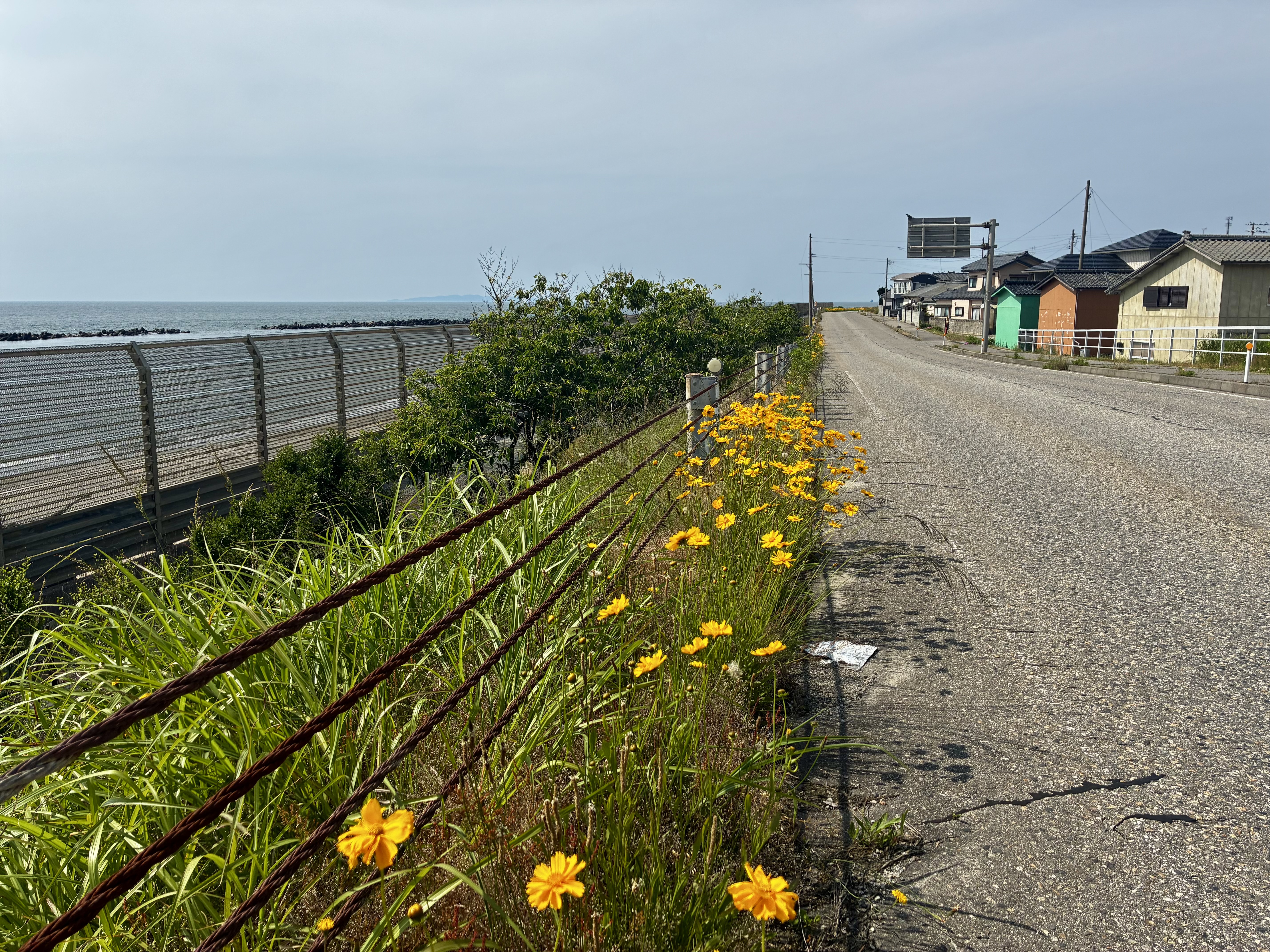
Sea of Japan

Dragon in front of tourist info center at Senami Onsen


The next stretch to Yonezawa included a slow climb to 350m on Route 113. Too much traffic, too many trucks, too many tunnels. Eventually I pulled off and lay beside a nearly dry gorge, cooling off a bit before continuing.

Passing into Yamagata ... did not end the climb.

I rested here.

At kilometer 304, we finally began descending into Yonezawa—though it turned out flatter than expected. I blew past the control, looking for a Family Mart, but it was a Lawson. A kilometer later, I pulled out my cue sheet, turned back, and found the right spot. A rider had even yelled to warn me as I passed. Sure enough, he was still there when I returned.

I’d ridden 332km, been out for 18.5 hours (20 including pre-start ride), and was still 3 hours ahead of the control close. I flopped onto the concrete outside the store and took a 45-minute rest.

The next segment would include a climb over mountains and then down to Fukushima-shi.  The latter part of this segment I rode on the Fukushima SR600 in 2022. At least tonight we would NOT take Prefecture Route 232 through the woods to Toge Eki, but instead would use National Route 13.  The climb from Yonezawa was just under 400m elevation gain. It was not so steep, and if fresh it would have been easy. I was not fresh, at all.  So I was relieved to get to the tunnel at the top. I rode 2.5 km or more through a deserted, flat tunnel, then a quick descent about 100m vertical on the other side ... until a second flat tunnel of 2.5 kms, then a fast descent all the way to the edge of Fukushima-shi. 

I am headed over (or through) that mountain to Fukushima-shi

Our route crept along the hills to Iizaka Onsen Station. Jerome and I had stopped here last year when it was a control point on a Golden Week 1000km event. It was deserted this time, at midnight. I took a shorter rest and headed on, stocking up on food to snack on in the hills ahead. 

Basho was here (Basho was everywhere)

I reached the overnight control at 1:40AM—two hours and 20 minutes before closing. After a quick bite with Tanami-san and another staffer, I grabbed a bed in a four-bed room. Two beds were occupied, one vacated, and one—mine—fresh. A light eas on and the room was hot, but I was asleep in seconds, before 2am, and suddenly wide awake at 3:40. Downstairs, Andrei was getting ready to leave. Soon, Sawamura-san and another rider showed up—they’d already done 60km and 600m of climbing since midnight, as they had rested at Yonezawa. Machines.

I rolled out around 4AM, just as the control was set to close. Only 215km left. Easy, right? Well... I started strong. Andrei had vanished. I passed one rider, while Sawamura-san and the other sleepers were still behind. The route wound up and down before a 300m climb to a highland. New tunnels cut through the hills instead of roller coastering over them. The roads were pristine—Japan’s “throw-money-at-it” model results in great infrastructure, and they threw money here after the nuclear accident. If only tunnels cured population decline.

After the highland, a long descent led to the coast. I passed signs warning this was a “difficult-to-return” zone—帰還困難区域 being officialese for “wasn’t safe, still isn’t.” Side roads were blocked with steel pipes. Patrol cars cruised slowly. No humans out and about—just a troop of 60–80 monkeys darting across the road. The wildlife seemed fine. Maybe radiation’s long-term health effects are less brutal than living near human society. Or maybe they just haven’t read the research.

Later, I passed piles of irradiated soil, stacked in black bags along the roadside. Many more waited in nearby “temporary” storage sites. The contrast was stark: silence, sunlight, and all that dark plastic entropy.


Those cranes on the horizon are at Fukushima Dai-Ichi

In Namie, near the coast, the town showed signs of re-occupation: new roads, fresh buildings, and vast open spaces. I stopped at a 7-Eleven—the cleanest convenience store toilet I’ve seen this year, and I’ve seen plenty. It was so immaculate I found myself brushing and wiping the toilet surfaces before I left. The staff—maybe a father and two teenage daughters—still had a COVID-era plastic sheet at the register. Polite, professional. No trash bins outside, and just one tiny receptacle inside for store-bought wrappers. I left them a glowing Google Maps review. Most reviewers whined about the lack of garbage cans, but really—if your neighborhood was surrounded by radioactive cleanup zones, would you want to take strangers’ trash?


The route headed south along the ocean, then veered inland past the destroyed nuclear facilities. Signs for “screening areas” and “difficult-to-return zones” were everywhere. Then the climbing began again—from sea level up to the highland at 500m. I was crawling. At one rest stop above a stream, I saw two older men fly fishing. One flicked his wrist and snagged a fish with delicate precision. We were 20km SW from the reactors, but here, life looked normal.


In Kawauchi, I stopped at a combined restaurant/convenience store that I also had rested at during the final afternoon of the Fukushima SR600.  It had been hot then. It was hotter now. I climbed more to the crest of a pass at 650m elevation, and breathed a sigh of relief.  It was 200m of descent and 13 kms until the Ono control point. Ono was at 507kms -- 95 kms to the goal!  It was just past noon, so 6 hours to go, well, 5 hrs and 40 minutes by the time I left the control.  Another rider was at the control and said many had just left before I rolled in. I was within striking distance of the main group and still had time to make the 40 hour limit. 

The next section was a climb up 100m, then down 300m -- generally a descent.  Except even the descent included lots of nasty little up sections. They had not gotten any new tunnels here. The little climbs crushed my soul in the afternoon heat. My feet started to hurt.  I took rests.  On one, I lay down on a small spur that went up a hill. Along came another rider!  He told me that I could still make it, and encouraged me. I swapped into thick wool socks—oddly, it helped, even if my shoes were now tighter than ever. I think from now I will always carry a variety of socks on these really long rides!

We rolled together at 20–25kph through farmland. The hardest bit was when we turned south into a stiff headwind across open fields. Then came a gradual climb toward the Fukushima–Tochigi border.

I asked the other rider’s name. “Fujita,” he said—one of the staffers I’d met in the dark 36 hours earlier. Back then, his wild, mad-scientist hair was unmistakable. Now, and yesterday at PC2, it was hidden under a cap. So I hadn’t recognized him. We kept each other company through the final stretches.

Once we got onto the real climb to the Tochigi border, I recognized the road from several brevets in recent years.   I climbed stronger than I had the past 12-14 hours and got to the top well ahead of Fujita-san.  I had 90 minutes left to go under 30 kms, and that started with a 10+km descent at high speed, another few kms with a very modest downhill, then a long trip across largely rural Otawara-shi.  We took it easy the last 10km and still arrived with 10 minutes to spare.  Half the riders finished in over 38 hours. The fastest time was 33:59. Second fastest was 35:51. So even if I was the slowest (I was, again, just like Iwaki) the difference was not very much.

I thanked Fujita-san profusely. If he had not come along, would I have given up?  No. But would I have made it on time? I just don't know. I lacked confidence during a crucial segment between 530 kms and 570 kms. And riding with him was a great comfort.  It was not until I was on the familiar climb to the Tochigi border that I smelled victory and got another spurt of energy.

After the "goal" we rode another 7 kms to the "reception" at bicycle shop Fleche in Yaita, near the start. My wife kindly picked me up and drove us back to the onsen inn.  627kms in total on the bicycle so I appreciated the ride. 

I'm done with the full 200/300/400/600 series for 2025!  I guess I still am a randonneur. 

01 May 2018

North Kanto 400km - Utsunomiya Cycle Picnic?!

Bike (and rider) rest at dawn on Monday 4/30, somewhere on local Rte 75 between Sano and Kanuma
Utsunomiya's audax group teamed masterfully with local authorities to schedule a 400km brevet with start and finish at a recreational facility just Northwest of Utsunomiya city--known to many as the capital of Tochigi Prefecture and the home to the greatest gyoza in Japan (though fans of Hamamatsu in Shizuoka may contest the latter designation).

Hirose-san reads the very helpful, detailed, relevant briefing for this ride. Impressivbe.

The finish was Monday morning (Showa Day holiday), concurrent with a major "cycle picnic" that offered rides of 15, 65, 75, 100 ... and 400 kilometers. That was us, the 400 km group.

This concurrent event had several benefits. For the normal brevet fee (JPY1200 or around US$11), we received free "Saitama style" reflective vests (see below), frame badges, and a ticket to the very nice onsen facilities at the adjacent "Romantic Village" Michi-no-Eki. We also had free overnight parking, with the facility conveniently located close to the Utsunomiya exit from the Tohoku Expressway, so only an hour and 40 minutes' drive from my home in central Tokyo. And, I even got to witness the mayor of Utsunomiya, as he came up and greeted, and exchanged business cards with, Hirose-san, the leader of Utsunomiya Audax, as I checked in at the goal. (Sorry, no photo. I would have liked one with the youngish (40-something) mayor in dark suit, white shirt, slicked back black hair, tie clasp, etc., very out of place among the spandex clad crowd, and Hirose-san, the randonneur group's leader, in his jeans and cycling jersey ... somehow Hirose-san obviously was the much classier of the two). With Utsunomiya's role hosting the Japan Cup pro cycling race each autumn, maybe it is making a push to be something special in the cycling world in Japan. (Now, if only they would make some bicycle friendly routes THROUGH the city, so we don't always need to go AROUND it.) But, of course, this was all just the icing on the cake.
But wait, there's more! Free reflective vest!
Optional frame badge in red, white and blue

Non-brevet riders at one of many booths of the Sunday morning "Cycle Picnic" at the Goal
We were there for the ride itself! And when I parked and unloaded my bike at 615AM Sunday morning, there were no families going to the concert at the michi-no-eki, no sponsors in tents at the cycle picnic, and no short distance riders, couples or children on bikes. Instead, it was just us hard men (and women) who chose to ride a 400km event on a nice Sunday in late April.

Then  again, course was not so hard, with around 1100 meters of climbing on each half. Why mention the halves? The riders were split into two groups. One started with the East half from 7AM, the other started with the West half from 8AM. I took the East version. We passed each other somewhere around Ashikaga, just over 200km for us, just under 200km for them. I pulled off at around 225-230kms for a quick pasta at a Family Mart Cafe in western Ashikaga one block from the course -- a nice quiet store with cafe seating -- where the course which followed a levy along the Watarase river. As I finished up another rider pulled in. He was going the opposite direction, having started an hour later, and had gone just 200kms. We shared information before I headed out.
Park in Mito, Ibaraki, with center of the city visible across the lake. Azaleas everywhere this time of year.

Decorated trucks at O-Arai beach -- room for another row, perhaps, but not for the thousand or more lined up trying to enter.
The first 93kms was fast, to Mito and out to O-arai and the coastline.  To this point, I was with some faster riders, like Kamano-san. After leaving the checkpoint, we quickly entered a LONG traffic jam along the coast. As I continued through the line of stopped traffic, gradually the percentage of trucks got higher and higher, until the line was ALL trucks. They were headed toward O-arai No 2 (Dai Ni) Sunshine Beach. The trucks were all decorated with special paint jobs, accessories like the gaudiest of samurai helmets. I saw more than one pedestrian in a black t-shirt with the rising sun flag of wartime Japanese military usage. I thought, this is either a huge assembly of truck maniacs who are being judged for best paint job and decoration, or some kind of strange right-wing rally. In any event, after passing the beach entrance we continued SW along local Route 16 ... and opposite a 5 km line of trucks waiting in the opposite direction. They must have had a VERY long wait, since there was no obvious room on the beach's parking lot for any more of them.
More trucks
Anyway, as we headed south then west, the going got tough. The wind had picked up and was from the SW, and it was getting hot. A group of 3 riders zoomed past and I could not "hop on the back" even to keep pace. I slogged and slogged this second quarter of the ride. It was more of the same, typical Japanese "inaka" settings of towns, suburbs, farms, rice fields, some rolling hills and even a few forests. Then more of the same. Finally, there was a climb over the north shoulder of Mt. Tsukuba (it seemed very steep, but that might have just been my fatigue, or my lack of a real "climbing gear" on the bike I was using, or my poor physical condition compared with some prior years). The brakepads on my carbon rims squacked on the descent (I changed the front pads before the next climb), and then into a checkpoint at 152.5 kms.

The next leg was easier, at least no big climb, and the wind from our side, not front. There was even a tailwind as we rode a very nice path along the levy-top next to the Watarasegawa through Koga city and to the 200 km checkpoint. One rider came up and said hello and "hisashiburi" at the 200km checkpoint, He was tall, and I remember him from past rides ... but could not (and cannot) pull out his name from my memory. I need an Audax "facebook" with names next to photos -- and the photos need to show people with and without helmets/sunglasses. Otherwise, I am still hopeless with most riders' names, even people I see at these events repeatedly over the years. I miss Inagaki-san, I cannot help but think. We all do, those who were lucky enough to ride with him.
The route was first East, clockwise, then a counterclockwise western tail, misshapen figure eight
I reached the 200km point around 540PM, 10 hours and 35 minutes after my start. Half way, and now cooler. From here, we again rode adjacent to a mammoth traffic jam as we passed through Sano-shi and entered Ashikaga. But at least parts of Ashikaga were nice, and it was now cool and dark and very comfortable to ride. After my stop at the Family Mart Cafe, the route hugged the hills just north of Kiryu, and eventually climbed to around 500 meters elevation after crossing from Kiryu into Maebashi. After the disaster of the Tsukuba climb in the afternoon, I had feared this stretch. But it was cool, and dark, and the road was smooth, and the lights of Maebashi and Takasaki stretched out to the South in the valley below, and it was just delightful. I want to take this road again next time I need to cover this ground. The climb is well worth it, to get out of the congestion and sprawl. At one point, I stopped for a rest and a bite from my rucksack, and no one passed. Was I on the right course? ... Well, the GPS said so, and sure enough, when I got to the checkpoint 7-11, there were at least 6-7 riders there, and many more pulled in before I left.  I was on track, not suffering any obvious problems, and had climbed the last big hill. So even though I was only 270 kms into a 400 km event, I felt sure I would finish. The "bonk" of the afternoon heat, wind and climb, the legs that could barely turn over, were forgotten. Randonesia usually sets in awhile after the event, but this time it seemed to hit even during the ride, a few hours after the bonk.

Sure enough, the ride through Maebashi and Takasaki to the South was easy, and then the route continued flat to the East through until dawn, as I re-entered Tochigi and finally climbed a small rise parallel to the Tohoku Expressway. I saw another rider stopped, resting and taking a photo, and pulled over beside him. He complained that he was sleepy, and was delighted to have someone set a pace for him. We had talked at a few checkpoints ... though I never got his name. I actually pulled him the next 5-10kms, the only real "domestique" duties for me this ride. We caught a woman rider, and I drafted off of her for a few kilometers until our small three-person "train" fell apart as first the rider fell away off my back, then eventually I pulled into a convenience store for one last rest. After a snack and a 10-minute nap seated on a bench and wedged against a wall just out of the rising sun's light, I was ready to bring it home.
Sunrise in Southern Tochigi on local Rte 75
The last stretch included some short uphills, and then on the home stretch we were suddenly among riders from the "cycle picnic". But it was a new day, and I felt inspired to push home quickly. In the end, my time (just over 24 hours) was not at all inspired, but at least the last stretch felt that way!
At "Michi-no-eki Romantic Mura" on Sunday morning, après onsen
All in all, it was a very good training ride, in nice country and beautiful weather, in not-unreasonable traffic, with good colleagues and a few perks. And after a long afternoon and then night of sleep, I feel refreshed and rested.  ... and ready to do it again, soon.

22 March 2016

400km Utsunomiya Brevet

On Saturday I rode the 400km Utsunomiya event.  Well, it actually started at 2AM Saturday and I finished well after midnight, so I guess I should say "on Saturday and Sunday".
An early scenic checkpoint
The start and finish were at the forest park west of Utsunomiya where the Japan Cup and other cycling races are held.  The park is on the edge of hills that climb to the west and become mountains.  But we would head Southeast, meaning that we did most of our descending (climbing) within a few kilometers of the start (finish).
Briefing at the start - Lots of route changes to explain, especially one area where the path along the Tonegawa was closed for construction and a detour ended by a dark walk through a field.  Ide-san (staff) gave me his "koma-zu" style cue sheet since I had brought only an earlier version.
Otherwise, we stuck to a relatively flat course.  Easy, right?  Well, it would have been, except for wind and rain.  Actually, mostly rain.
The scenic Ushiku Checkpoint.  Next time I ride a course like this, I think I will try to play "count the convenience stores".
The outbound leg was via Tsukuba, Tsuchiura, Kashima and to the tip of Chiba at Choshi.  The return was via the Tonegawa.  Something like 150 kms on or near the banks of the Tonegawa.  I was warned by many of the participants that the headwinds coming UP the Tonegawa could be vicious, and would get stiffer in the afternoon and early evening when we would pass.

In fact, the wind was not bad. We had an impossibly stiff headwind only for a few minutes crossing the river from N. to S. in Choshi, the entire weight of a western Pacific gale coming at us. On the return I faced stiff headwinds for less than an hour.  No doubt I enjoyed (though did not notice) tailwinds on many other stretches.  I noticed some other cross- head- and swirling-winds, but they were not sustained and not nearly as bad as what we come across on some rides in these regions.
Choshi checkpoint views.  I got a nice harbor views a few steps away ... but really did not want to spend any more unnecessary time in the rain to go back and get the photo after I had my warm food!

Starting the return trip up the Tonegawa - looking back at floodgates in the distance on a bridge.
What was bad?  The rain.  It started raining off and on just as I got home to pack on Friday evening.  Other than some brief respites, it rained straight through from the 2AM start until about 2PM, after I was already on the return from Choshi.
Another rider in another checkpoint convenience store.
The Renovo -- a smooth ride.  I was very happy to have the fenders this trip!  And the dynamo lighting!
No equipment issues the entire trip ... fenders keep the grit to a minimum even riding in rain for many hours.
Not time now for a detailed equipment rundown ... later.
The rain was very tough -- riding in standing water.  The roads were generally nice and lightly traveled until we passed Tsukuba and Ushiku, where we had our second checkpoint at a Lawson. Through Tsuchiura, Kasumigaura, and Kashima and beyond, it was pouring rain and we were riding on heavily traveled roads, lines of traffic, zooming trucks.  Ugh.
Finally dry!
The return leg, however, was great.  Much of the return was on bike paths with NO traffic.  The Tonegawa had some stretches of beauty.  There were cows grazing on the banks, trimming the grass along the levy.  There was even a water skiier.  The rain ended around 2PM and we even got a little sun for sunset!
Sunset near Toride.
I had planned to do this ride after a nice nap on Friday evening.  Unfortunately, I got behind schedule and other plans intervened (a dinner with colleagues and a guest who I wanted to meet but who would leave town on Saturday).  After a couple hours of riding, I started taking cat naps -- stop, drink coffee, nap 10-15 minutes, then continue.  I did this at least 6 times over the entire event.  It worked until the last 50 kms, when my pace slowed to a crawl.  I had hours of spare time before the cut-off, and somehow could not push hard.  I finally stopped at a 7-11 where the midnight shift clerks seemed very excited to see a gaijin rider.  They said I was the 3rd or 4th rider to come by, and asked a million questions.  They got out a folding table and wheeled out 2 desk chairs so I could rest INSIDE, in an aisle of the store, while I ate some pasta and drank MORE coffee.  Another rider, Ohno-san, joined. Then another.  We had a very subdued party in the aisle between the magazine rack and the cosmetic/toiletry section -- the first time I felt like more than a customer at a 7-11 convenience store in Japan, as they clearly departed from the rulebook.  Somehow it seemed the perfect last stop for a ride that had featured nothing but convenience store food for 24 hours!

Thanks to Utsunomiya Audax for a course that was mostly nice, and in nicer weather would have been mostly easy.  The course was not the most interesting, but at least the heavy traffic was limited to the Ibaraki stretches around Lake Kasumigaura.  So if I compare  this route with the Nihonbashi 300 I rode in early 2015, which took those same heavily traveled routes around Lake Kasumigaura in the other direction from Choshi, I would estimate that this time we had 100km out of 400km that was somewhat unpleasant, whereas on the Nihonbashi 300 maybe 175kms out of 300kms was so.  This ride I would do again; the other, never.  And if I were to design a course to/from Choshi, I would definitely use the Tonegawa path in one direction, and Kujukuri-hama and rural Chiba in the other.

In any event, after a few hours on a bike path in the dry weather on the return, the rain was only a distant memory!

Update:  The 392 kms during a 24-hour period I captured on my GPS unit put me at #118 out of over 180,000 participants in Strava.com's "March Gran Fondo" ride challenge.  Not bad ... though still less than one-half the 24-hour distance recorded by the #1 rider.