Showing posts with label Brevet. Show all posts

13 June 2025

First Half of VCR Aoba 600km -- Am I Still a Randonneur?

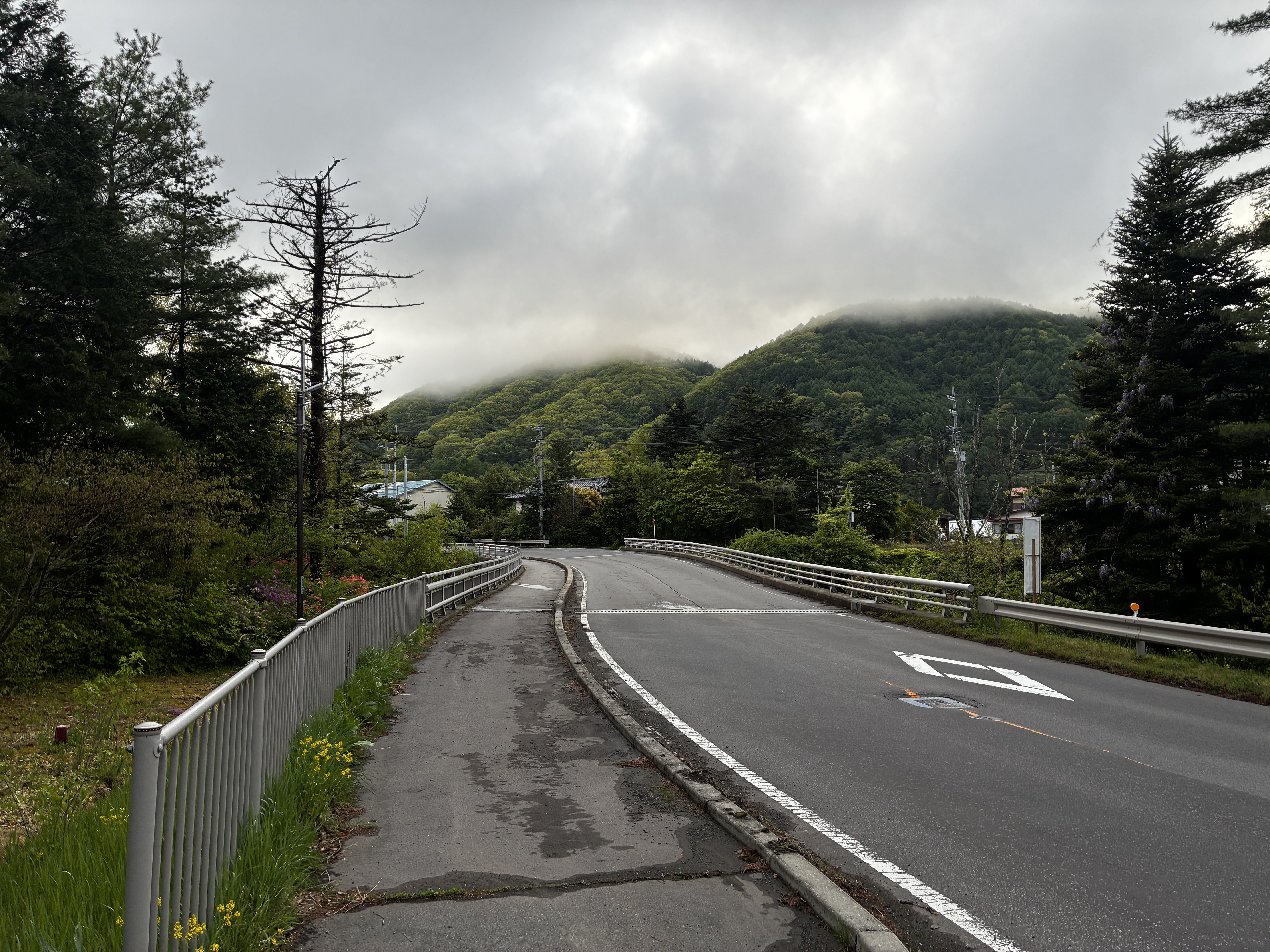
On the climb to Torii Toge ... after the rain stopped.

Having cleared Audax rides of 200, 200, 300, and 400kms this year -- the last on a second try -- I had only a 600km ride left to complete the basic "super randonneur" series for 2025. I have done the series most years since 2010, absent injury or pandemic, and it is often an official pre-requisite for joining 1000km, 1200km or longer events. Even if it is not a pre-requisite, it makes no sense for me to try such a longer event unless I can clear the series first.

I signed up for two 600km rides, not knowing whether I would be able to join or complete either. 

The first was a May 17-18 VCR (Velo Club Randonneurs) Aoba event, out from Inagi-shi through NW Tokyo and Saitama, then via Yamabushi Pass and Chichibu into Gunma, eventually over Torii Pass into Nagano, and more hills in Nagano, Yamanashi, Shizuoka, and back to the start. The profile was daunting. I figured it would be a very difficult challenge, probably more than I could manage within the time limit in my current condition, but I would try it anyway as I liked the course, especially the opportunity to ride through Naganohara, Tsumagoi, and over Torii Pass, plus the next climbs between Ueda and Matsumoto over the broad, high shoulder of the mountains that stretch south into Yatsugatake.

The course looked very difficult -- not any one part, but the sum of the parts. The 600km showed 8800 meters of elevation gain on RidewithGPS. And unlike some courses, from what I could see the major passes did not have tunnels at the top that cut the actual elevation gain to less than what was showing on RidewithGPS. Any 600km event with over 10,000 meters elevation is in a special category of "SR600" and given a 60 hour instead of a 40 hour time limit.  A typical 600km in Japan might have 6000 meters of climbing.  This was was in between, but shading toward an SR600, without any extra time allowed. I remembered doing a similarly tough course more than a decade ago, but this one looked even tougher, and I have not gotten faster in the past 10 years -- the opposite.

Anyway, the course looked very nice to ride, so I figured I would at least try to do the first half, and see if I could somehow manage. I would ride my new "Mugikusa Pass" lightweight climbing bike, and use a battery light instead of a dynamo -- everything to shave off a few grams of weight and save a few watts of power.  I knew that once I got to Fujimi, close to the Nagano/Yamanashi border ... I would have 100km of downhill/flat riding to Kofu then along the Fujikawa to the coast, then after a few bumps,  a second long flat stretch, then after an 850m climb to Hakone Pass, downhill and then relatively flat to the finish.  So I figured, if I could just get to Fujimi in decent shape, I could press onward. I booked a business hotel in Shiojiri, leaving the climb up Shiojiri Toge, between Shiojiri and Okaya, and the very gradual climb up to Fujimi Toge, for after some sleep, however short it would prove. I have done these climbs when exhausted and lacking sleep, and it just is not very efficient and takes forever!

Staff (left/rear), riders (right)

The start was at 6AM at Inagi, around 27km from my house. There were no good options.  I could go out the night before and stay in a business hotel, losing any chance of early sleep.  Or I could get to Shinagawa Station extremely early, rinko my bike, take the first train to Kawasaki (I think), then transfer to the Nanbu Line to Minami Tama, reassemble the bike, and ride a few minutes to the start. Or I could just ride from home and get in 27kms before the actual 600kms. I chose the last option.

As the ride approached, the weather forecast looked difficult, as if there would be rain the first day.  And the forecast did not improve.  When I woke up the rain had already started, so I rode in rain more than an hour to the start. At least the rain was not cold, nor hot. The temperature, around 16-17 celsius, was good for riding.

When I got to the start at Omaru Park ... there were 4 staff, including Minoda-san who I've ridden with, or more accurately behind, on many events, and only 5 riders. The sign-in sheet was full of "DNS" markings. More than 2/3 of riders who had been foolish enough to try this one had opted out. No women joined.

Five riders and one pre-ride by a staff member. 14 DNS/no shows.

They let us go a few minutes early, and I was second to depart, behind a faster rider. Despite him being faster, I kept catching him a traffic lights over the initial 15-20kms.  Finally, I got stuck waiting at a gated train crossing for what seemed like 5 minutes, and he was gone ahead for good.  

At the holy shrine water stop.
Yamabushi Pass

Leaving Chichibu City

Another rider soon passed me, and the other two did also as I rested at the "holy shrine" water stop just before ascending Yamabushi Pass. I played "leap frog" with all but the first rider through Chichibu and even onto the climb out of Takasaki around the west side of Mt. Haruna, passing them when they took a rest stop and vice versa.

Michi no eki on the Haruna climb to Osawa Toge

There were two climbs around Mt. Haruna. The first was long and grinding, and still wet, always wet, peaking at Osawa Toge. Then there was a downhill, and a second climb that ended at the mouth of a tunnel. We descended through the tunnel and popped out the bottom along the Agatsuma River, just above the Yamba Dam and near our checkpoint, Kawarayu Onsen station.

Big station, no customers

The Yamba Dam is one of Japan's most controversial infrastructure projects. Its reservoir fills the valley and destroyed a great deal of natural environment. Local opposition slowed the project for many decades, even as preparatory work went forward. After the DPJ took control of the government in 2009, the project was stopped mid-way. When the LDP regained power in late 2012, it restarted. Now it is done. 


The reservoir west of Yamba Dam

I must say that this entire area looks far nicer now that the dam is done. They have ploughed in infrastructure and money to make it a success.  A few minutes after the PC, I saw a bus ... drive straight into the reservoir, making a big splash but floating.  I laughed -- this was a classic tourist "hippo" (kaba) bus, the kind of gimmick a bureaucrat might come up with to attract visitors. It was too far away to know for sure, but I did not see any passengers. Likewise, Kawarayu Onsen's main facility looked pretty deserted. Perhaps not surprising, given the earlier rain.

Anyway, as I emerged from the tunnel and headed for the control point, another rider was just heading out of the control. I was at least close to 2 of the 4 other riders, I was sure. And somewhere while passing the tunnel, the rain had stopped, completely. The road was already dry along the Agatsuma River. Only 10 and a half hours from home, and 185kms of cycling in the rain, and it had finally stopped.  Within 30 minutes, I even saw some blue sky. 


Climbing gradually to Tsumagoi, with a few bumps

The ride through Naganohara then climbing up through Tsumagoi and all the way to Torii Toge (elev. 1400m) was the literal and figurative high point of this ride. It was the longest climb, and Tsumagoi looked lovely, less beaten down than when I was here in 2020. Again, lots of road construction then underway is now complete. And I guess there has been some spillover investment as Karuizawa has boomed. Still, the climb is not easy, and there are some steep parts that were difficult with over 200kms and 3000m elevation gain into my legs. The sun had set by the time I got to the top and crossed the Gunma/Nagano border.  


Sunset at Torii Pass - Gunma/Nagano Border

The descent into Sanadamachi and then Ueda was very familiar from when I stayed in that area for a month in 2020, an escape from the city and the summer heat when everything was shut down. I had done the Torii Pass climb/descent probably 10 times back then. But it had been almost five years since, and it was dark now, and I was now quite tired. Also, I had an unfamiliar front light.  I wanted to keep the light on a low/intermediate setting, so it would last through as much of the night as I needed.

If that climb through Tsumagoi had been the highlight of the ride, then riding Route 18 west of Ueda was the opposite. It was a slog. I stopped for some ramen at "Ramen Daigaku" along route 18 near Sakaki. I apologized that I could only eat half of the serving, telling them it was not the taste but rather my stomach and the fact that I was in the middle of a long ride. 

We had dropped from 1400 to 400 m elevation by now.  I crossed the Chikumagawa and continued to the next climb ... a relatively steep one from 400 to 800 m. I needed two short rests to make it to the top. It was getting late, 10PM by the time I started the descent. Very dark and quiet, except the lights in a tunnel along the top. The next stretch, through hilly Nagano countryside over to Akashina, looked very familiar. I am pretty sure I did this stretch on my very first 600k ride, in 2010, but I did not save that on  Strava or RidewithGPS.

Anyway, by the time I got to Akashina and turned left heading south up the valley toward Matsumoto and Shiojiri, it was well after 11PM, and there was a brisk headwind. 


It was warm, almost hot. I finally got to the hotel at Shiojiri, after 1AM, checked in, took a bath, and ... set my alarm so I could sleep for 4 hours and then get breakfast before leaving, far behind the schedule I would need to stay on track. I needed the sleep. The front desk clerk warned me that visiting school kids would fill the breakfast room early ... so I ended up sleeping later and just grabbing breakfast before it shut at 9AM.

At Shiojiri Pass crossing into Okaya

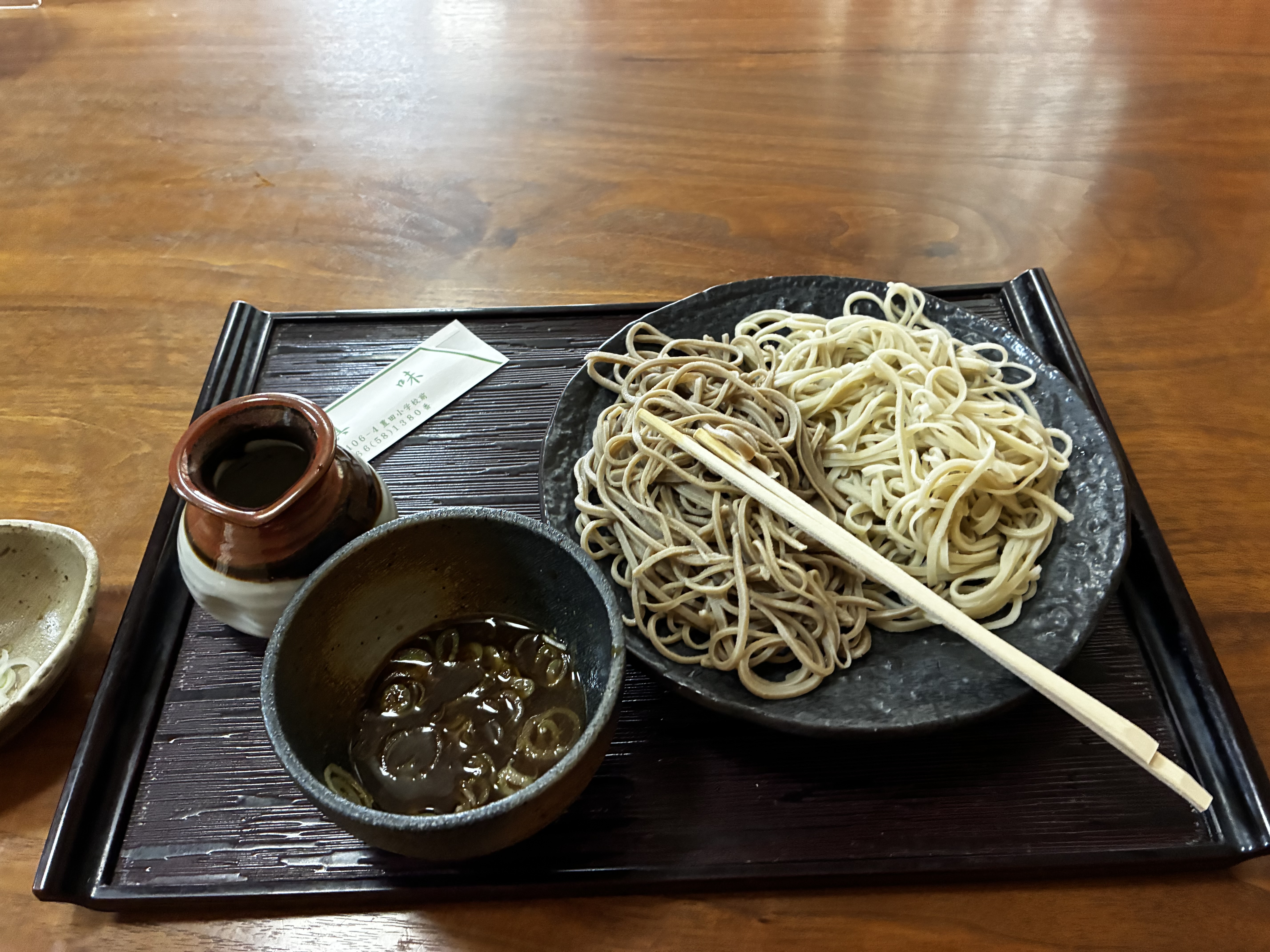
I rode over Shiojiri Pass ... It was hot and there was plenty of direct sunlight. Somehow I felt no faster than if I had continued the night before. I stopped for some soba in Chino.  ... and went to the train. 


It was hot, I was cooked, I did not feel like riding more, even up the gradual hill to Kobuchisawa. I needed to get back to Tokyo and did so, via train. The Chino train station was not convenient ... I ended up climbing a short nasty slope, then racing to try to catch, but just missing an express. Not recommended.

I had abandoned rather than riding on. Surely a real randonneur would have kept going ... at least over Fujimi Toge and downhill to Kofu, or to the Shizuoka Coast. And with this, I had DNF'ed a second brevet in 2025. 

But in truth I was fine with my ride. I had ridden 316km before checking in at my lodging, with 4200m of elevation gain, in just over 20 hours, half of that in the rain. My hands and thighs were chafed from the rain, but I had done much better in the warm rain this time than in the cold rain on February 1. I had seen a bit of new territory and plenty that I had not visited recently. And I had gotten over the climbs, even if somewhat slowly. So I look at the ride as great training rather than as a failure.

19 May 2025

A Lovely March 20 -- 200km ride in Chiba ... by AJ Tamagawa

I've done AJ Chiba rides that never entered Chiba. I've done an Audax Nihonbashi SR600 in Fukushima (and a corner of Yamagata), nowhere near Nihonbashi.  So I guess it should not have surprised me that AJ Tamagawa had a brevet course that is nowhere near the Tamagawa river, and instead goes back and forth across Chiba!

The course looked like a perfect 200km for late Winter/early Spring. And the start was near Funabashi Station, just over the border from Tokyo into Chiba. This was an easy train ride from Shinagawa, not too far from my house. It was as if the event had been designed for people coming from Tokyo! ... as most of the Tamagawa regulars would be doing. This event was listed as the Tamagawa group's Audax Japan 20th anniversary celebratory brevet. I guess all the local clubs are supposed to designate one of their rides this year for such treatment. And I think this course was good enough to merit the distinction.

For a start that was easy to get to, there was a trade-off of some urban riding the first and last 30 kms, until well past the center of Chiba City.  Some of this was nice, open, along Tokyo Bay past Makihari. In the morning there was almost no traffic. But on the way back it was not pleasant, alongside zooming cars in the dark. I guess if I had one criticism of the course ... I might suggest they push the start further along the same train line, to somewhere near Chiba Station. They could eliminate 2/3 of the slogging and replace it with more countryside and coastline! 

This brevet, similar to the 300km in Izu last month, had a pancake flat start and finish, and a very hilly middle. In this case, the first and last 35kms was almost flat (a few gentle rollers for part of the return, but nearly flat), and the middle 130km had around 2300 meters of elevation gain.

The course profile: Flat at both ends. 2300m of elevation gain in the middle section.

Bike check

A lovely morning -- cold but it would warm up soon!

I rode out solidly in the middle of the pack (with my start group -- 20 minutes after the first wave).  

Early in the ride.

On the bigger climbs outbound, a number of smaller, lighter riders passed me, but I was still making decent time.  I kept my stops relatively short -- just a convenience store, not a sit-down meal with others, at Kamogawa, even though some riders I had been leap-frogging with mentioned that they were going for a Chinese restaurant. 

Somewhere along the reservoirs around Katakura Dam and Kameyama Dam, after the biggest climbs of the outbound leg ... but still heading up before a final descent into Kamogawa.

Leaving Kamogawa, we climbed up prefectural route 81 to Seichoji Temple -- the same climb as Jerome and I did in our "thunder snow" Chiba 200km in January 2024. 


On the coast near Kamogawa.

On the climb out of Kamogawa

But this route had an additional 500+ meters of elevation gain compared to the "thunder snow" brevet, much of it in the second half.  Instead of taking the most direct route back north, our route zigged toward the East over lots of nasty shorter climbs, eventually going to a hilltop PC called "Miharashi Terrace", then another control point in Mobara, and only then cut back toward the NW.  

Spectacular view from Miharashi Terrace

Proof of passage.

This was not the "nasty" part of the climb up.

Miharashi Terrace had a very nasty entrance climb from the main road. I walked part of it.  From there, we were riding pretty much into a headwind as we approached the Mobara checkpoint, slogging on the flat sections.

Then we finally turned NW and the wind was mostly at our backs. By the time I was up the last climb after Mobara, around 100m elevation gain, I could feel the goal approaching, almost taste it. The goal may have been 30kms away, but no more climbs, and a tailwind. 

We took a fast small road alongside, sometimes in between, various golf courses, gradually descending.  Then once we got closer to Chiba City, from Midori-ku west we took a limited access road that also was fast, below grade in some stretches but with room for bicycles.  I felt strong at the end ...  the feeling itself exhilarating after my 400k DNF and 300k slogs in recent months. 

My time was not fast -- nearly an hour slower than the "thunder snow" brevet 14 months earlier, but still under 12 hours.  The extra 500+ meters of climbing and additional urban slogging at lights explained the time. That, plus I had done only one other ride in March that exceeded 150kms, and none with over 1000 meters of elevation gain. Finishing strong made it feel like a fast ride, at least.

To get my proof-of-completion time stamped receipt, I waited what seemed like at least 5 minutes as a part-time worker slowly checked out someone buying a week of groceries at the convenience store.

I chatted with the AJ Tamagawa leader upon my arrival at the goal ... embarrassed that I don't remember his name as he is always extremely friendly and encourages me to do more of their rides (which was a natural a decade ago when I lived near their start in Futako Tamagawa, less so now). The staff gave me a "stamp card" to fill in for the Audax Japan 20th anniversary event ... which I promptly lost so will not complete, despite other rides that would "qualify" for stamps. ... there goes my chance of a door prize.

Anyway, this ride was everything I could expect in a late-winter brevet in Kanto, and Chiba has some wonderful riding country for this time of year, once you get away from the congestion near Tokyo!

After dawdling at the finish, I got back to Funabashi Station, rinko'ed my bike, and hopped the 20:04 train that got to Shinagawa 33 minutes later.


300km from Kamakura to Minami Izu and Back

Sunrise on the southeastern Izu coastline

After a trip to visit family in the USA, I was back in Tokyo and ready to ride -- to get "revenge" for my 400km DNF in the cold hard rain and dark of February 1.  The 300km Kanagawa Audax ride from Kamakura to Minami Izu and back was my chance to do so. 

I had done this ride some years earlier, in November 2021. My outbound leg then was at a blistering pace, one of the fastest of the group. I rested at the Shimoda foot bath near Sakamoto Ryoma's statue, and took the return more slowly ... but still finished in a decent time. I liked the 8PM start also -- it allowed us to complete 3/4 of the ride before there was significant traffic. And even in late November, the temperature never dipped below 10 degrees C, the sunrise was spectacular, and I finished just as the rain started.

Three years later ... was a bit of a different experience. 

First, February in Japan is a LOT colder than November, with late February/early March being the coldest and wettest part of winter. This time Strava tells me it was 3 degrees C at the start, and it surely dipped near 0 C before dawn and hovered in that range until after sunrise. And with the wind Strava tells me it "felt like" -5 degrees C even when it was 3 degrees.  Anyway, it was really cold. Cold, even with good winter gear while riding, definitely very cold while stopped. This time, unlike February 1, the rain did not come until an hour or two before the end. It was a hard, cold shower passing through, and it was already dark outside with cars racing down the coast road between Odawara and Kamakura.  But I was not about to let it deter me when I was so close to the goal.

Second, this time the ride had an 11PM start, rather than 8PM.  So I was already tired shortly after the ride started.  11PM is not as good for me as an 8PM start ... and with leaving home by train, getting to Kamakura, etc.,  it was not as if I could just sleep early and then ride.  And a 3-hour later start also meant that we had traffic on the entire return trip. 

(In June, I will try a 600km brevet that has a 2AM start. I will stay at an onsen about an hour away, sleep from 7-12 or so, then ride to the start and go. I hope that will be enough sleep. I hope I will not feel as tired then as I did on the Izu ride!)

The organizers had shifted the ride to February in order to try and time it perfectly to catch the Kawazu sakura, which usually bloom in late February, 4, 5, or 6 weeks before the "yoshino" sakura in Tokyo.  We did see plenty of early blooming sakura in southern Izu, as well as some spectacular na-no-hana (rapeseed), ... but the sakura along the river in Kawazu, the very definition of Kawazu sakura, were not out yet. 

Anyway, the ride still had lovely coastline and a memorable sunrise as well as the early flowering plants. And anywhere inland would have been even colder.

I took some photos after the sun came up, but was tuckered out by the cold. I was determined to finish, and I had decent gear to keep warm enough while riding, but I felt as if I was using a lot of energy just to keep my body moving. And did I mention that this ride has hills?  Over 3000 meters of climbing on the middle 200kms; flat the first and last 50kms.  No single climb was higher than 100m elevation gain, but the climbs seem endless.  Izu is for climbers.

All those little 50, 75, and 100 meter climbs ... add up to over 3000 meters elev gain.

On the return trip, we were riding along a line of Sunday traffic ... sitting traffic ... all the way from Ito-shi to Odawara. I felt sorry for the drivers, and the passengers.

As on the February 1st ride, I had some stomach issues while riding. I ate too much or the wrong food at a convenience store stop? Or did not wait long enough before getting back on the bike? Or the cold had me in such extreme fatigue that I could not manage to eat what I used to be able to?  I used to have stomach problems around 5-6 hours into a long, multi-day randonee, but they would be temporary and after a few hours I would feel fine ... and continue to be able to eat and ride, eat and ride, for the next several days. I'm not sure any more.

And I often have feet issues after hours in the saddle. This time they were minor, resolved by getting off the bike and resting briefly a few times.  The RAMAX performed just fine. No bike issues, no tire issues. 

All-in-all a successful outing, even if much slower than in 2021. I made it, despite the cold, despite the climbing, my stomach, my feet, and the nasty cold rain for the final hour or two. I just rolled it in and checked in with 20 minutes to spare.

At the start .. reflectives!

Sunrise soon!

Inatori -- Izu is quite built-up here, south of Itoh/Izu-Kogen!
This almost looked to me as if I were in the Mediterranean


Finally approaching Kawazu!

Nanohana in Minami Izu, a few kilometers from the turnaround.
You can see a photo stage set up to the right side.

Last time, in 2021, I had Shimoda's Ryoma-san all to myself. ... 

A line all the way up to Manazuru Station ...

Not fun to ride alongside this endless line
 ... but I felt sorry for the drivers who did not even have that choice.

A detour to the restroom at Odawara Castle-west parking lot.
This castle and its grounds and moat never disappoint.

Done and dusted.


15 January 2024

AJ Chiba Flower Line 200km Brevet ... with Thunder Snow!

At the start


I injured my wrist on July 27, 2023, and the recovery has been longer than it should have taken. 
After a negative x-ray, and 10 days for my bruised ribs to recover, I started to ride again. But my wrist felt tender. I could not put my full weight onto it without significant pain. I got a wrist brace, tried to adjust my riding position, and hoped for the best. 
After a trip to France and a DNF at Paris Brest Paris, and a couple weeks off the bike to see if it would fully heal ... it was no better.  So back to a (different) orthopedist. This time, the x-ray showed a scaphoid fracture, confirmed by a CT scan. The "non-union" fracture would need surgery. After another overseas trip, I had surgery at the end of September, with a 25mm bolt inserted to hold the two pieces of bone together so they would heal. They did so.
The next six weeks, as I recovered from the surgery and let the bone heal, I walked, a lot, but still gained weight.
In early November, I got on the trainer and did some Rouvy rides.  On November 19, I took my first ride outside of my immediate neighborhood and short (2km each way) commute.  By early December I was doing 40-55km rides several times a week.  I had a week off for an overseas trip, then kept going with the shorter rides.
Finally, it was Christmas Eve and time for the "Festive 500". I rode 513kms over the last 8 days of the year, spread quite evenly with no single day longer than 110kms, and not that much climbing. But I was starting to feel more strength on the bike. My right knee complained at times in recent months with a sharp pain or some tenderness, but usually not actually while riding the bike -- more likely from twisting it a bit when getting on or off, or some other off-the-bike irregular motion. Once it got noticeably worse, or noticeably more noticeable, after a weight training session. In any event, whatever I did to it, it seems better now than a few weeks ago.
In early January, I rode to Hakone on January 3, almost 100kms, and felt pretty good. Then, on January 5, I went on from Hakone to Kofu before hopping a train to Kobuchisawa. That was a serious ride of 118kms with 2000 meters of elevation gain.  First there was a steep 700 meter climb up the Old Road (箱根旧道) to the pass above Ashinoko. Then there was a shorter climb to Otome Pass. Then a long (700m+) climb from Gotemba up to Kagozaka Pass above Yamanakako. And finally there was a couple hundred meters of climbing from Kawaguchiko to the southern end of Wakahiko tunnel. 
The following day I added 103kms getting most of the way back to Tokyo. All of this had me feeling like I was just about ready for the first brevet of the year when January 13 rolled around.

Over 100 riders total.

Jerome readies.
For this, I had chosen AJ Chiba's Flower Line 200km, held January 13 this year. For a winter brevet, the course looked great, with much lower traffic volumes and more rewards (lovely sea coast, beautiful "satoyama" countryside) than the typical Kanto winter 200km. It was, indeed, a lovely course.
Jerome joined, and was allowed to register on the spot, a courtesy from the organizers who know him well from his many Chiba rides. We got stuck in traffic on the Aqua Line both directions, but at least the outbound delay was modest.
The forecast was for excellent weather ... until mid-afternoon. Then the temperature would plunge and we would get some precipitation and a wind from the North. So my plan was not to dawdle, no long lunch, just a purposeful ride. Indeed, there were 3 climbs, 2 of them relatively short, to just over 200 meters elevation, on the outbound leg, and one from sea-level to nearly 350m elevation after Kamogawa on the return, 150kms into the course. I wanted to get over that last climb before the nasty weather arrived -- precipitation at that elevation could be snow or ice, and the road could quickly become difficult or impossible to ride.
So I was disappointed to learn that I (and Jerome) would start in "Wave 3". Wave 1 would go at 8AM, Wave 2 at 8:15, and Wave 3 at 8:30.  The organizers offered that each wave could start immediately after the "bike check", which would be 10 minutes earlier. No reason to wait, especially as the course was 205, not 200 kms in length.
I was the first one through the Wave 3 bike check and took off as fast as I reasonably could. I wanted to get ahead of any line of riders so that I could time the traffic signals easily going through Sodegaura and Kisarazu. This was a good strategy -- Jerome caught me and stayed with me at times, but I basically was alone until more than 20kms into the course, when I passed one, then another rider from Wave 2.  Of course, Jerome says that I go out too fast, and I do, and at some point in the ride we switch places and he is faster and stronger than I am. But this time I had good reason, and I was happy to get a good average speed (>28kph) on my Wahoo to the first checkpoint at ~37km.  
Heading south with favorable winds and sun!

After the first checkpoint, we headed for the two short inland climbs of the outbound leg. I remembered the second of these very well from a few years back, the Shiitake Mura being just below the Pass. I still felt that all was okay. No physical complaints and the equipment was working well.  Except for my GPS track of the ride. Usually I will "copy" a ridewithgps track to my account then make sure it is synced to my Wahoo unit. But this time I just "pinned" the organizers' track. That should achieve the same result, but this time even though Wahoo showed a 205km route, the route track ended at the first checkpoint. I tried reloading it in various different ways using the iPhone apps from ridewithgps and Wahoo, but I could not get it to show on the Wahoo, even though I could see it on my iPhone. But during the ride my iPhone was stowed in my back jersey pocket, inside a vest and, later, a rain shell. And I could not operate the iPhone (if I did take it out) without removing my winter gloves ... never easy to get them off and on again at the drop of a hat. Oh well, at least from here the course would have relatively few twists and turns, and I could memorize most of them from PC to PC, and follow visible riders at times.

Shiitake Village climb


We got to Tateyama, started along the coastline around the southern tip of the Boso Peninsula, and could see Kanagawa's Miura Peninsula across the bay. A second checkpoint was at 82km -- by now after the climbs Jerome was riding ahead of me, and when I arrived he was already eating a large 7-11 spaghetti. I was not so hungry, but opted for a smaller rice "doria", and put a 7-11 chicken sandwich in my rear jersey pocket for later. Even the "doria" was probably too much carbs at that point, and I felt a bit bloated for the next stretch until I could fully digest.
As we left the PC, Jerome said "next PC at 142km". Both the organizer rep (who was standing there) and I immediately corrected him -- nope, there is a photo checkpoint at "Aloha Garden", 12 km on, at km 94-95.  It was not listed in the brevet card, but was on the cue sheet. We were off and pretty much rode together to the photo check. But I was struggling a bit to keep up. I told him to go on ahead so we could each stick to our own pace. I needed that to fully digest the "doria".
It worked. I felt decent and made decent time all along the southern coast of Boso. It was beautiful and as dramatic as this flat coastline ever gets. Even better, the wind was generally from our backs -- from the southwest -- as we proceeded. This can be a difficult stretch with a stiff headwind.  
On the southern coast of Boso - the "Flower Line"

At least the sea walls have murals on them. My bike butts heads with the shark.
Makes me wish that I had been RIDING a shark.
It was just after 3PM when I pulled into PC3 at Kamogawa. 142kms in 6 hrs and 40 minutes. I was on pace for a 9hr 45min time -- fast for me for a winter brevet, whether due to the course and relatively favorable winds, my equipment (the "Sky Blue" Parlee and smooth-as-silk Gokiso wheels), or my conditioning rides over the year-end/New Year. One rider put on rain pants, rain jacket, helmet liner, etc. before she headed out. I said "if I put on my rain gear, I will get hot, and guaranteed the rain will stop". 

Some rain drops now--pavement turning dark and damp.
As I approached Kamogawa, there were some raindrops ... but not so much as to require rain gear over my winter gear. I headed out 10 minutes later, rode out of Kamogawa and turned North to start the biggest climb of the day -- around 6 kms and 350 meters elevation. After a brief warm-up section, the climb got steep and stayed at 7,8,9, and 10 percent grades for a couple kilometers. There was even a new circular skybridge. And the rain HAD stopped, for now. I would have been very hot climbing with an extra rain layer, even as the temperature plunged.


Looking back from the sky bridge as the weather changes

At the very top, there were 3 younger riders. I had passed them leaving Kamogawa (they waited at an odd "Y" intersection where we had the green light, as I passed).  They passed me early in the climb. At the top, they were resting and putting on more clothes. The precipitation had started again -- just a few drops of nasty sleet now. I did not rest but kept going.  After a few minutes descending, I did not feel any more precipitation, and was relieved to be lower where any that fell might be less likely to stick to the road. This was it. All downhill to the finish. Mission accomplished?
Alas, it was not that easy. The sun set just as the precipitation started up again, mostly as rain, but this time, it was hard. I put on my thin rain shell, and my warmer gloves. This worked OK for awhile, but the precip had turned to "wintry mix" of snow, sleet, and rain.  And the wind got stronger, stiffer, faster. By the time I was all the way down the hills and emerged from the "satoyama" area at around 170kms, the conditions were awful. I stopped once to put on my new Q36.5 rain pants. These cheered me up -- easy to fit on over my shoes (and overshoes), easy to zip tight, no straps to adjust. And they worked as promised -- kept me dry but breathed enough so they did not get covered in sweat on the inside, as most rain pants have done. They were expensive, but I was very glad I had them.
My gloves did not perform as well. My hands were nearly frozen. I tried my thick Pearl Izumi winter gloves ... soaking wet now. I could not even get my hands back into them after a stop. So I went back to the Q36.5 Amfib gloves. They are okay in dry conditions down to many 3-4 degrees C, and they are somewhat water-resistant, but they were soaked, and my hands got cold, frozen cold.  The headwind was vicious. I had long ago taken off my glasses so that I could see better in the dark/rain. But sleet or snow would hit my eye and temporarily blind one side or the other. I needed to squint and dry not to look directly into the tempest. I finally got to a 7-11 and pulled off for a cup of coffee, a quick check of the iPhone, and a change back to the thick Pearl Izumi gloves.  As I emerged and remounted, I could barely make progress to the North, and was getting pummeled with wet snow. The road was full of puddles. 
It was a long slog north the next 15 kms or so.  Several times I needed to dismount, the wind was so strong I could barely turn over the pedals, even in a very light gear. I heard claps of thunder amid the wet snow and sleet. Thunder snow!  At a second 7-11 stop during this stretch, to check my iPhone/map and warm a bit, I got word now that Jerome had finished. 
Anyway, the route finally made a left turn at 193kms. I was all alone, but could get the turn and continue now with a cross wind (and some protection from nearby trees, buildings, hill) west toward the bay and finish. 
Just as the course reached a "T" intersection, and I faced a need to guess my direction, two riders passed me. I followed as they made the right turn, then continued straight at the next intersection.  I could follow them a few more kms until we reached familiar territory and I knew the route.  We caught another group of 3-4 riders. I got behind at a traffic light, but caught up a bit on a long, straight stretch along the bay, straight into the nasty wind -- a reminder of what we had faced previously. But at the end of the stretch was our goal, a parking lot, the organizers, and, in my case, a car that was already warmed up and waiting. The organizer checked my brevet card.  My time was 10 hrs and 50 minutes -- not fast, more than an hour behind Jerome, way way too late to "beat the weather" as I had hoped, but still way, way ahead of the 13 hr 30 minute cutoff and, considering the weather, not bad at all. I asked if he wanted to see the photo from Aloha Garden. "Not needed, not today". He was as cold as we were.
After grabbing a quick bite with Jerome at a fast food place in Sodegaura, I drove home. The Aqua Line had a 40kph speed limit due to cross-wind restrictions on the return. In fact, we were sitting in traffic until after the bridge becomes a tunnel, so no worry about exceeding 40kph!  
But all in all, a very successful start to the 2024 brevet season for me. How often do I get a real adventure like that on a 200km brevet? Not often!
Our route was counter-clockwise.