 |
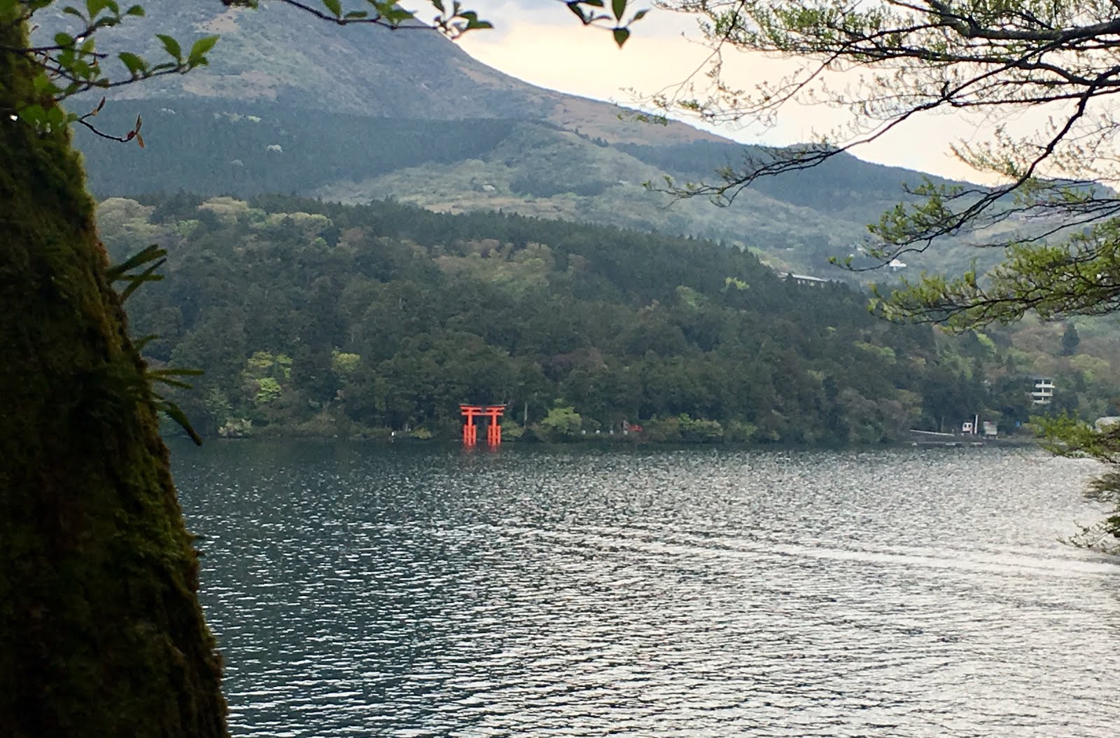
| A lower shoulder of Fuji barely visible over Ashinoko if you look closely, after the rain. |
This Golden Week has been without any major bike rides.
I have somehow managed to maintain my sanity with shorter rides and trips near Tokyo, a few swimming workouts, and a mix of events in town, all undertaken without too much rain. (While still sane, I am now "chomping at the bit" for the 600km Okitsu classic, coming up May 18-19).
One of the events this week was a hike planned for students from the Keio LL.M. program. I suggested the "old road" at Hakone -- since I have done the climb from Odawara to Ashinoko/Moto Hakone by bicycle several times in recent weeks, and also that is where my teachers took me on a hike when I was at the Inter-University Center for Japanese Language Studies more than 30 years ago.
 |
| An orderly procession |
We planned to meet at Hakone Yumoto at 930AM. That would have given me time to ride out, if I had left home shortly after 6AM. I left home well after 7AM, so rinko'ed my bike and hopped the Tokaido Line from Shinagawa. I was late enough so that I took the train all the way to Oiso and only rode the last 21km to Yumoto. At least I was confident that bicycle would be the fastest way to get between Odawara and Yumoto -- I rode by a standing line of cars and buses, as usual. Yumoto is a major bottleneck from all directions, and requires a train transfer if you take JR to Odawara.
 |
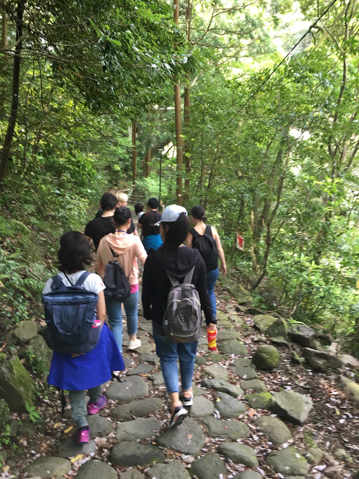
Ai the trailrunner leads the group across water.
Valerie next.
Then Kohei, Ai's husband, carries their daughter Nozomi. |
 |
| Delicious green shade and dappled sunlight aside a stream. |
The hike up the hill is mostly along on road the first half, and mostly on trails -- including the rough stone "paved" old Tokaido path -- the second half. It is nearly 13km from Yumoto to Ashinoko, and parts of it are steep. We rested briefly several times, including at Hatajuku, where there were woodcraft exhibits just off of the road.
 |
| Looking back toward Yumoto and Odawara |
Everyone made it up the steepest part of the trail, the "nanamagari saka" or "seven hairpin curves slope". Actually, there are 12 hairpin curves on the current road, though the trail skips some curves and just goes straight up stairs or a very steep path at some points. This must have been quite steep back in the Edo Period, with only 7 switchbacks!
 |
| Our smallest hiker |
Our first major stop was at the Amazake Chaya rest house -- Amazake being "sweet sake". I was curious to stop in, having passed it several times on my bicycle. The rest house serves a variety of traditional Japanese snacks, including ice cold Tokoroden, oden with miso, iced matcha green tea and, of course, amazake. I think all agreed that it was a really nice place to stop for a rest. From there, it was only a short climb over the last ridge and then down to Ashinoko.
 |
| Well deserved rest at Amazake-Chaya. |
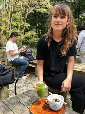 |
| Janina samples the delicious green tea and tokoroden |
 |
| Close up of the snack |
 |
| As we leave the Amazake Chaya |
We could hear the thunder claps in the distance as we started this last stretch, and it started to rain ... though not the torrential downpour I associate with "thunder shower" ... on the last stretch downhill to Moto Hakone. Ai, wife of Kohei, one of the Japanese lawyers in our LLM Program, jumped from rock to rock on the descending trail as if she were an elf. I asked if she is a trail runner. Yes, she replied. Very impressive, though actually everyone was impressive, and made it to the finish without complaint.
 |
| We just hiked up that. |
 |
| A better view of the old stone paved path |
We could enjoy a filling lunch including "wakasagi" fish from the lake as the rain fell, and then headed across the road to the Moto Hakone bus station.
 |
| Kohei, Ai and Nozomi waiting for the bus in the cold rain. |
More than half the group decided to head back by bus -- the prudent choice, especially for Kohei, Ai and their two-year old daughter Nozomi (who Kohei had carried up the mountain). With a small child, always quit while you are ahead). But also Wenyi and her friend Chao-san, as well as Janina. Three diehards remained, undeterred by the rain, and I continued with them in the rain down the cedar-lined path toward the Hakone Sekisho (checkpoint), restored to its Edo Period glory.
 |
| On the cedar-lined route to the Hakone Sekisho |
 |
| The restored sekisho -- show your passports, please! |
 |
Hakone could be a cold, wet posting for a bureaucrat.
(Apparently some people would skip the checkpoint and pass around the back of the mountain. This was a serious offense, but was typically explained away and excused with "I got lost", part of the Japanese tradition of hon-ne and tatamae,
if I read the explanatory material correctly.) |
By the time we left the sekisho, the rain had stopped, so we strolled on a detour through Onshi Hakone Park, climbed up and down lots of stairs (down the walkway of 200 stairs), and stopped at a view point. The views were well worth the effort.
 |
| Helpful sign to show where Mt Fuji would be, if it were sunny today. |
 |
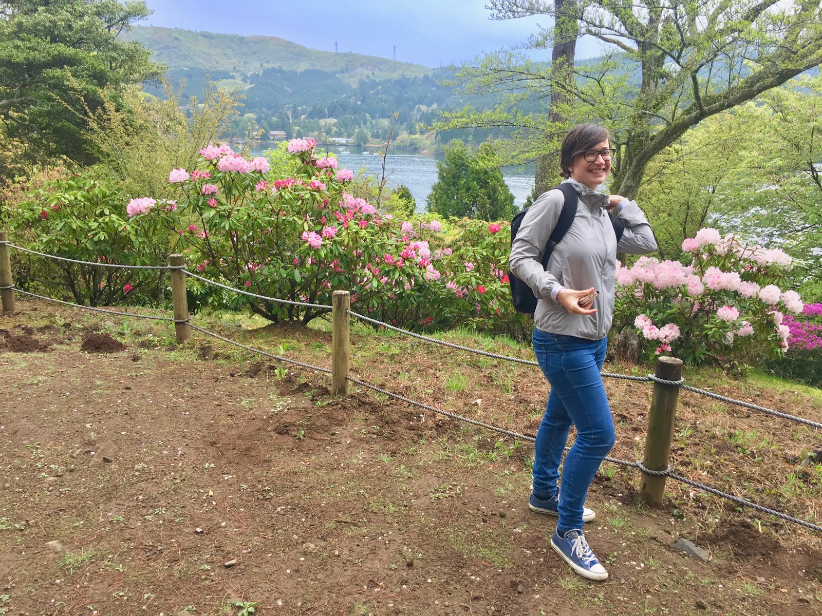
| Valerie, still smiling. |
 |
| Hakone Shrine and its Torii across the bay |
 |
| The diehards- one crazy professor, one LLM student and two Canadian (BC) youth. |
 |
| Lower portion of the walkway of two hundred stairs. I only counted 197. |
We did get to see, and cross, the famous Ashigawa-bashi or Ashigawa Bridge. I know it is famous because the mapboards inside the park told us it is one of the hundred best bridges in all of Kanagawa Prefecture.
 |
| One of the best 100 bridges in the entire prefecture! |
This tells us a lot. For example, we know it is likely not in the top fifty, nor the top ten. And we can be pretty sure that it is not in the top 1000 bridges in the country. But it was even less impressive than we had anticipated. My first thought upon seeing it was "where is the bridge"? But sure enough, a granite post told us this was it, and there was some water, or at least a muddy area, underneath the pathway at some point. Hidden in the brush on the opposite side of the mighty 2-meter (or 2.5-meter?) span was a plaque acknowledging its "best 100 bridge" status.
 |
| Ashigawa-bashi! |
 |
| Best 100 bridges of Kanagawa! |
 |
| Across the bay again. |
We took the bus down the hill. I thought the bus would take us on the limited access "shindo" or "new road" back to Yumoto, but the driver announced as we started up that, due to traffic jams, we would take the same route we had come up, and we only switched to the limited access "shindo" for the last few km.
 |
| Silouhette of Canyon at Odawara Castle -- classic pose. |
After standing on the crowded bus through the 12 hairpins of the 7 hairpin slope, I was glad to hop on the bicycle again and ride 30km to Hiratsuka before hopping the Tokaido Line home again. So, counting the short trips to / from Shinagawa and the walk after lunch at Ashinoko, 53-55kms on the bicycle and at least 15-16km hiking. I slept soundly.
 |
| The main hike. |


No comments:
Post a Comment