 |
| A quick rest at Dogashima while heading south. The RAMAX rests. |
 |
| Vista south of Matsuzaki, just before Ishibu Tanada viewpoint |
After a cancelled/postponed 300km brevet last weekend, on Saturday I finally got my first "points on the board" toward qualifying for Cascade1400 with a 200km brevet. The event was held by AJ Nishi Tokyo, whose rides usually start from Machida, at or near the Cherubim (hand made bicycle) shop.
This 200km event was highlighted online months ago by Joe Wein, who regularly rides Nishi Tokyo events, who loves Nishi Izu, and who has done a similar event several times before. When I checked in before the start, I told the organizers I was very happy to ride a 200km brevet on a course that I LOVE to ride, even if there is not a brevet. I would rank this as one of the best road cycling routes IN THE WORLD and one that rivals iconic locations such as Cap Formentor or Sa Calobra on Mallorca, or passes like the Stelvio or Galibier in the Alps. I have ridden this coastline North to South many times. But I never have tried the full coastline North to South, then South to North, in a single day.
I was expecting a crowd ... but there were only a handful of people at the start area when I exited the north side of Mishima Station. There were 2 ride choices -- a route that went south along the western spine/ridge of Izu (the "Daruma-san") route because it went via Mt Daruma -- and the Matsuzaki route, that went along the coast in both directions. I had chosen the Matsuzaki route because it had a later 8AM start time. The Daruma-san route had been listed initially with a 7AM start, too early to arrive by train from Tokyo, though I saw now it had been switched to a 730AM start.
The organizers had capped the two routes at 20 riders each. And at least half of those registered had reported "DNS" (did not start). Indeed, the weather forecast showed rain was expected from mid-day and get heavier and heavier. The tenki.jp website did not look too ominous -- only "weak rain" until evening. But the Apple iphone weather site suggested we might get rain as early as mid-morning. The TV weather report on Friday night warned of typhoon-like wind gusts and heavy rain across all of Japan (though the worst of it seemed on the Sea of Japan coastline), with two low pressure systems moving from west to east and bringing potentially severe weather. I guess people were scared off.
Anyway, I arrived around 730am after the Daruma-san riders had left. Only 6 (or so) riders were at the briefing for the Matsuzaki ride. One, Yo Okumura, was one of the organizers, who I have ridden with before. Joe Wein was there as well, with his Elephant NFE. They let us start early -- the briefing done and all riders signed in or reporting DNF.
I really appreciated even 10-15 minutes early start, given the weather forecast for later in the day. And I knew that this would be one of the hardest 200km brevets I had done, if not THE hardest. (The other one that comes to mind was also a Nishi Tokyo 200 -- in October 2014, up around Mt. Fuji. The typical Audax 200 in Japan I have done is in January ... around the Miura Peninsula, or to Atami and back, or from Numazu west along the Shizuoka Coast -- all with no more than 1000-1500m of elevation gain.
On Saturday, we would never exceed 300m elevation, but were going up and down constantly, and my Wahoo GPS recorded nearly 2900m elevation gain by the end. (Strava "adjusted" data showed just over 2700m climbing. When uploaded to ridewithgps, the summary shows 3027m elevation gain. The ridewithgps "route", which does not reflect tunnels, shows over 4500m climbing. Thank you, tunnels!)
Indeed, a Spring 2015 R-Tokyo 400km brevet that went from Tokyo to Minami Izu (arriving on the Nishi Izu coast at Toi and leaving at Matsuzaki to ascend Jaishi Pass, and returning the same way), was as close as I have ever gotten to hitting the 27hr time limit for a 400km brevet.
 |
| On the path along the Kamogawa |
 |
| On the path along the Kamogawa (2) |
 |
| On the path along the Kamogawa (3) |
 |
| We reach the coastline at San-no-ura |
I liked the route the organizers had chosen leading from Mishima station to the Kamogawa and its cycling path. There is no perfect way through Mishima and western Numazu to the Izu coast, but this was a pretty good one, especially the first few kms from the station. I will use it again. We started with nice weather -- cool, cloudy, but still dry. Four of us started together and I tried to push ahead. Joe caught me at a couple traffic signals along the way and we rode together some, until I pushed ahead as we got to the cycling path. I know that Joe usually starts out slower than me and does not push quite as much, and this day in particular I wanted to bank a lot of time early in the ride. The RAMAX is well-balanced for a TT style solo effort, and I could make good time with fresh legs over the first segment. It also gives me plenty of confidence on the descents.
The route left the cycling path to cross the Kamogawa and cut East to pass near a historical iron furnace from the 1860s, then continued South up the valley to Shuzenji. The checkpoint opened at 8:42AM, and I relaxed the last few kms as I saw that otherwise I might arrive before it opened. I got there at 8:43AM and my receipt shows 8:46AM. I was leaving at 8:52AM as Joe and another rider (Hirano-san) were pulling in.
 |
| No Fuji today |
 |
| Riding under a canopy of flowering sakura trees! |
 |
| The climbing starts ... at Osezaki |
The route crossed the river again and looped back North to Izunokuni then climbed a short (~75m elev) slope to the West, through a tunnel, and down to the coastline at San-no-ura. From here we followed the coast all the way South to Matsuzaki. From San-no-Ura, after 10~15kms of mostly flat riding, the route climbs above Osezaki and then goes up and down along the hill before descending into Heda. From Heda it climbs again, with more up and down high on the hill, until it descends into Toi Onsen. From Toi Onsen there is a flat stretch of 3-4kms, then a more gradual but long uphill, then a swift descent with some tunnels down to Nishi Izu-shi. In between Nishi Izu and Matsuzaki, there are more tunnels and all the up and down is quite short.
 |
| More sakura between Heda and Toi |
 |
| Toi Onsen |
 |
| RAMAX leaning, just south of Toi |
The entire way it seemed there were sakura along the road, there was little traffic (especially Shizuoka Rte 17 north of Toi Onsen ... a bit more as always on National Rte 136 south of Toi), the temperature was ideal, and I felt as if I had better stamina than even a few weeks ago, the result of a hard one-day ride each weekend, supplemented by a few shorter mid-week morning rides.
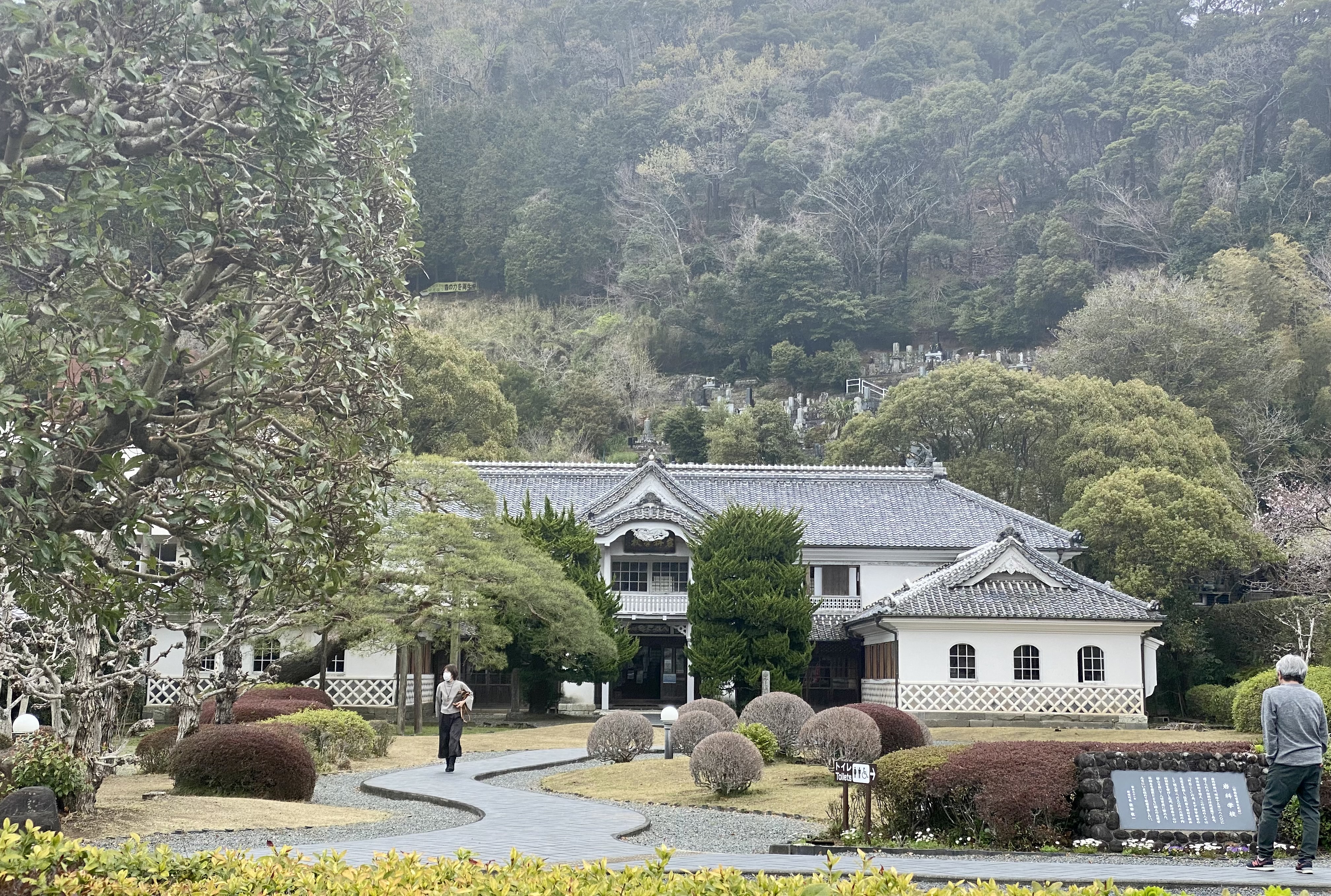
This route was all familiar territory for me, until the area South from Matsuzaki. We headed up the familiar road for Jaishi Pass, but quickly turned off and took a parallel local lane past the Iwashina School, a building from 1880 that blends western and Japanese elements in what was, at the time, a novel design, and that symbolizes Japanese architecture's westernization.
Then we crossed the road to Jaishi and headed up a hill on a mountain road. This road was steep at times, but led through some very nice countryside. Eventually, there was a lovely vista, and then a parking area with an observation deck and a signboard -- looking down at the Ishibu Tanada tiered rice patties. This was our 108km turn-around checkpoint -- a photo of the signboard with brevet card.
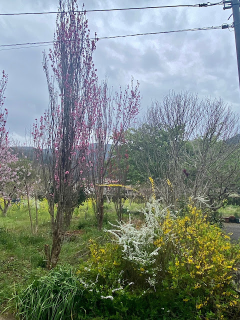 |
| Flowering trees and yellow rapeseed outside of Matsuzaki |
 |
| Iwashina School |
 |
| Near the Ishibu Tanada |
 |
| Matsuzaki Coastline, on the return. |
 |
| Lots of these or similar sculptures at intervals |
After a short descent, the route turned right onto Rte 136. The descent continued ... and brought back memories of climbing this hill in the other direction long ago. You get to it just as your fatigue tops out, legs in pain with lactic acid. There was an AJ Nishi Tokyo rider resting at a bridge at the bottom of this hill. He said he had come via the Daruma-san course -- even more climbing. We leapfrogged each other a few times. (I saw only one other audax rider, who passed me on the big hill before the Heda checkpoint, where we met a second time. He also had done the Daruma-san course. He was at the finish as well.
But to get back to Matsuzaki, there were more short ups and downs, and ups and downs. The view was spectacular, but my legs were not. In Matsuzaki I stopped at a Family Mart to get a nama-pasta ... but the relevant shelf was bare. I guess their afternoon delivery had not yet arrived. Not to worry, I found what I was looking for at another Family Mart within five minutes to the North. The food and short rest was what I needed.
I could count on my hands the number of rain drops that fell on me before the Ishibu Tanada checkpoint. There the raindrops started to fall in earnest. I put on my thin Endura rain shell for the descent. In Matsuzaki while stopped to eat, I added my shoe covers. Later on I unfurled my "Rain Legs" rain chaps. Then I switched to my warmer, water proof (err, resistant) gloves. What had been a "light rain" had, by Toi, become a "steady rain". After Heda, I would call it even a "hard rain" -- certainly as I approached the finish. There was water in the road, puddles in places. As it got dark, I saw a big frog sitting in the road, in my headlight's beam. Ten minutes later, there was a medium-sized frog, hopping left to right. And later, a small frog hopping energetically. There was even what looked like a little sand crab sliding across the road. On the descent into Heda, there were even some pretty violent wind gusts ... just as the TV weather had predicted. I had images of the recent pro peletion crash during the Strade Bianca where a cross-wind gust had taken down one rider, sending all those behind him flying. Fortunately, the wind quieted a bit for the next section.
 |
| Ashi no yu (foot bath) at Toi Onsen. |
 |
| Tourist info at Toi Onen |
 |
| RAMAX leaning. Up a hill just North of Toi |
The nearly two hours from Heda were just a long wet slog. I felt okay, no serious fatigue or specific aches or pains. As I entered Mishima I started to bonk a bit, so pulled off where there was an awning to offer a bit of a shield from the rain, to eat an onigiri from my back pocket. Before I knew it, I was at the goal. Soaked through, I bought a nice bath towel at the 7/11 where I needed to get my last proof of passage, and then dried off a bit at the Toyoko Inn in front of the station where the organizers were checking us in.
How many finished? I don't know, but I guess not that many. There were a few riders packing bikes in rinko bags when I got to the Toyoko Inn, including the rider from the Heda checkpoint. Okumura-san was there, with suspiciously dry cycling clothes. He told me he had just ridden part of the route and DNFed before the rain hit. Joe reported Sunday that he and Hirano-san missed the time cut off by a few minutes in Heda, and slogged back to Mishima in the dark and wet. Did anyone else complete the Matsuzaki course other than me? I'm not sure. Indeed, this is a hard 200km. But it was just what I needed, following my last two weekend hard rides of Yanagisawa Pass and Mitsumine Shrine. If I can keep this up, I will be ready for Cascade1400.


No comments:
Post a Comment